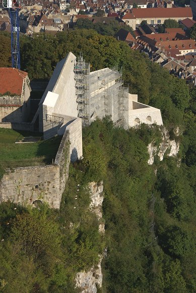
Now used as to house various museums and a zoo, the citadel is open to the public.
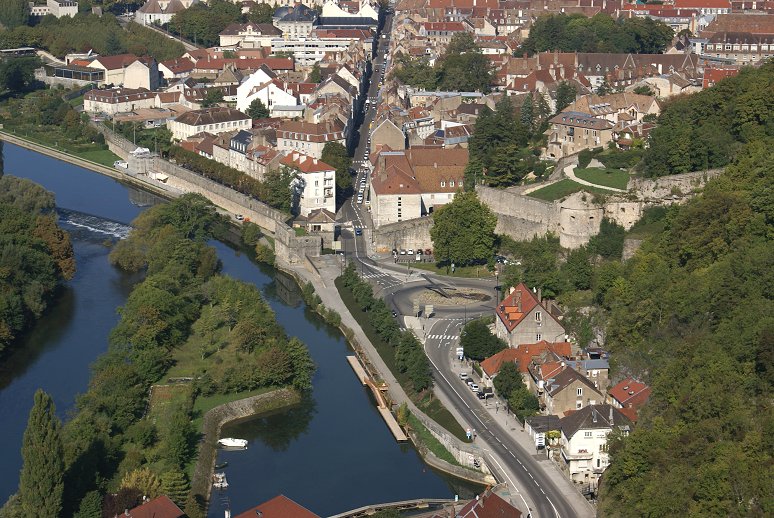
| In a heavily contested area of what is now France,
the town
of Besancon and Franche Compte has variously belonged to the
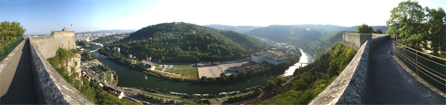
Burgundians, Spain, and France. Situated in a meander of the
River Doubs, the town required relatively light defenses along
the river, but the town was dominated by a narrow neck of high
ground.
It was here that Vauban started building a citadel after the
capture of the place in the late 1660s. Returned to Spain during
the peace, construction continued. France regained the town for
good in the 1670s, and Vauban finished the work of fortifying the town
and building the citadel. The town itself paid most of the
expenses involved. Now used as to house various museums and a zoo, the citadel is open to the public. |
|
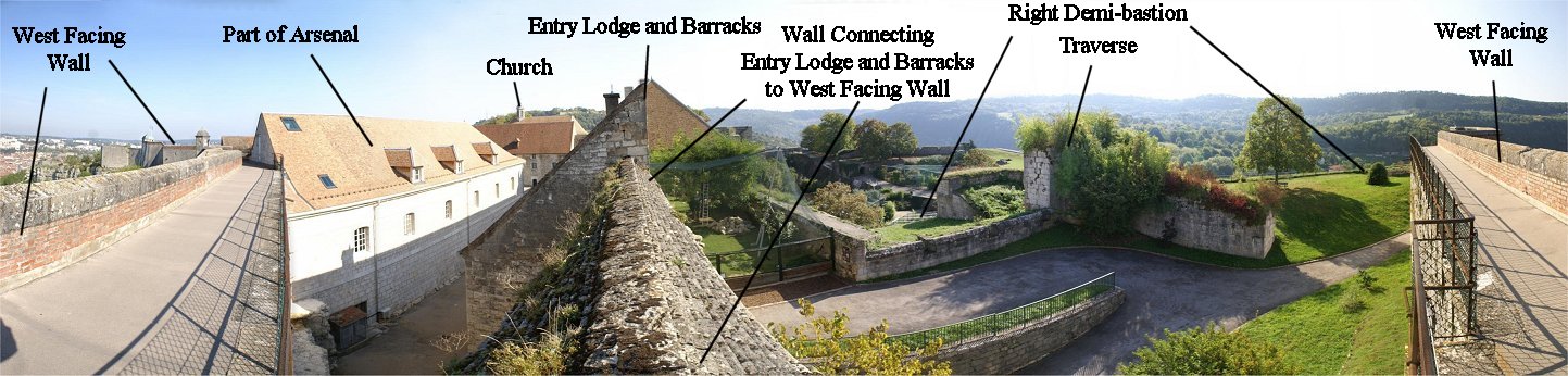
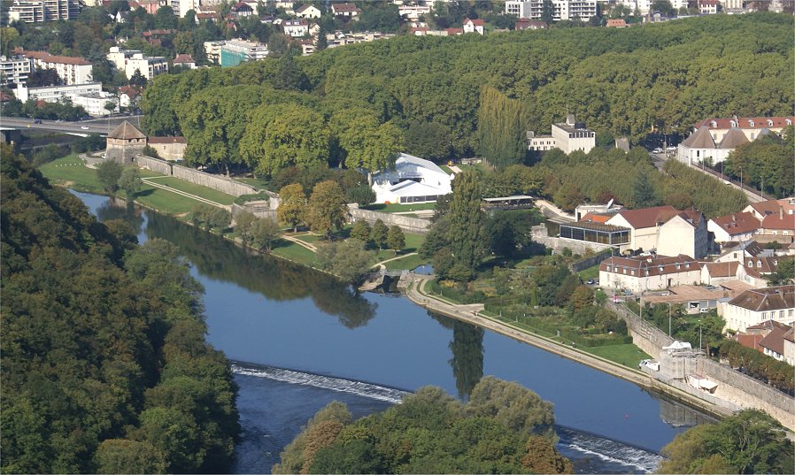
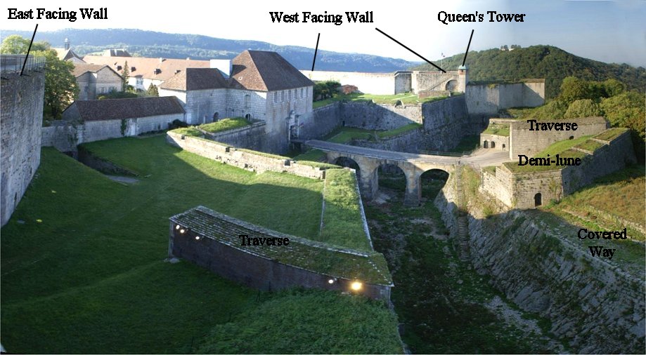
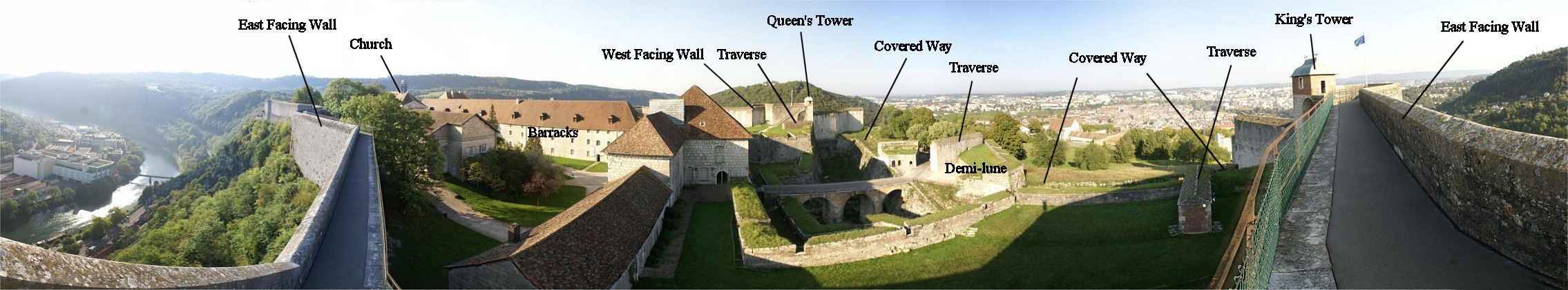
With cliffs on each side descending to the river, the citadel's defenses were primarily designed to defend an attack from either from the south or from the town itself. Two "fronts" faced town. We will tour the citadel beginning from the town side. 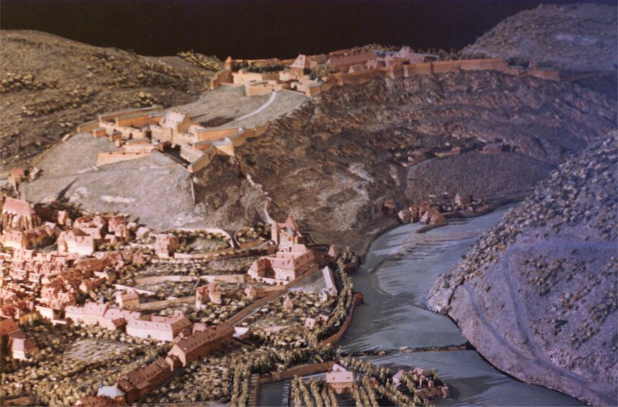 |
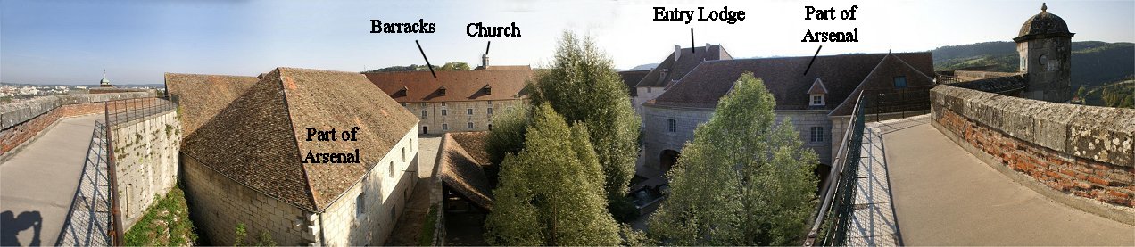
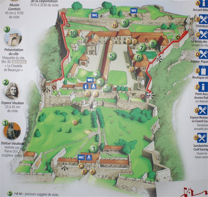 10 - Magazine 5 - Barracks 6, 7, and 8 - Arsenal |
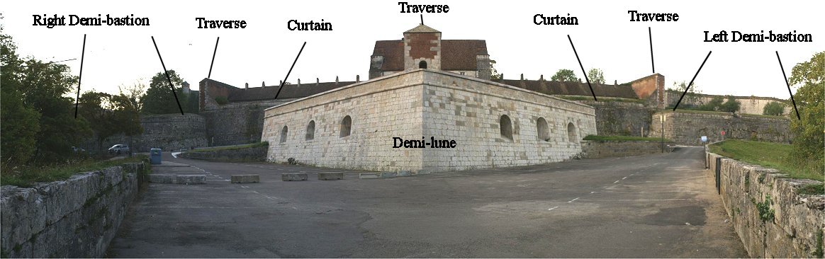
| Because Franche Compte was only recntly integrated into France,
there were many people in Besancon who would have prefered the old
regime. This partly explains the two strong defensive lines
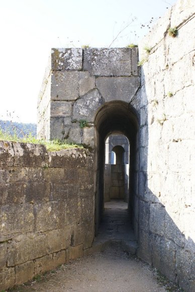
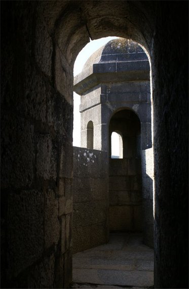
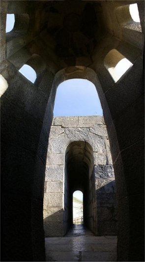
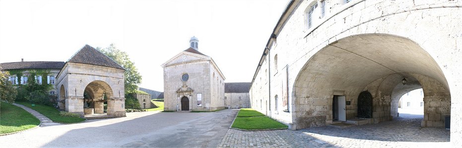
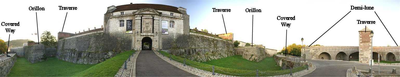
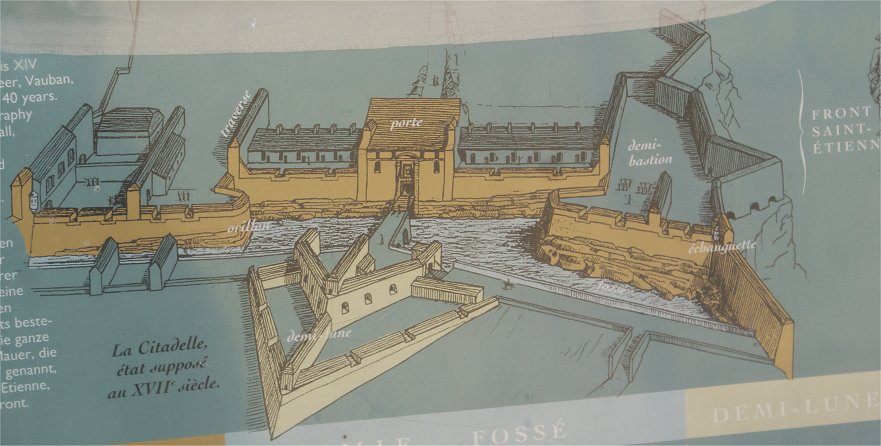
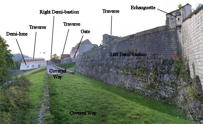
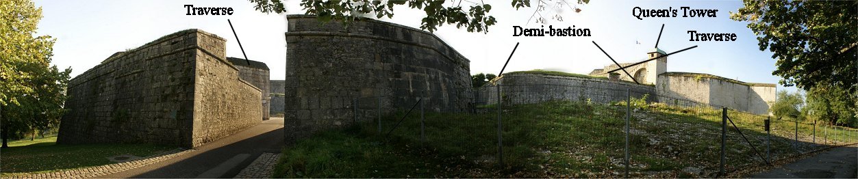
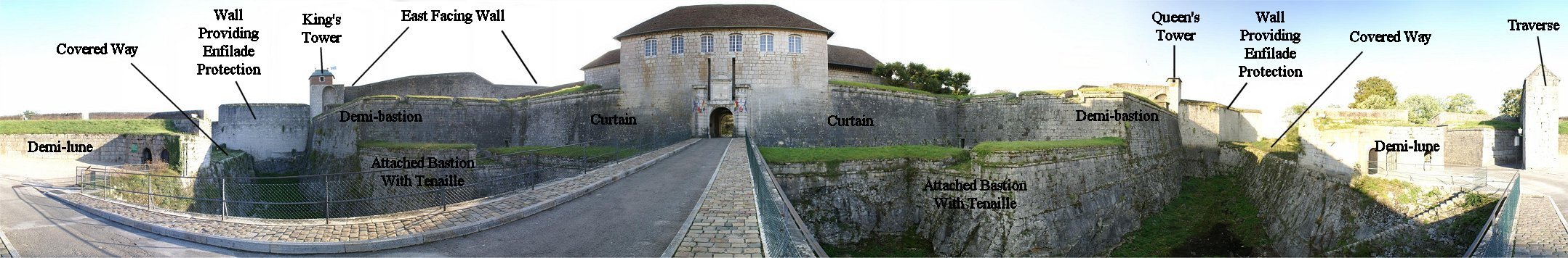
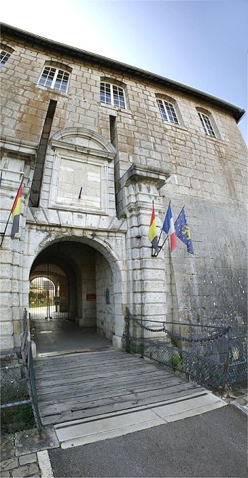
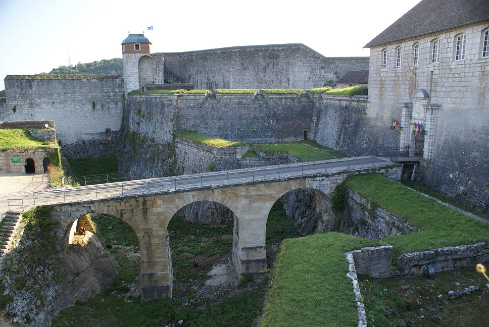
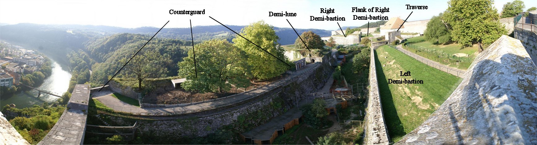
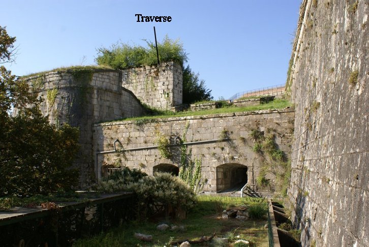
facing town. Terrain also effected the choice as the ground drops more steeply in front of these defenses. The Front Saint Etienne, essentially a hornwork, was built by Vauban where the Saint Etienne cathedral had stood before its destruction in 1674 when the French besieged the citadel. The first of the two panoramas above is from the front of the demi-lune, a rare early morning view without cars. The second panorama is from behind the demi-lune, showing the demi-lune's massive stone and brick traverse. The demi-lune features two levels, the lower one with vaulted niches for artillery and an upper level for infantry. Brick traverses are also visible atop the curtain wall near the two demi-bastions, which have recessed flanks. The curve of a demi-bastion is called an orillon. The covered way, for the infantry to fight from, would have had two traverses also, in the modern parking lot on the extreme left of the panorama. The vertical slits atop the gate were once used to raise and lower a drawbridge, since replaced. During the French Revolution, a royal coat of arms as part of the decoration above the gate was chiseled off. Before we walk through the gate, first we will walk along the covered way to the right. |
 |
 |
 |
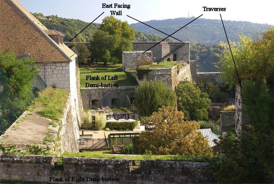
| Facing the south, the Front de Secours replaced a medieval
wall with
defenses capable of mounting 53 cannon. While the two defense
lines
facing town are fairly conventional, the Front de Secours is somewhat
difficult to understand because it is not symmetrical but also partly because a zoo now occupies the area.
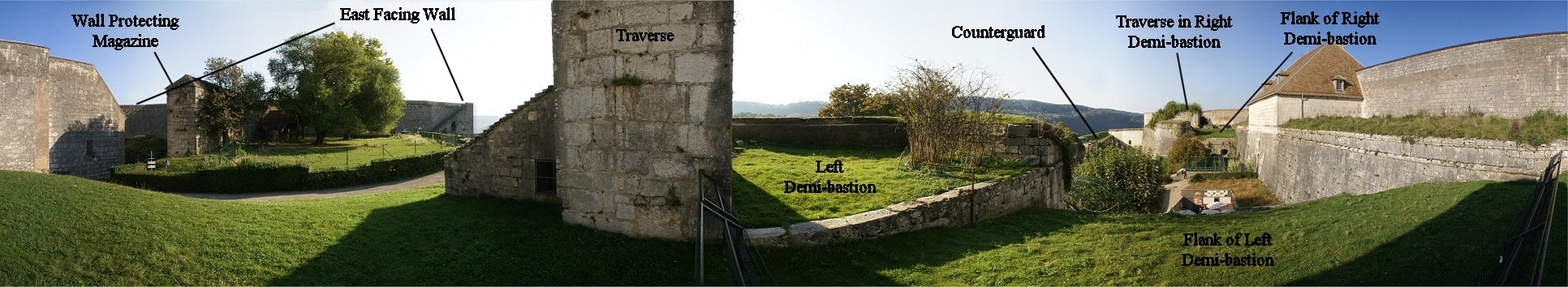
There are two demi-bastions, which is ordinary enough, but
counterguards are to their front. The left counterguard is
shaped like a demi-bastion. Between it and the demi-lune,
and to their front, is a lunette. Next, we will walk to the flank of the demi-bastion, at the closer of the two traverses in the photo at right. |
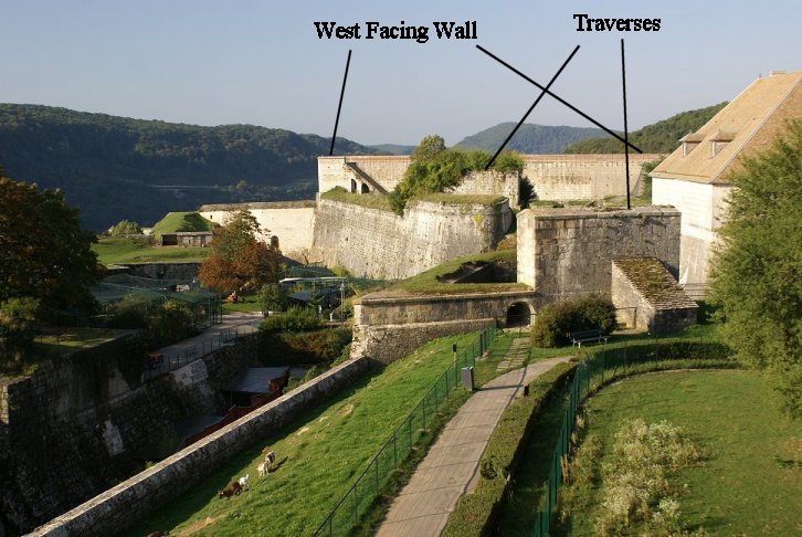 |

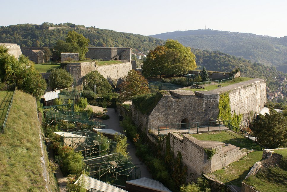
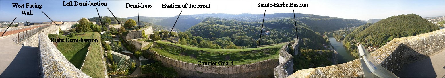
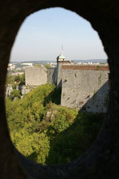
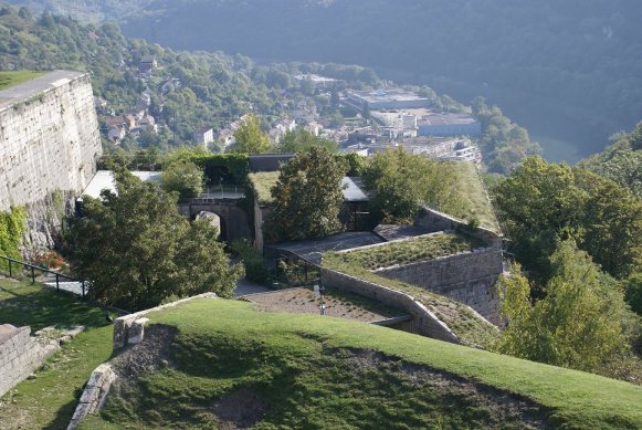
| On the left of the panorama, the western wall facing the river
intersects the right demi-bastion of the Front de Secours. The left
demi-bastion is visible in the distance with a demi-lune between them
to the front. An additional outwork, a bastion of the front, can be seen to the right of the
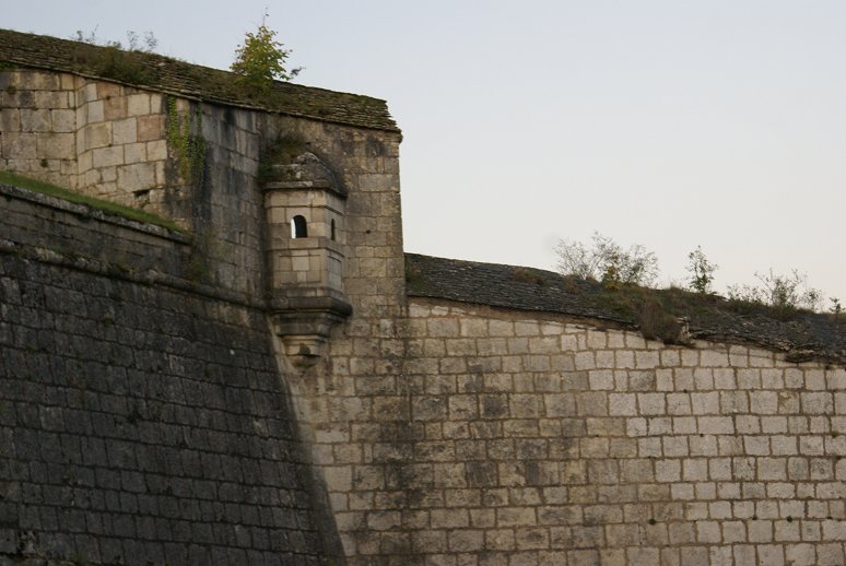
demi-lune. (See zoomed view at right.) Extending to the right from the demi-lune are two works parallel to the demi-bastion, the first of which is a counterguard. The second is a covered way with a bastion (Sainte-Barbe) on its right side. Three levels, therefore, can fire on the enemy. |
 |