Hawthorn Crater
Hunter-Weston's VIII Corps extended south to Beuamont Hamel, another of
its attack objectives. Here, the regular army 29th Division would
attack, aided by the blowing of a 40,000 pound mine beneath the
Hawthorn Redoubt. A veteran of the Gallipoli campaign,
Hunter-Weston did not have a great reputation. For the first day
of the Somme he hoped to blow the mine at 3:30 then sieze the crater -
this a full four hours before the main attack. This would have
completely eliminated the element of surprise, so this plan was not
well received. The man in charge of the mine recommended that it
be blown at 7:30 as the attack began. Eventually a compromise of
7:20 was decided on. This, of course, alerted the Germans of the
impending attack. Simultaneously the artillery bmbarment was
shifted tot he German second line, leaving the German infantry ten
peaceful minutes to prepare for the attack. As was true
elsewhere, counterbattery fire had left the German artillery largely
intact and ready for battle.

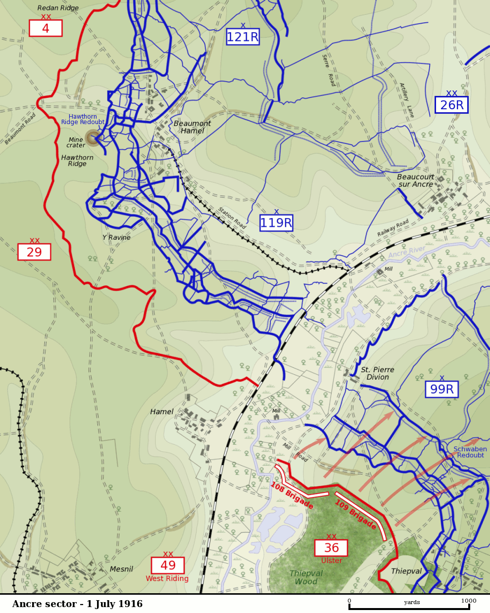
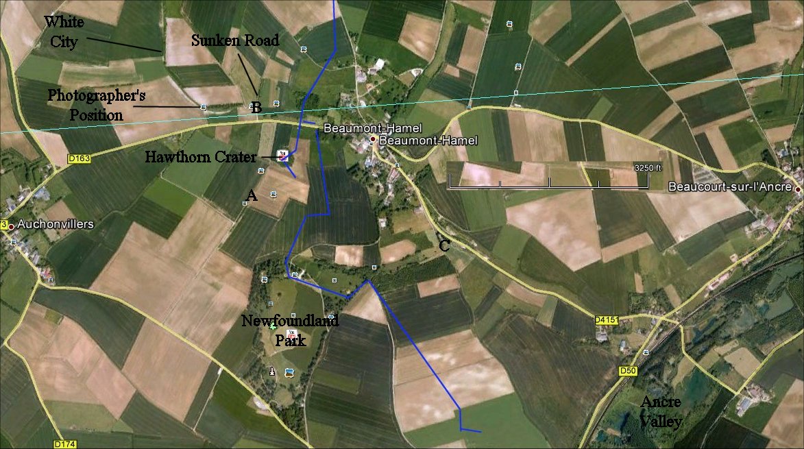
This map from Wikipedia shows the area well. At lower right is
the 36th Division's attack, which will be shown in another section.

The blue line is the approximate German front line. The British
attacked from the west - the left of the map. A,B, and C
correspond to the panorama locations below.

A) Hawthorn Crater
The explosion of the mine was recorded by motion picture, and if you do
a Youtube search of "Hawthorn Mine", you can likely find footage.
The explosion blew three German sections skyward and opened up a
white, chalky crater 50 yards wide and 60 feet deep. Surviving
Germans raced out of their dugouts, sure that a British attack was
imminent. In the immediate aftermath of the explosion, and ten
minutes before the main attack, two British platoons with machine guns
and mortars with rushed forward to capture the crater.
The Germans reacted quickly, however, and were closer, so they
reached the eastern edge of the crater first. Reaching the
western edge of the crater, the British found the Germans on the
opposite side. Exposed to enemy fire from their flanks, the
British had no hope for securing the destroyed German strongpoint.
Soon, the main attack began. With much of the German barbed wire
still intact, the attacking British infantry took heavy losses.
Some of the dead from the fighting near the crater were buried in
the Hawthorn Ridge No. 1 Cemetery.
The British and German lines were not close. For example the
motion picture photographer's position was the approximate British
front line, a good 1,500 feet from German lines opposite in a small
wood lot indicated on the panorama. White City was an area held
by the British that hidden from German view by chalky white piles of
earth and rock. In no man's land the only significant cover for
the attacking troops was a sunken road. We will go there next.

B) Southern End of Sunken Road
The axis of advance of the attacking troops of the 29th Division was
from the direction of Auchonvillers toward Beaumont Hamel. The
Brits had tunneled from their front line forward to the Sunken
Road. Via tunnel the 1st Lancashire Fusiliers moved to the sunken
road to attack the German held wood lot to their front. (Some
times of the year you may be able to make out where the tunnel
emerged.) The Lancs couldn't see the German lines from the sunken
road, and they never reached the German line. A singleThe unit
lost 18 officers and 465 men that day. Although the sunken road
was evacuated, it was later re-occupied and incorporated into the
British trench system.
Next we continue through Beaumont Hamel and into the German rear.

C) End of Y-Ravine
Here at the civilian cemetery on the southeastern corner of Beaumont
Hamel you can see the end of Y-Ravine, a continuation of the prominent
feature of Newfoundland Park. This was a German rear area with
dugouts and so forth, and the Germans used the ravine to move to and
from the front lines in what is now the Newfoundland Park.
The 29th Division lost 5,240 men on July 1st.
Copyright 2012 by John Hamill


