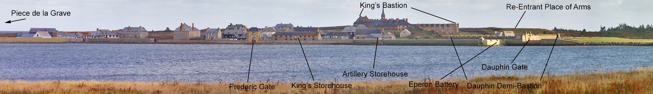
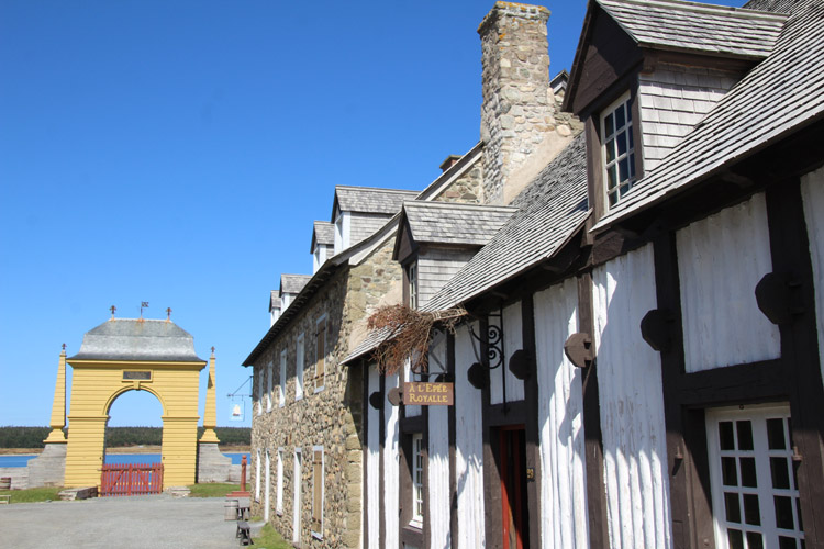
Louisbourg
The 1713 Treaty of Utrecht ending the War of Spanish Succession brought
big changes to Atlantic North America. France was forced to give
up Newfoundland and Acadia - now southern Nova Scotia - leaving them
only Cape Breton Island, known as Isle Royale, and what is now known as
Prince Edward Island. To protect New France and the
Atlantic fisheries, France needed a new naval base in Cape Breton
Island, a place that could also be used for trade and for processing of
fish. Several sites were considered. Ultimately,
however, Havre a l'Anglais was selected, an ice free harbor with plenty
of beach area for fish processing, a place that had been used by
English fishermen; it was renamed Louisbourg. Two engineers,
Verrier and Verville, designed the defenses, which would become the
most impressive of the western hemisphere. A comparable
European fortress would have featured dressed stone, but Louisbourg was
built with rough stone which would prove difficult to maintain in the
difficult climate with freezing and thawing. Implied by many
historians is that the fort should have been entirely earthen.
Agriculture is marginal in the area, and climate and the short
campaigning season were perhaps the greatest
defenses of Louisbourg. The French navy was also a
strong deterent; a British expedition needed overwhelming naval
superiority to succeed, both to blockade the Louisbourg squadron and to
prevent the French from sending a relief expedition. Such were
the difficulties that after the place was captured in 1745, a French
expedition to recapture Louisbourg in 1746 was forced to return to
France without even sighting the town, having suffered thousands of
deaths from disease in the process. In 1757, the difficulty of
mounting a major
amphibious operation
from England, on time, with naval opposition was more than they could
manage for that year - having removed troops from the New
York frontier, the effort was cancelled when it was learned that
the French squadron at Louisbourg was superior.
In 1745, New England
forces supported by the Royal Navy captured the town, but in the peace of 1748 it was returned to
France, an event that angered many American colonists.
In 1758, the town was again captured, this time for good.
The capture of Louisbourg blocked French communication with New
France, and the next year
the British continued to Quebec, which they captured, followed by the
rest of New France in 1760. The peace treaty confirmed the
British
North American conquests, leaving the French only some small islands
for
fishing. The British destroyed
the
fortifications at Louisbourg in 1760 and abandoned the place in 1768.
In the mid
20th century part of the town and fortifications were reconstructed to its 1744 appearance,
making it one of the great historical tourist attractions of North America.
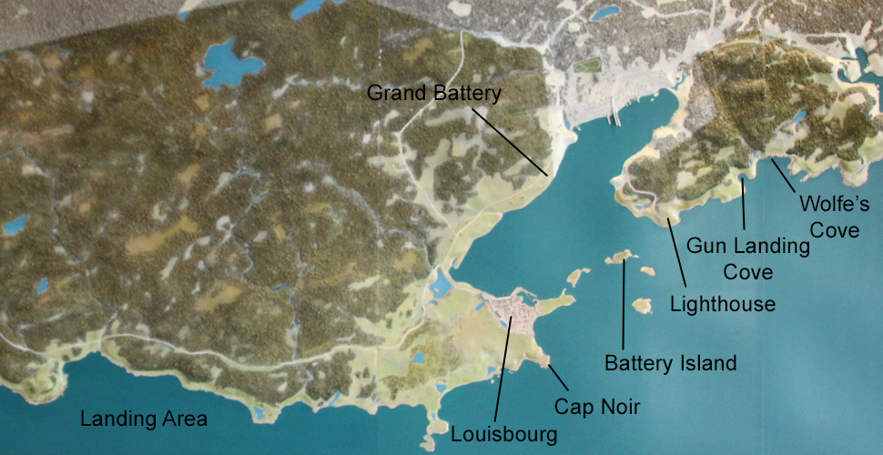
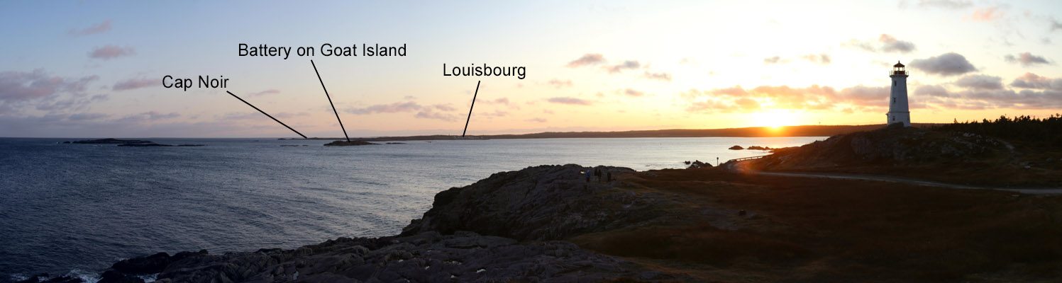
The Americans 1745 and the British in 1758 landed at Gabarus Bay
and pulled cannon across swampy ground to besiege the town.
In 1758 the French contested the landing but were forced back.
They then abandoned the Grand Battery covering the entrance to
the harbor. A force under Wolfe marched to the French battery at
the lighthouse and captured it, getting supplies landed at Gun Landing
Cove
and Wolfe's Cove.
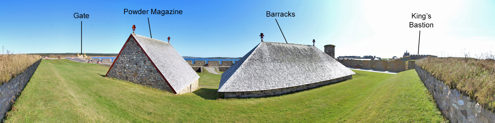
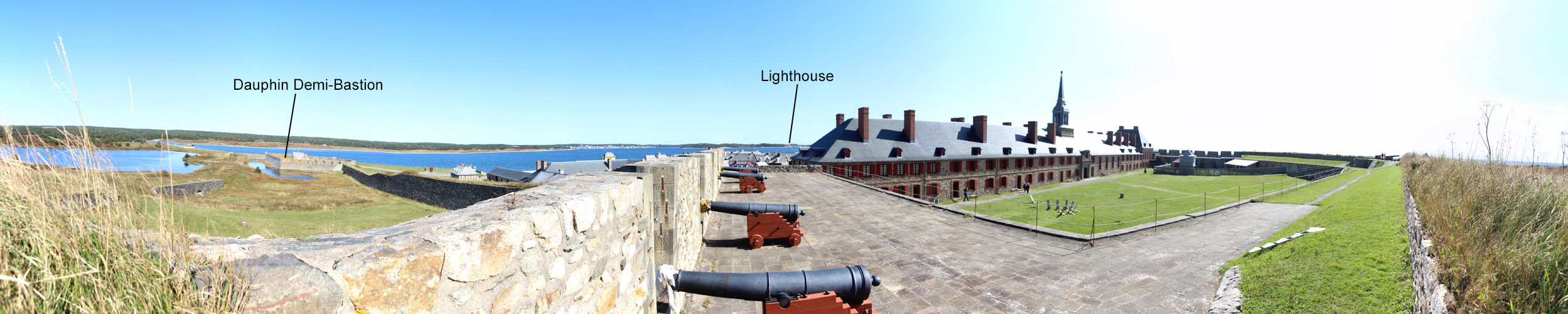
Grand Battery
Built between 1724 and 1732 to cover the entrance to the harbor,
fire from here and the Dauphin Demi-Bastion created a crossfire in the harbor. The Grand
Battery had minimal landward defenses, so in 1745, the French
abandoned the battery, and the Americans used its guns against the battery on Goat Island as well as the
town. The New Englanders made a costly attack on the French
battery on Goat Island, but finally forced the island to surrender by
bombarding it from the area of the lighthouse. This, in turn, led
to the surrender of the town.
In the 1758 siege, the Grand Battery was again abandoned, but the guns
were made inoperable. Like in 1745, the British once again
bombarded the Goat Island battery from the area of the lighthouse.
The French ships had to withdraw closer to Louisbourg where they
enchanged fire with British siege lines then with batteries on this
coast manned by the Royal Navy. Several ships were
destroyed, and on July 26th, 600 British sailors and marines captured
two French ships from their skeleton crews. With the town now
under threat from the harbor and with the walls breached, the French
surrendered that day.
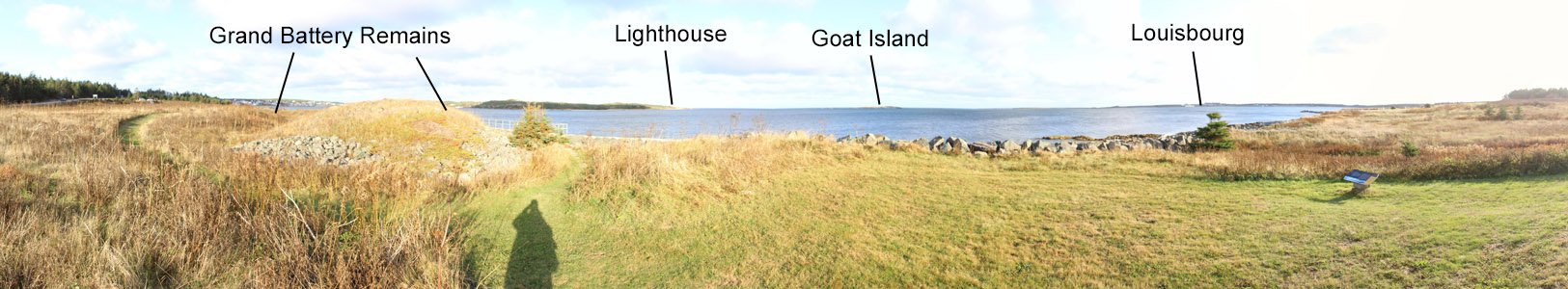
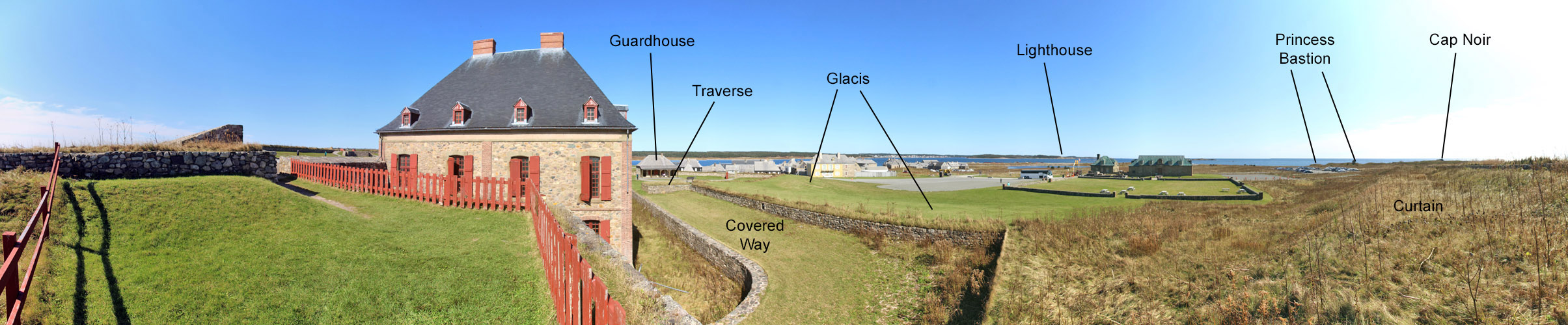
Modern Lighthouse
On June 12, 1758, Wolfe with 1,400 men marched from the landing site at
Gabarus Bay to Lighthouse Point. A French battery there was
abandoned with the cannon rolled off the cliff. After
constructing batteries, the British opened fire on the French battery
on Goat Island on June 19th. On the 21st, French warships
withdrew closer to Louisbourg, and on June 25th, the French batteries
were silenced. Facing the threat of the British fleet entering the
harbor, the French sank four ships in the channel on the night of June
28-29.
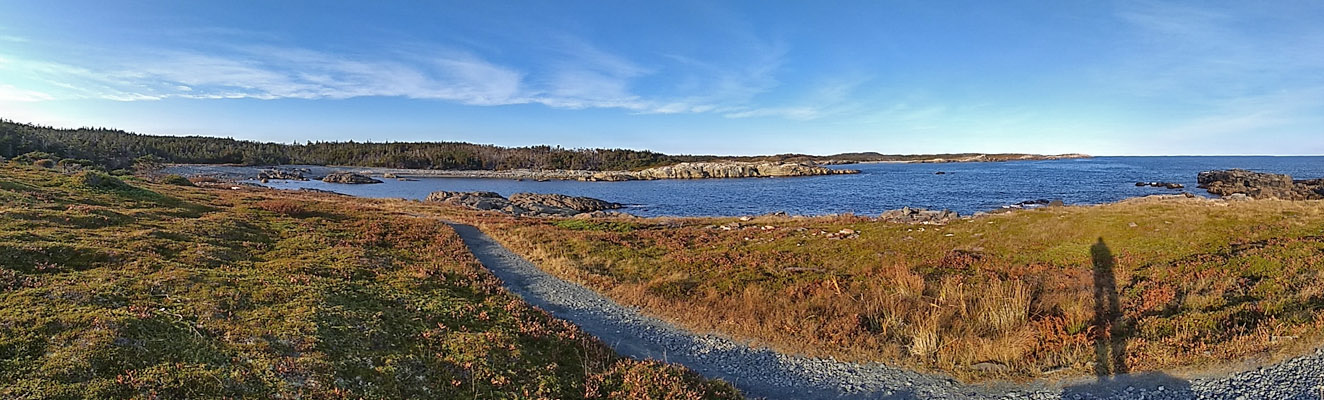
Gun Landing and Wolfe's Cove
Guns and supplies were landed at two coves just to the east of the Lighthouse.
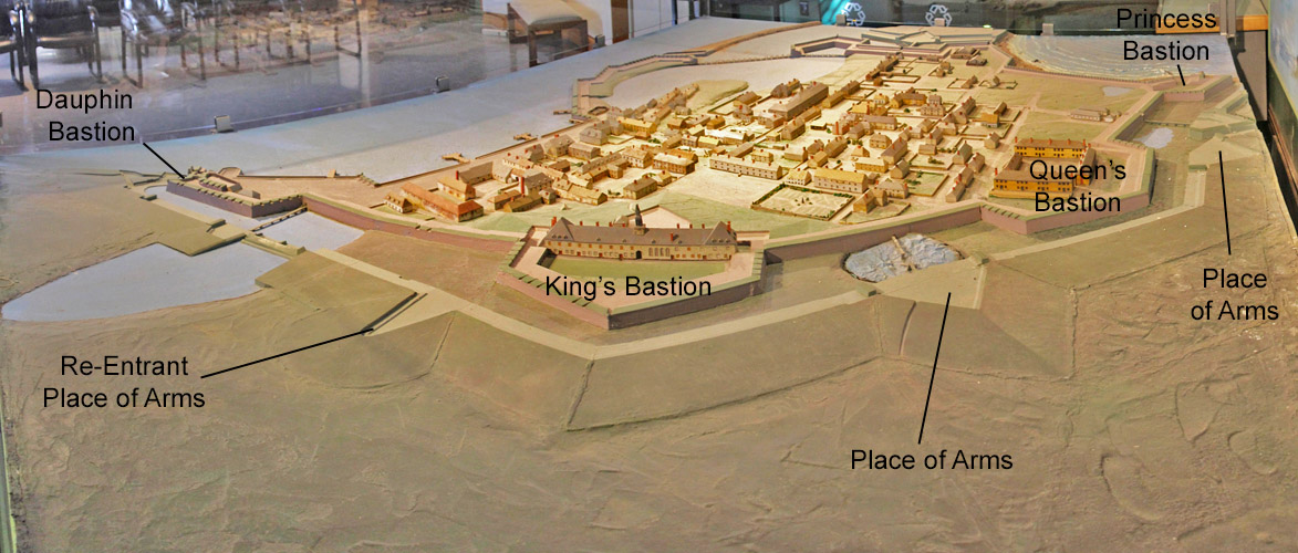
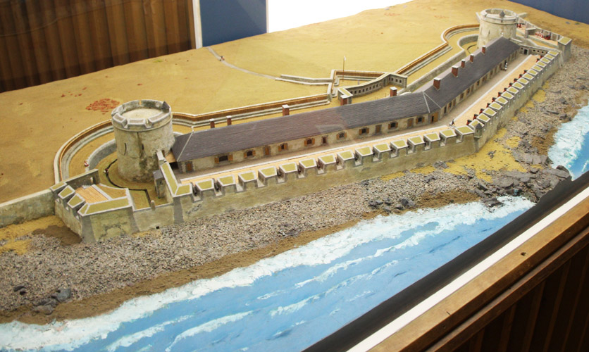
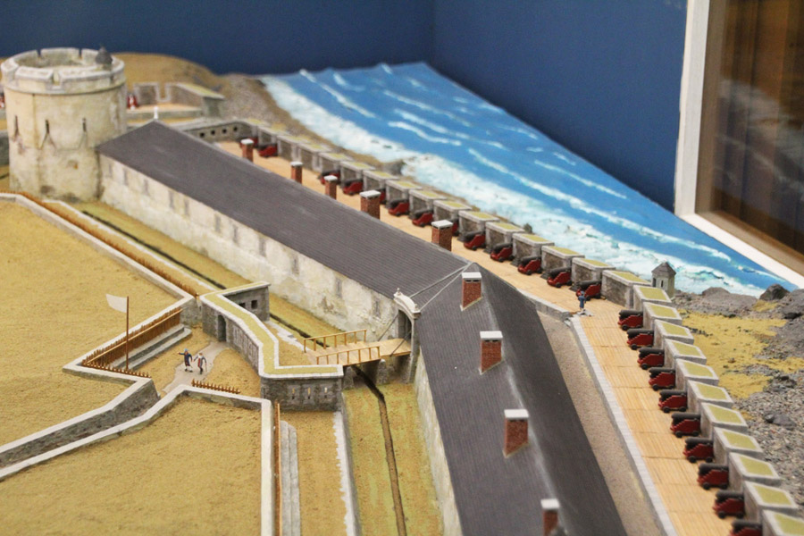
This model reflects the cavalier added to the Dauphin Bastion after the 1745 siege.
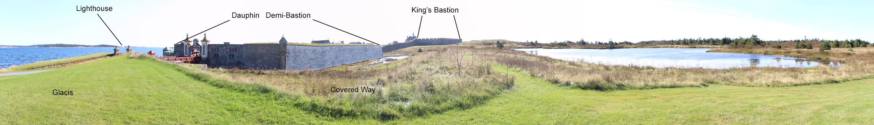
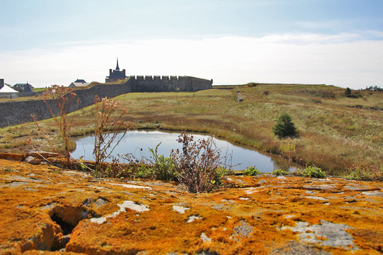
A large pond in front of the Dauphin Demi-Bastion aided the defenses of this sector.
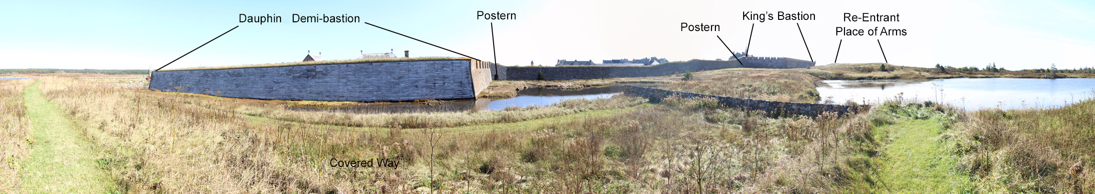
In 1758, British siege lines got to within about 50 yards of the
Dauphin Bastion. On July 9th, the French launched a sortie from
this gate, capturing
some of the British earthworks before returning to the fortress.
Because of the stresses caused by freezing and thawing, the walls
deteriorated quickly. To help protect them, wooden planking covered
some walls.
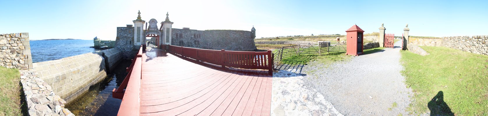
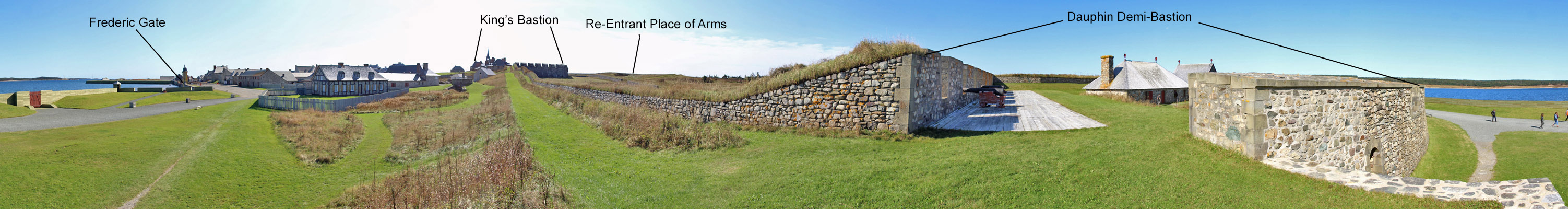
Dauphin Gate
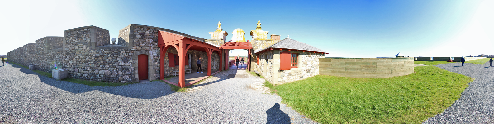
Guard houses on either side of the gate have firing ports.
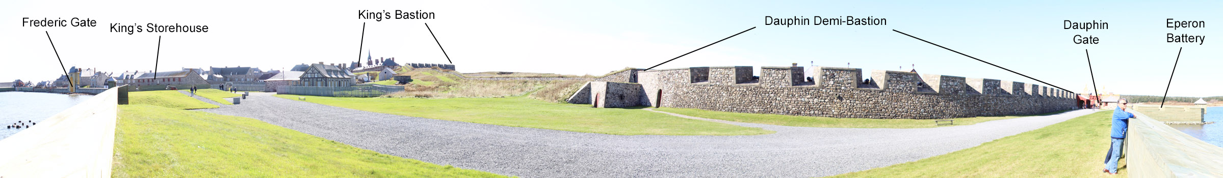
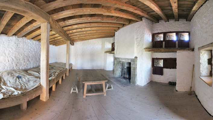
Inside the Dauphin Demi-Bastion
The Dauphin Demi-Bastion was built between 1728 and 1730, and it is
reconstructed to its 1745 appearance. At this point in time the
bastion was arranged so that artillery was facing the harbor, creating
a crossfire with the Grand Battery. The bastion's flank had
cannon covering the curtain extending to the King's Bastion, but there
were no
cannon facing directly inland. This was a major
deficiency in the 1745 siege - this was alieviated by the time of the
second siege by an elevated cavalier. Despite this, in the
1758 siege the cavalier and the bastion were bombarded into ruins.
Among those "manning" the guns was Madame Drucourt, wife of the
governor, who was known to fire the cannon.
From Dauphin to King's Bastions
In the 1758 siege, the curtain between these two bastions was breached,
making an assault feasible. Rather than face the horrors of
street fighting, the French surrendered. Although the British
artillery was well respected, at least one historian has remarked on
the deficiencies of the British engineers.
Cannon on the flank of the Dauphin bastion swept the curtain extending to the King's Bastion.
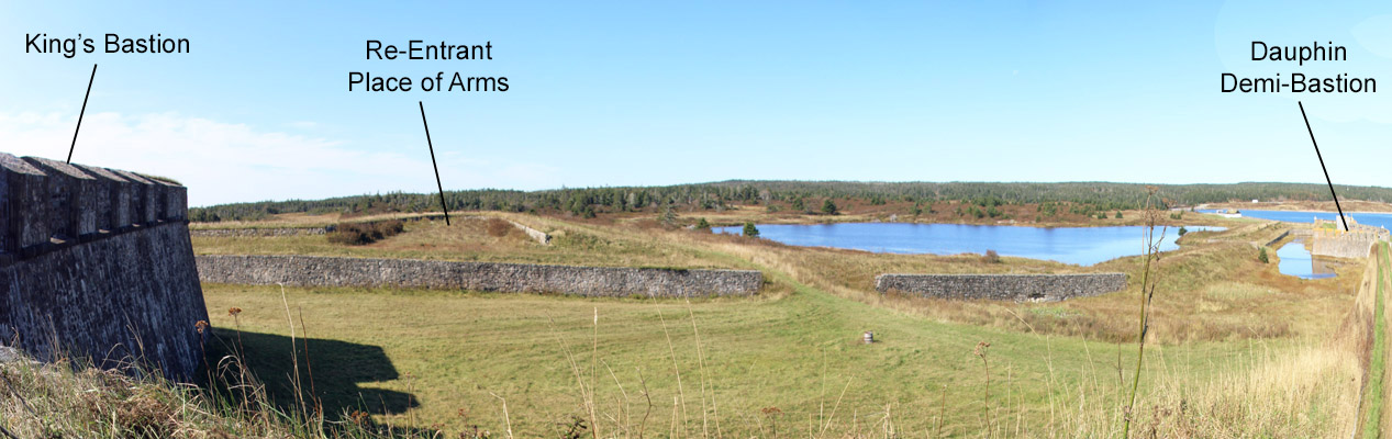
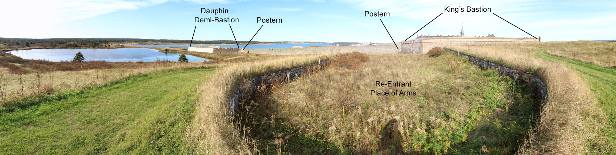
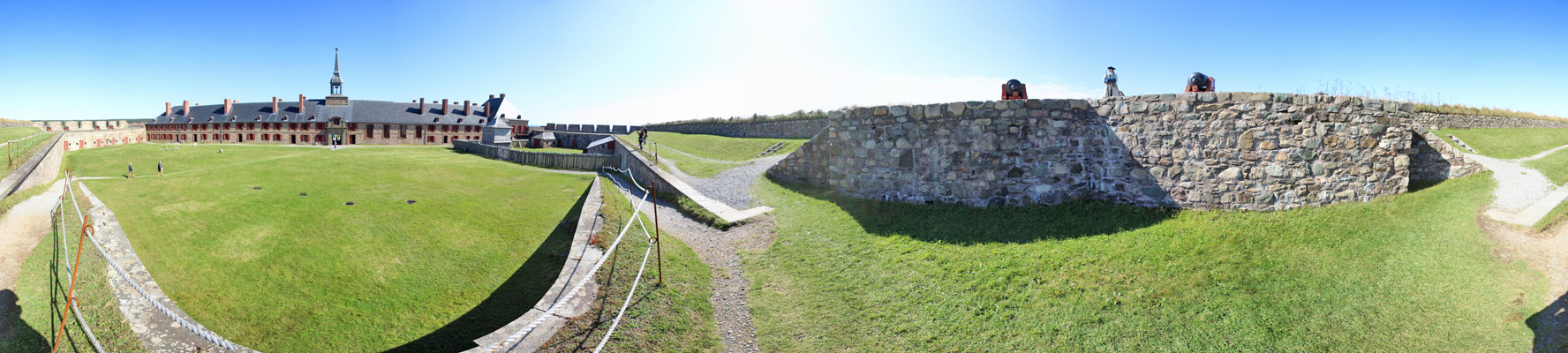
Re-Entrant Place of Arms
Although the King's Bastion was on high ground, dead ground existed to
its front, ground that could not be covered by fire from the fortress.
The answer was to build a re-entrant place of arms to the front
of the bastion.
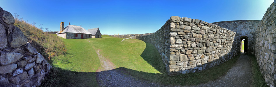
King's Bastion
Like the Dauphin Demi-Bastion, cannon in the King's Bastion were
generally aligned the sweep the area between bastions and to the front
of other bastions. The fort
designers believed that the rough ground and marshes around the
fort made a formal siege unlikely. Indeed, swampy ground made the
transport of cannon from the landing site to siege lines a difficult
task. The ground was shaped by glaciers, leaving an odd array of
small hills and ponds in front of the fortress.
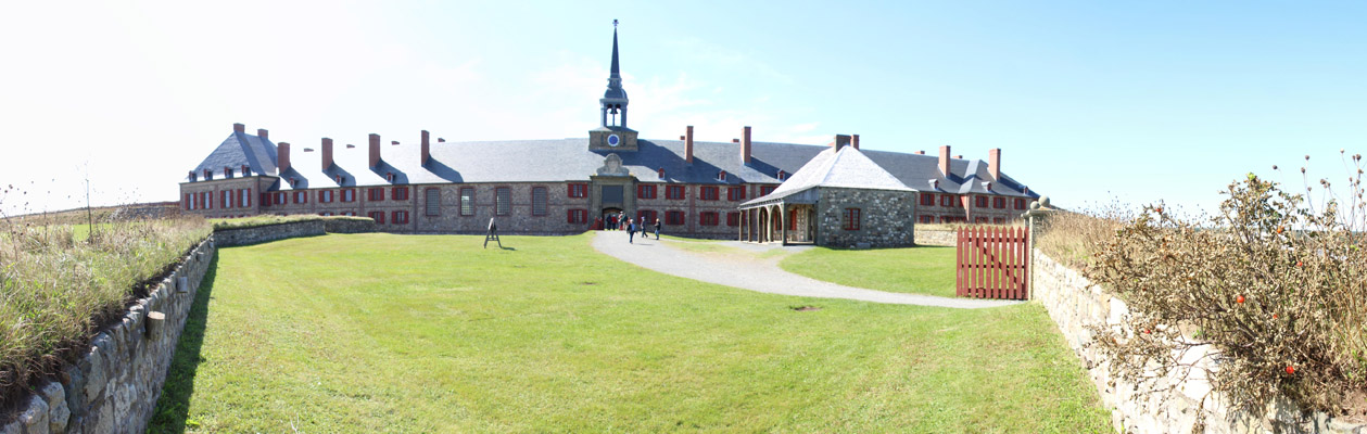
The longest building in North
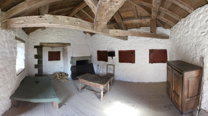
America is at the base of the bastion, the gorge - this building contained a
barracks, a chapel, and facilities for the governor.
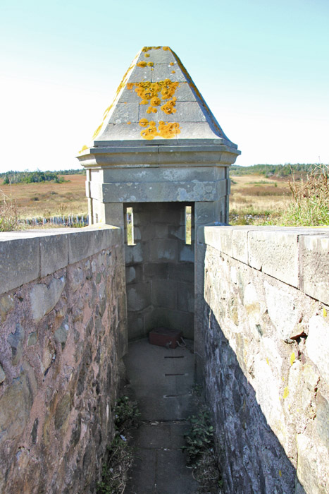
A sentry box overlooks the whole area in front of the fortress.
You can see that high ground overlooks the fortress. Not
visible in the photo, a countermine gallery extended toward enemy siege
lines from the ditch below.
Southeastern End of Building
Here you can see the ditch to the rear of the building followed by a covered way for defense by infantry.
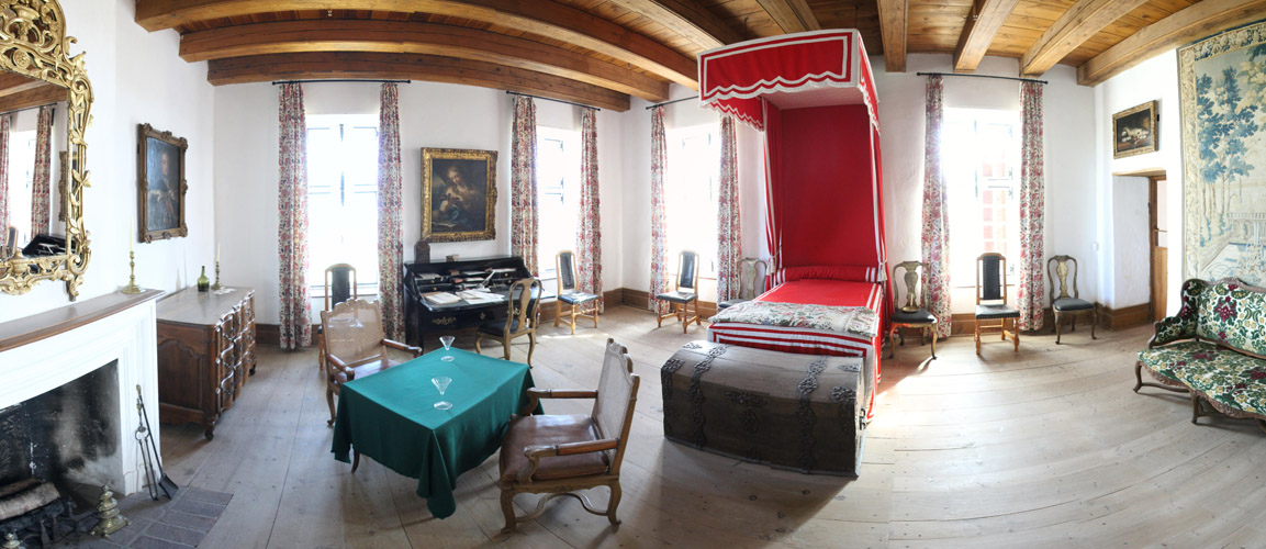
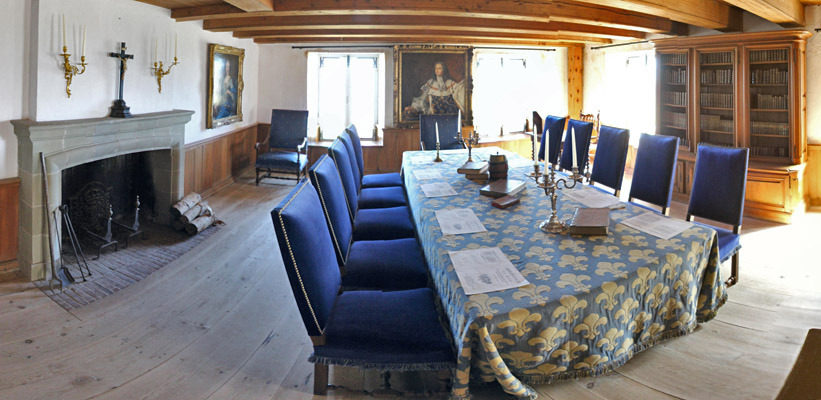
Governor's Areas
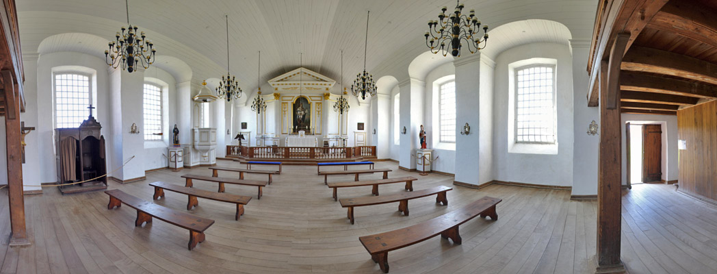
Chapel
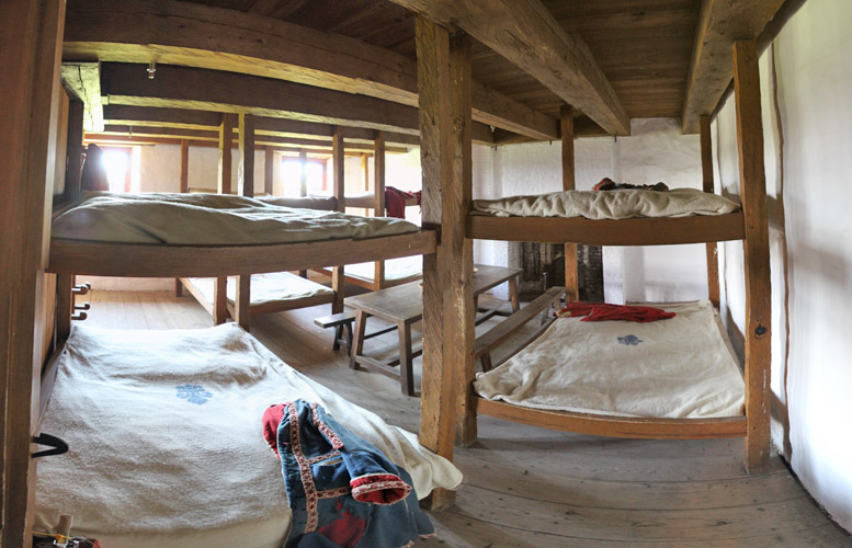
Barracks
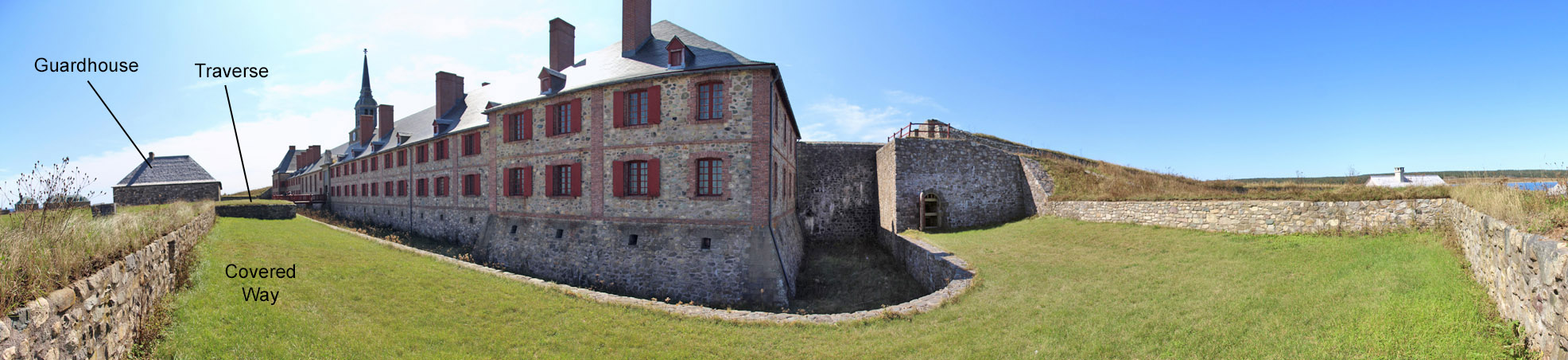
Rear of the Building
The area here could be defended by infantry from an attack on the rear of
the bastion. A traverse at left protected from flanking fire.
Place of Arms
The fortiffication of the rear of the King's Bastion was fortified made it a sort of poor man's citadel.
Here you can see the glacis, or cleared field of fire, at the rear of the King's Bastion.
Place of Arms From King's Bastion
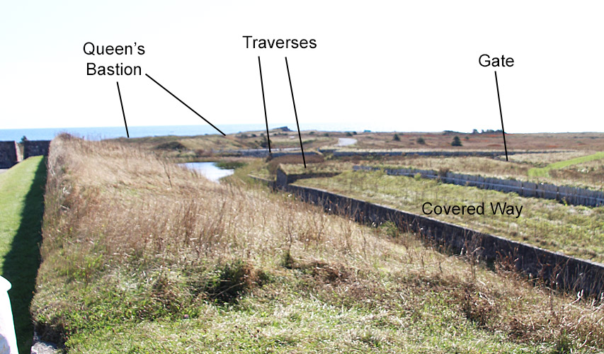
Infantry manned defenses to the front of the main walls, the covered way and outworks like places of arms.
An inverted V-shaped outwork, a place of
arms, can be seen from the ramparts. Traverses on each end of it
protected from flanking fire and allowed a continued defense if the
covered way was captured.
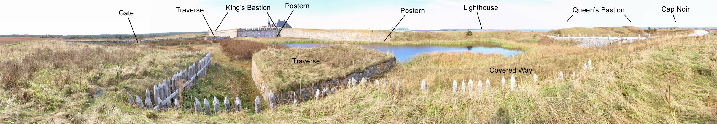
Place of Arms from Other Side
Here you can see the traverses at either flank of the place of arms.
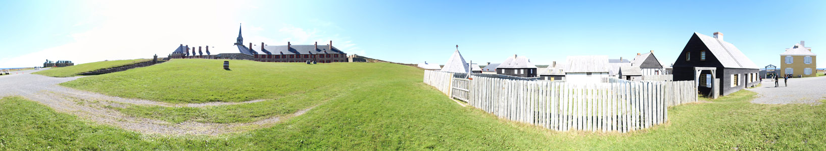
The reconstruction ends between the King's and Queen's Bastions.
After the 1745 siege, the New Englanders built a wooden barracks
inside the Queen's Bastion.
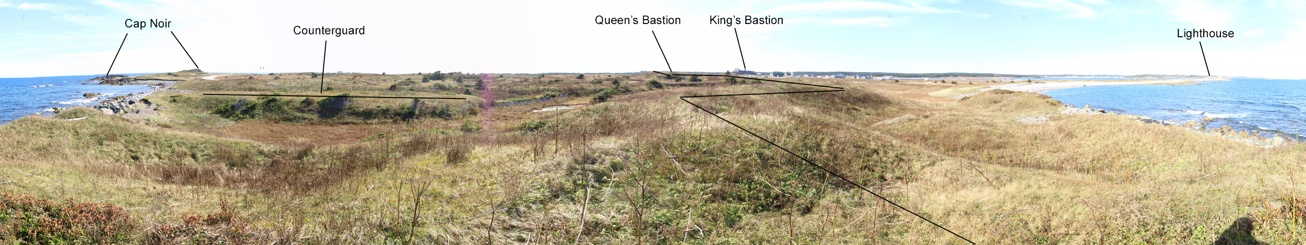
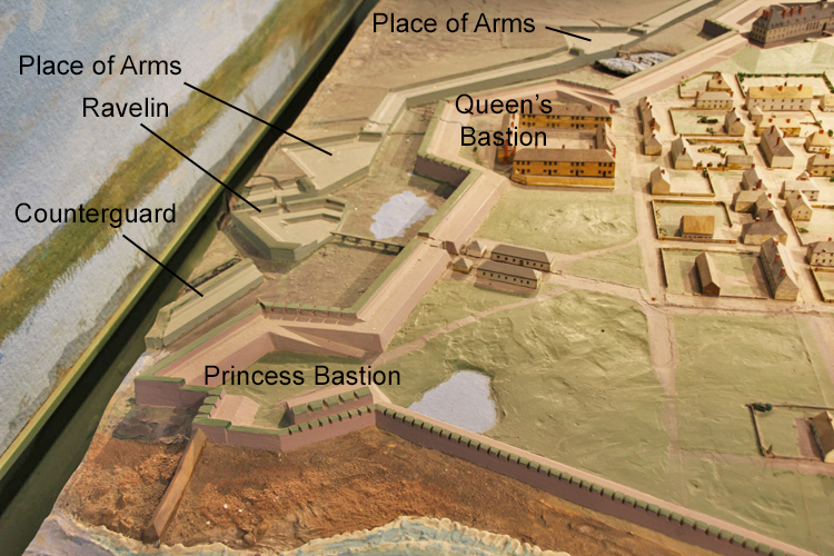
From Princess Bastion
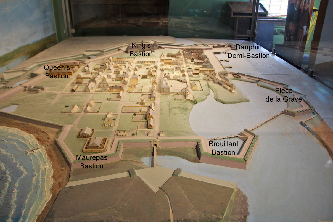
In 1731, construction began on the Queen's and Princess Bastions.
Not reconstructed, it is difficult to make sense of the
fortifications here. A counterguard gave added protection to the
Princess bastion. A ravelin was built between the Queen's and
Princess Bastions as well as a place of arms - both are difficult to make out from the ruins.
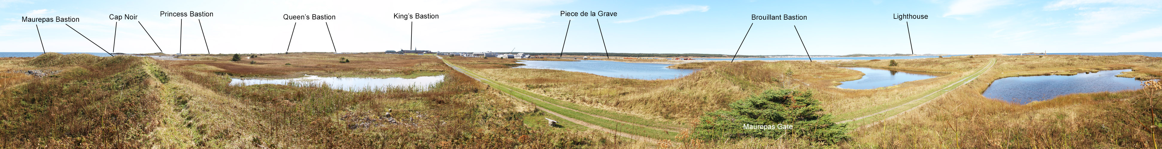
In 1737, construction began on the Maurepas and Brouillant Bastions and the Piece de la Grave, which faced the harbor.
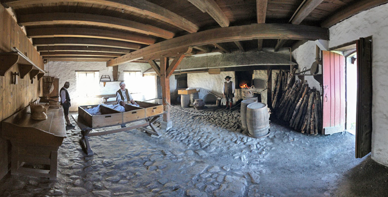
Bakery
Frederic Gate
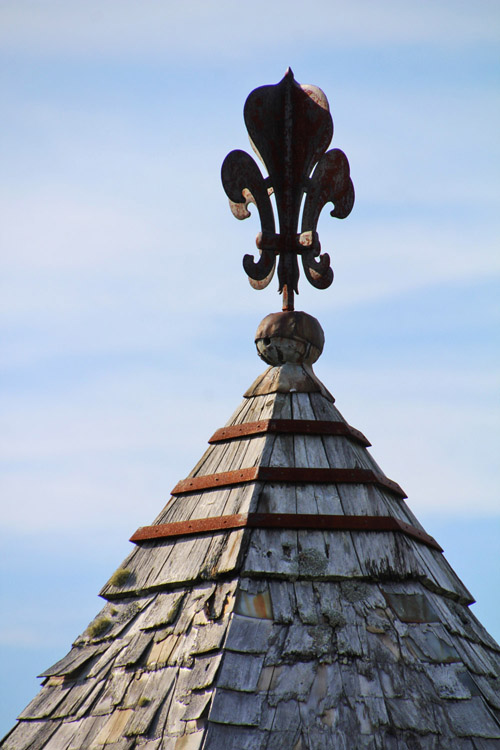
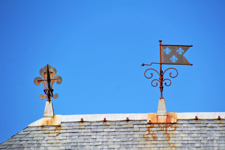
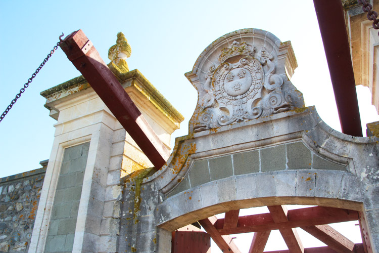
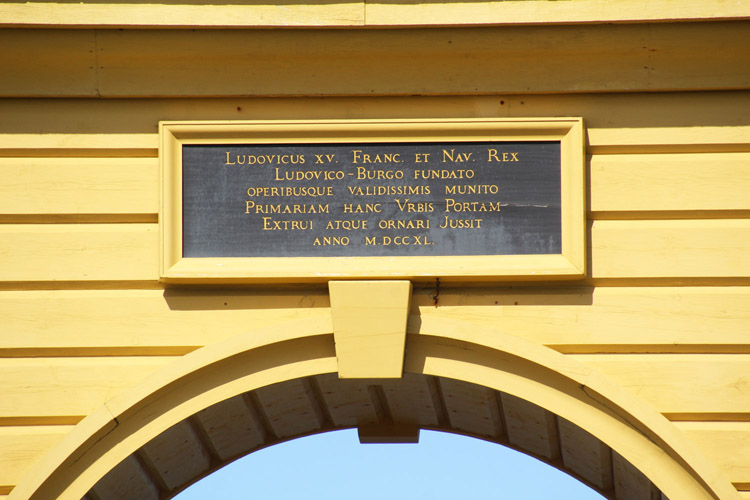
Government buildings were topped by symbols of the monarchy.
Copyright 2020 by John Hamill