Maubeuge
Louis XIV acquired Maubeuge on the River Sambre in
the 1678 Treaty of Nymegen. Vauban was immediately set to work
designing a fortress to add to the France's first line of border
fortresses. Construction began in 1679 and continued to 1685.
Refinements continued into the late 1800s when a system of
Séré de Rivières forts was built around the town.
These forts were attacked and captured by the Germans in 1914.
Fort Leveau, one of these forts, is preserved as a museum.
In the 1920s, demolition of city walls began, extending into the
1940s, but fortunately money ran short, and there is now a stretch of
fortifications open for touring.
The town was an important base near the Spanish, later Austrian
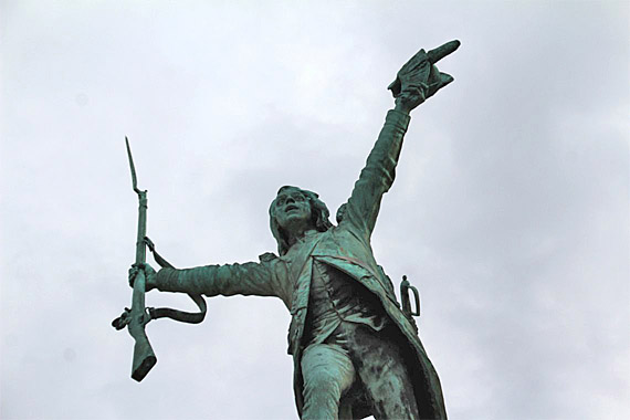
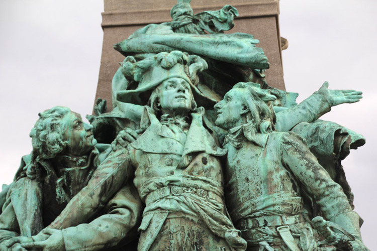
Netherlands - now Belgium. The French Revolutionary battle of
Maubeuge took place nearby, and the town was a useful base during the
Waterloo campaign.
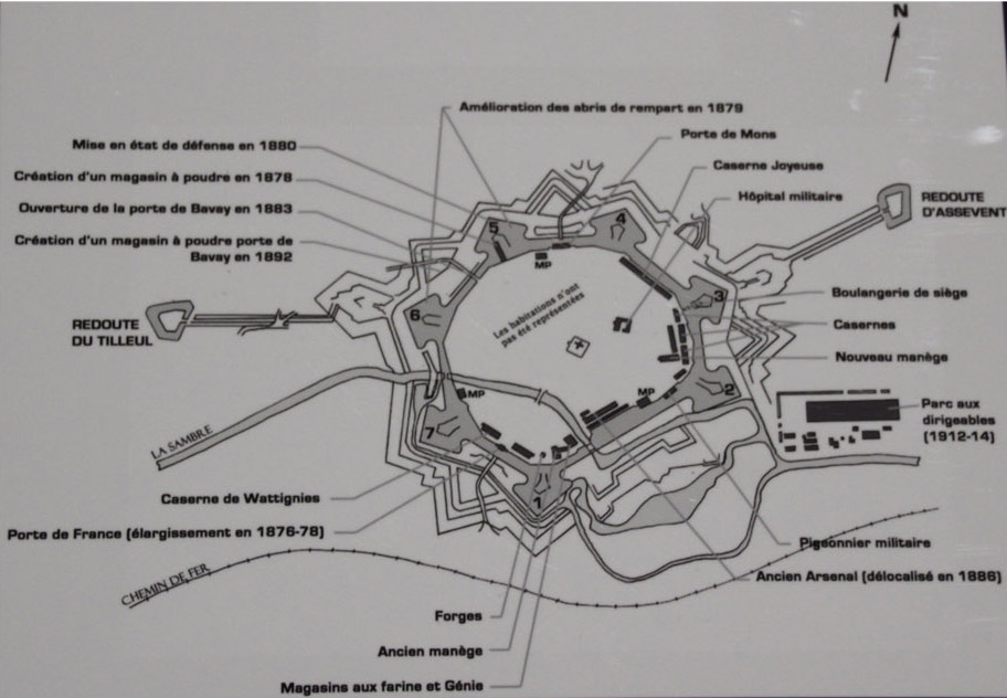
Vauban planned seven bastions plus outworks. To add greater
depth, redoubts well outside the walls were added later. Today,
Bastion 6 is included as a zoo. Tourists can walk from Bastion 5
to Bastion 2 - this is the route that we will take.
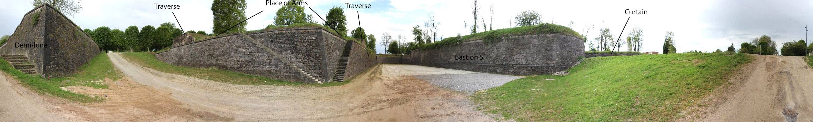
This is the ditch below the western face of Bastion 5.
From inside Bastion 5 you can look back at the location of the previous
panaorama, the intersection in the ditch. The cavalier inside
Bastion 5 is a fallback position in case the walls were breached and
successfully scaled. Two traverses protected the fighting
positions in the bastions from enfilade fire. Next, we'll go to
the top of the traverse at left.
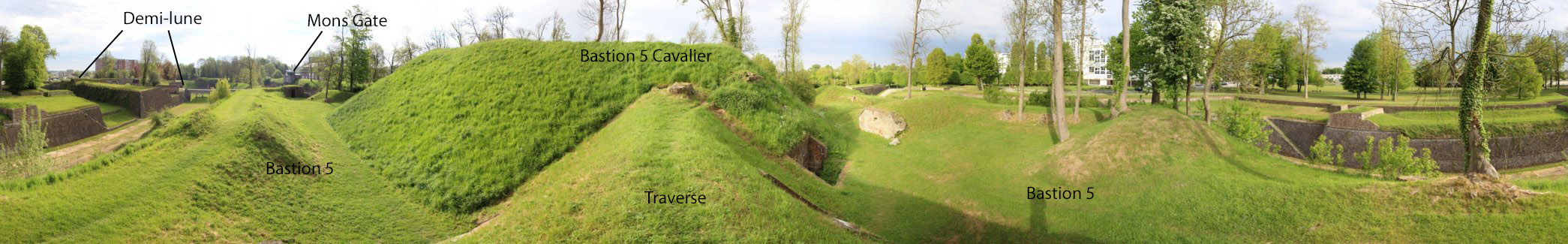
From atop the traverse you can see the Mons Gate and the redoubted
demi-lune protecting it. Next we'll get to the top of the
cavalier.
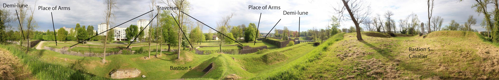
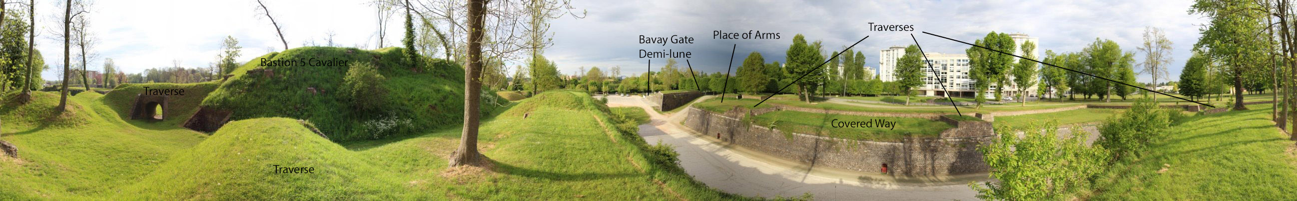
From atop Bastion 5's cavalier you can see across the ditch to the
infantry fighting area, the covered way, protected from enfilade fire
by several traverses. Places of arms existed as fall back
positions in case a portion of the covered way was captured. Next, we
continue walking toward the Mons Gate.
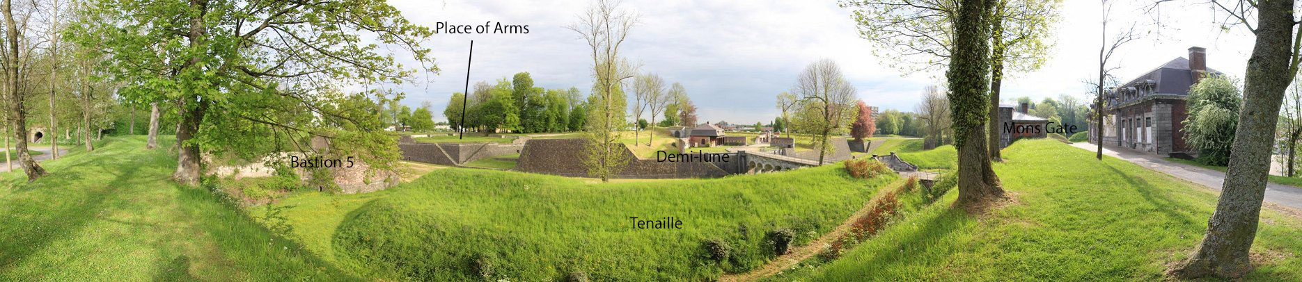
Atop the curtain, the wall connecting the bastions, you can see that
this wall, and the Mons Gate, is protected by not only the redoubted
demi-lune, but also by a tenaille. The tenaille protects the
curtain from cannon fire.
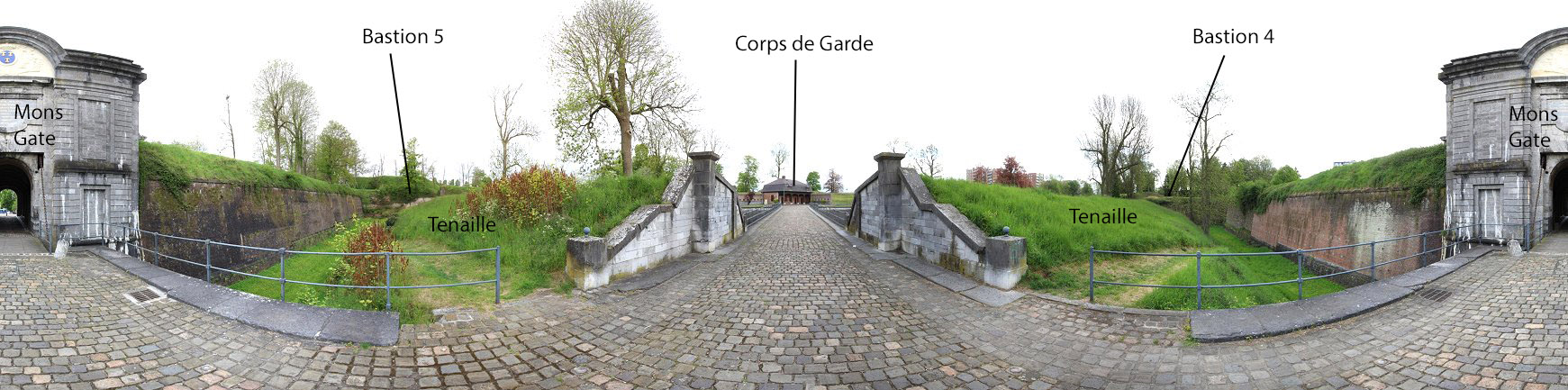
We have passed through the Mons Gate and will now walk toward the
demi-lune with its Corps de Garde, the post for the entrance guards.
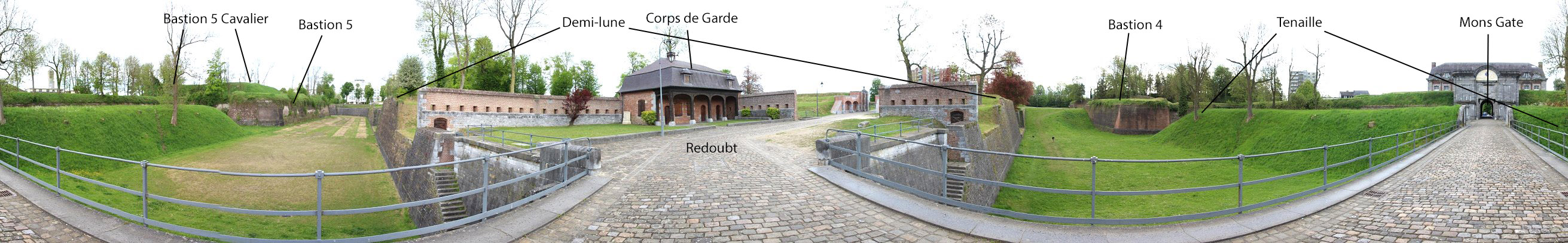
Between the tenaille and the demi-lune, you get a good idea of the
layered nature of the defense. After an attacker captures the
covered way (not visible), he must capture the outer section of the
demi-lune, then the demi-lune's redoubt. If he places artillery
in this redoubt, the tenaille blocks it from hitting the curtain wall.
An advance from the tenaille to the gate must endure flanking
fire from Bastions 4 and 5.
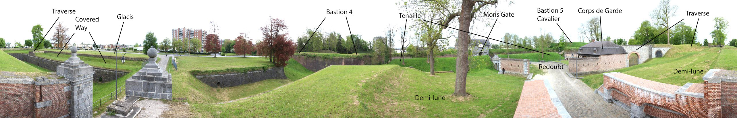
Continuing atop the demi-lune, you can understand its structure and the
covered way and glacis (or field of fire) beyong. Next we'll walk
through some woods along the other side of Bastion 4.
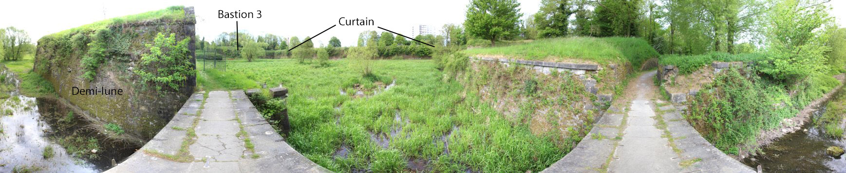
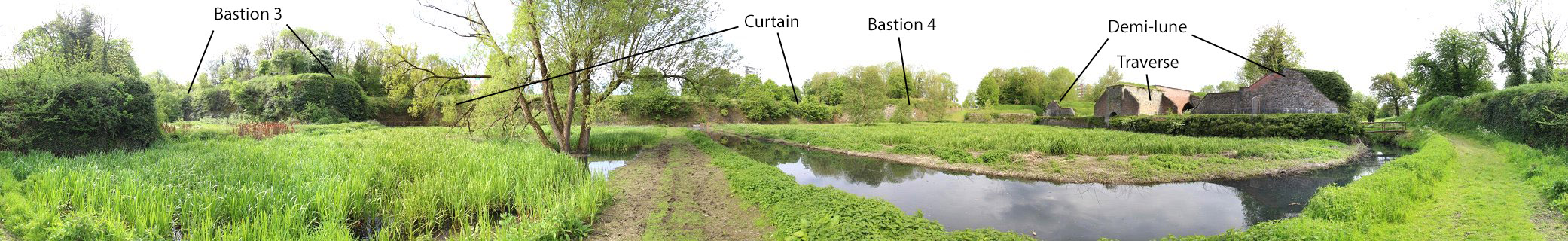
A trail eventually leads us to a demi-lune protecting the curtain
between Bastions 4 and 3. Water from the Sambre was diverted to
aid the defense in this area.
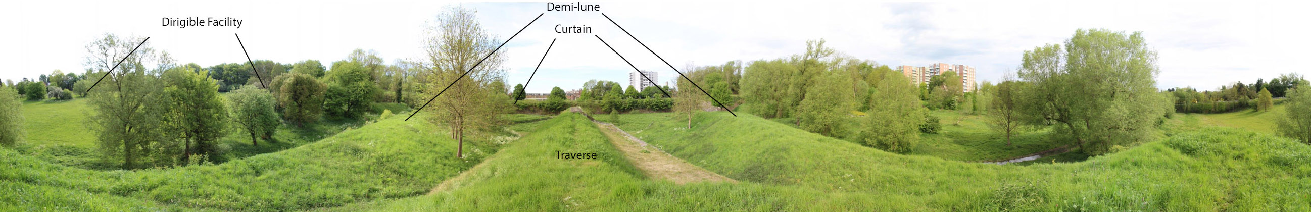
Atop the demi-lune you can see the traverse bisecting it, making an
arrow shape. In the early 1900s a military dirigible facility was
built outside the demi-lune.
Continuing along the trail you can see the rear of the demi-lune, showing the stone and brick construction of the traverse.
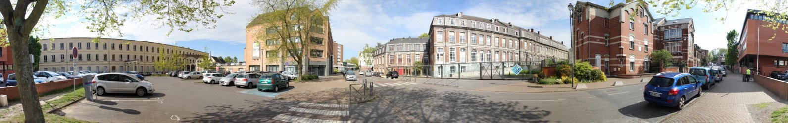
Continuing the trail takes you around Bastion 3 and into town.
The town includes an arsenal building (long building at left) and
barracks.
Copyright, John Hamill 2017-18.