Thiepval


South of Hawthorn Ridge, the River Ancre flowed through a gentle valley.  South of the valley the ground rose to the village of Thiepval.  This area, especially the high ground, was the objective of X Corps and its two front line divisions the 36th Ulster and the 32nd.  If they could capture the high ground around Thiepval, they could dominate the German front line to the north and to the south.


The two maps above from Wikipedia should help orient you with the area, especially the details of the trench network.  Ancre British Cemetery is between the two front lines on the far left of the map on the left.


The German front line ran roughly along the blue line.  The British attacked from the west, or from the left side of the map.  The letters on the map correspond to the letters by the panorama names.  Only the Ancre British Cemetery panorama hs no letter as it is off the map to the north.


Ancre British Cemetery

The land no occupied by Ancre British Cemetery was in no man's land on July 1st.  Men of the 36th Ulster Division attacked across this ground from left to right, suffering high losses with no gain.  The gully the cemetery lies in extends north toward Newfoundland Park.  The River Ancre was on the British right.  Next we cross the river and climb uphill toward Thiepval Wood, where the Ulstermen made some progress.


A) Pope's Nose German Salient

The German observation post on the left of the panorama was part of the Pope's Nose salient.  The 36th Division attacked the German lines here and at Ulster Tower from Thiepval Woods.  On the right of the panorama you can see Ancre Cemetery which we just came from as well as Beaumont Hamel and the Newfoundland Park.Down the track at right was the fortified village of St Divion.


B) Ulster Tower


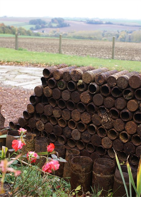
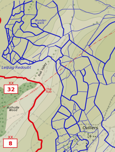
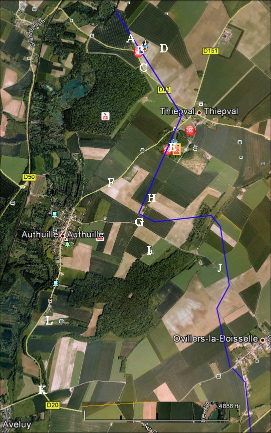
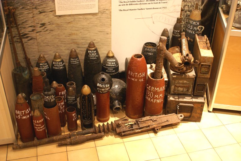
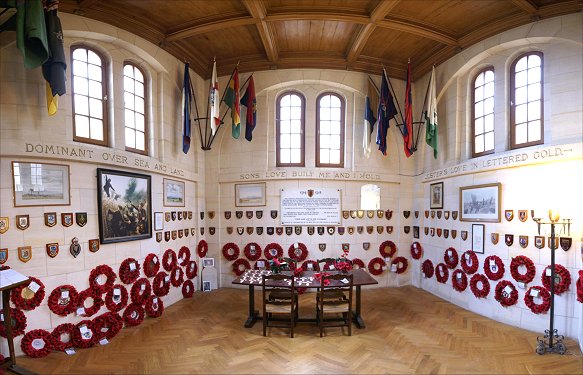
Patterned on a tower near Belfast, Northern Ireland, an area familiar to some of the men of the 36th as they had trained there in 1914.  Ulster Tower sits along what was the German front line on July 1st attacked by the 108th Brigade.  The is a small museum and collection of battlefield relics.  Climbing to the top of the tower, however, is not possible.


C) Connaught Cemetery

Continuing down the road we come upon Connaught Cemetery, which was in no man's land on July 1st.  Here, men of the 109th Brigade from the Thiepval Wood attacked German lines across the road.  The German wire had been well dealt with by British artillery, and mortars laid down an effective smoke screen.  More importantly, the German artillery was late in responding to the attack here and fell on the supporting 107th Brigade, not the attacking troops.  The British barrage advanced forward to the German trench lines but also moved along the German communication trenches to their rear.  The attack was an incredible success by the standards of the day and reached beyond the Mill Road Cemetery and the Schwaben Redoubt, which was in the German support lines.


C) Connaught Cemetery

From the other end of the cemetery you can glimpse the Thiepval Memorial.  Next let's go to the Mill Road Cemetery.


D) Mill Road Cemetery

The view from Mill Road Cemetery is excellent.  The Ulstermen attacked from Thiepval Wood just beyond Connaught Cemetery, reaching just beyond where we are now.  You can see the Ancre Valley, including Ancre British Cemetery and Beaucourt, which some claim - wrongly - that British troops reached on July 1st.  The German second line was just in front of Grandcourt.  Although the British planned to capture the German second line on July 1st with their reserve brigades, it was not to be that day.  


D) Mill Road Cemetery

Here on the other side of the cemetery you can see the site of the Schwaben Redoubt, which the men of 109th Brigade captured.  The 107th Brigade moved forward from reserve, with elements reaching the Stuff Redoubt.  The gains made here were untenable, however, with Thiepval still in German hands.  German machine gun fire from there made this place unsafe, and German counterattacks recaptured their front lines.  Had the British been able to capture and hold the German first line here near Thiepval, they would have looked down on the German line in either direction.  As it was, the 36th Division had lost 5,104 to no avail.

In the center of the cemetery the stones are flat on the ground.  Because of German digging, the ground here is not safe or stable, so the stones are flat and the area taped off.

Next we continue to the Thiepval Memorial.


E) Thiepval Memorial

Because of the nature of the fighting, many of the British missing were never found or never identified.  In 1932 on the high ground near the town of Thiepval, the British government completed an enormous memorial to the missing with the names of each of the missing men from the Somme battles.  A total of over 72,000 names are now on the memorial, which can be seen over much of the battlefield.  Recently, a visitors' center has been added to help interpret the battle for tourists.


F) 97th Brigade

On the road to Authuille you can look back and see Thiepval Wood where the 36th Ulster Division attacked, and to the right of it you can see Thiepval Memorial.  To the right of the memorial in the panorama, the British front line was in this field facing uphill.  In the area just over the top of the ridge on the reverse slope was the Wonderwerk Redoubt.  The 96th Brigade attacked Thiepval itself but was repulsed due to machine gun fire from the ruins of the town.  The 97th Brigade did better as it attacked in the general area shown.  The men of the 97th Brigade had moved into no man's land before the bombardment ended.  When it did, they attacked kicking a soccer ball and were able to surprise the Germans, arriving at German lines before many of the enemy had emerged from their dugouts.  The success didn't last, however.  As they advanced further, fire from the Wonderwerk Redoubt was intense, and they encountered uncut wire.  Reserves did not reach the battle in time, and the attack stalled.

Next, let's drive down to Authuille then back up to the Leipzig Redoubt.


G) Leipzig Redoubt

We just drove from the road from Authuille and are now on top of the ridge.  A track goes into a rough area, an old quarry, which was site of the Leipzig Redoubt.  Although the 17th Highland Light Infantry entered the Quarry on July 1st, and trenches nearby were captured, the British attack failed to capture the Leipzig Redoubt.  It was only in September that the Brits took the place.  Let's walk through, and a little beyond, the redoubt.


H) Leipzig Redoubt

We walked along the track at left through the redoubt.  Attacking British troops successfully gained the top of the ridge here but were repulsed by fire from the Wunderwerk Redoubt to the right of the track.  

Here we can see the higher ground beyond at Thiepval Memorial.  Because of the failure to capture the Leipzig Redoubt and the heights at Thiepval on July 1st, the Germans on this high ground could enfilade the Ulstermen attacking from Thiepval Wood.  Success in one area could be undone by failure elsewhere.

Next, we return to the car and see the Lonsdale Cemetery further down the road.


I) Lonsdale Cemetery

 Sadly, Thomas Hardy's sentiment is not always correct.  You can see where we parked the car by the monument, the one shown in the picture at right.  (The car is facing the direction that we came.)  From the car we walked over to Lonsdale Cemetery, where many men from the 11th Border Regiment are buried.  Attacking the Leipzig Redoubt, the unit lost 26 officers and 490 men.  The 32nd Division lost 3,949 casualties attacking the heights at Thiepval.


J) Nab and Nab Valley

We have come down the road in the center of the panorama and are looking back from where we came.  Nab Valley marks the rough boundary of British X Corps on the left and III Corps on the right.The British front line ran through the wood to the left of, and parallel to, the road visible in the panorama.  Very near the minor intersection ahead, the British front line bent back at roughly a 90 degree angle along the road -  and faced up the ridge that we are on.  This salient was known as "The Nab".  Quarry Post, whose approximate position is shown, was an important location - a reserve area, a battalion HQ, and a dressing station.

The German line jutted forward from the Thiepval Memorial to the Leipzig Redoubt, then bent back to Nab Valley where it bent again toward the road visible here, crossing it about 3/4 of a mile from the valley floor.  German held Ovillers is up the road behind us.

Next, we will take a side trip into the British rear areas - Blighty Valley Cemetery and Crucifix Corner.


K) Crucifix Corner

This intersection was called Crucifix Corner during the war.  In the woods here are traces of trenches and a modern version of the crucifix that stood here during the battle.  Many British troops marched by Jesus on their way to the front.

If we drive toward Authuille from here we will come upon Blighty Valley.


L) Blighty Valley Cemetery


Beyond Authuille, a short walk off the road leads up through a shallow valley used by the British for a narrow gauge supply rail line.  Many British troops approached the battle through this valley.  Visible down the walking trail is Blighty Valley Cemetery, and Authuille Wood is beyond.  Although hidden from German view, the area was shelled regularly.  Next, we return to the road.


Copyright by John Hamill, 2012


Back to The Somme