Utah Beach
Not one of the original invasion beaches, Utah Beach was added when the
invasion was pushed back from May to June. Troops from Utah Beach
were to cut off the Cotenin Peninsula and capture Cherbourg, whose
capture would easy Allied supply. Although Omaha Beach would
create the most problems, planners were most worried about Utah Beach.
Separated from the other beaches by rivers, it was feared that a
German counterattack could crush the beachhead. The Germans used
dams to flood the ground behind the beaches so that three of four exits
from the beaches were causeways across this water barrier.
The airborne drops were designed to open up these exits and
protect the beach from counterattack.
The aerial bombardment was more effective than that at Omaha Beach
since the bombers approached parallel to the coast. A naval
bombardment followed.
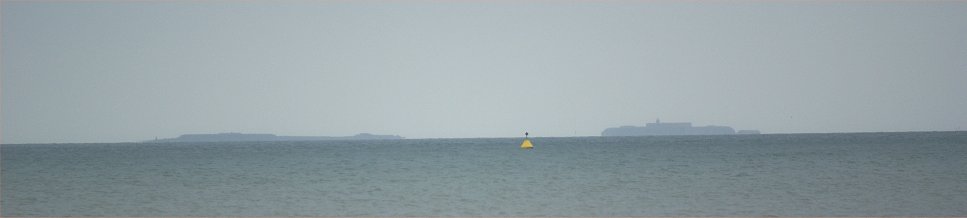
Offshore Islands
The St-Marcouf islands off of Utah Beach were thought to be advanced
German outposts. In reality, they were found to unoccupied when
Allied troops landed on them at 5:30am.
Like many of the other landings, the ones on Utah Beach were
further east than intended due to low light and currents. The
landings were, in fact, 1,800 yards to the east in an area that
planners believed was too shallow. Defenses were lighter, however.
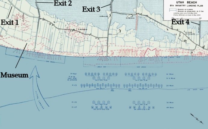
Utah Beach
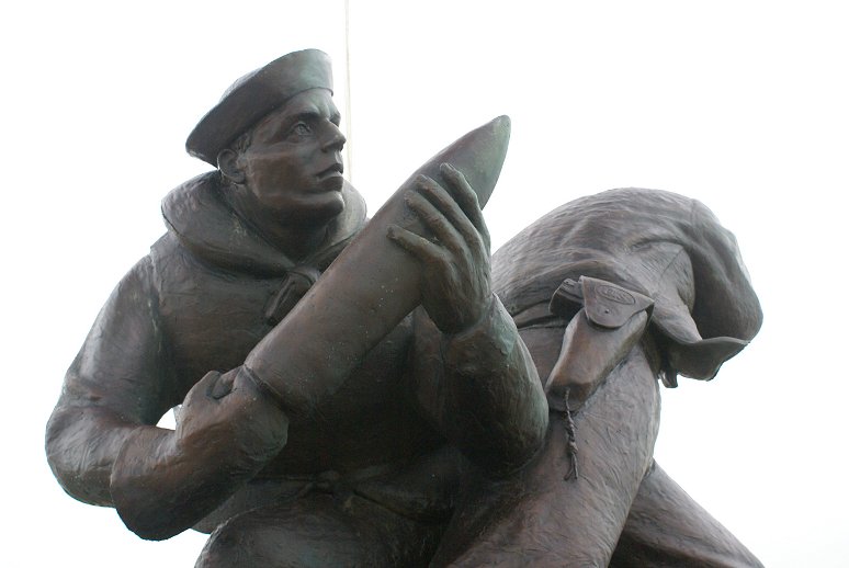
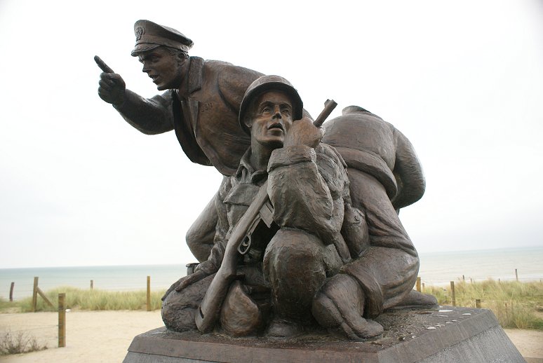
Around 600 men from the 8th Regiment of the 4th Division landed.
BG Theodore Roosevelt, Jr was in the first wave. Either he,
or Col James Van Fleet, depending on the source said, 'We'll start the
war from right here." For his bravery leading and directing
troops, Roosevelt was awarded the Medal of Honor for his actions.
The beach was secured at a cost of less than 200 casualties.
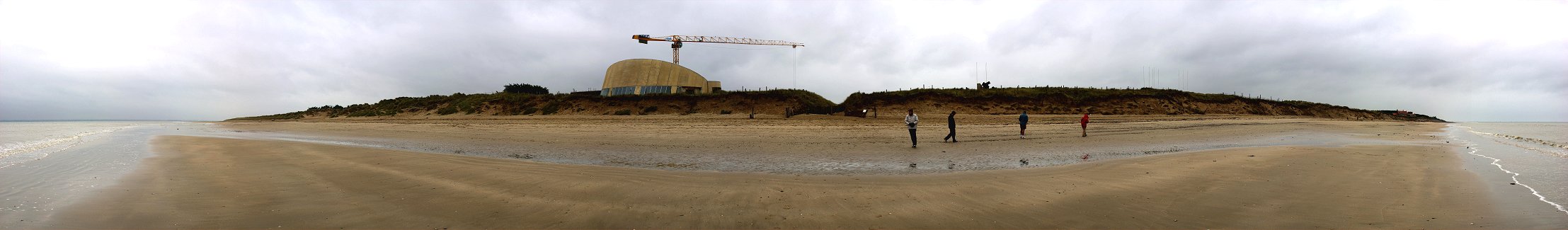
The museum visible here was under repair when I visited. It
is at the approximate center of the landings. Beyond
the beach to the left, the coast curves inland to where two rivers
enter the English Channel. The gray strip above the sea at
left is the coast beyond, near Pointe du Hoc and Omaha Beach.
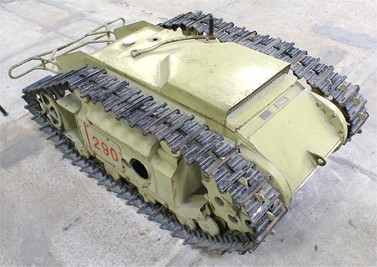
The Germans tried to use a secret weapon, Goliath, a remote control,
self-propelled mine. The naval bombardment, however, had cut the
communication wires. This vehicle is at the Tank Museum in Saumur.

The road behind the Cafe Roosevelt is exit two. Exit two goes directly inland. Exit
one is the road behind the museum that parallels the beach
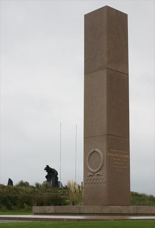
for a stretch before heading inland. The Navy
Memorial is prominent in the center of the image.
Exits one and two, rather than two and three as originally planned, were used to move inland, causing congestion.
Navy Memorial
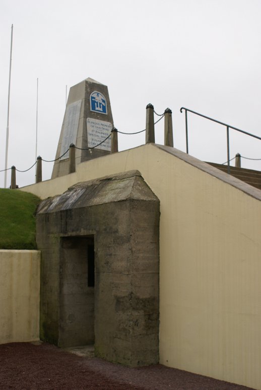
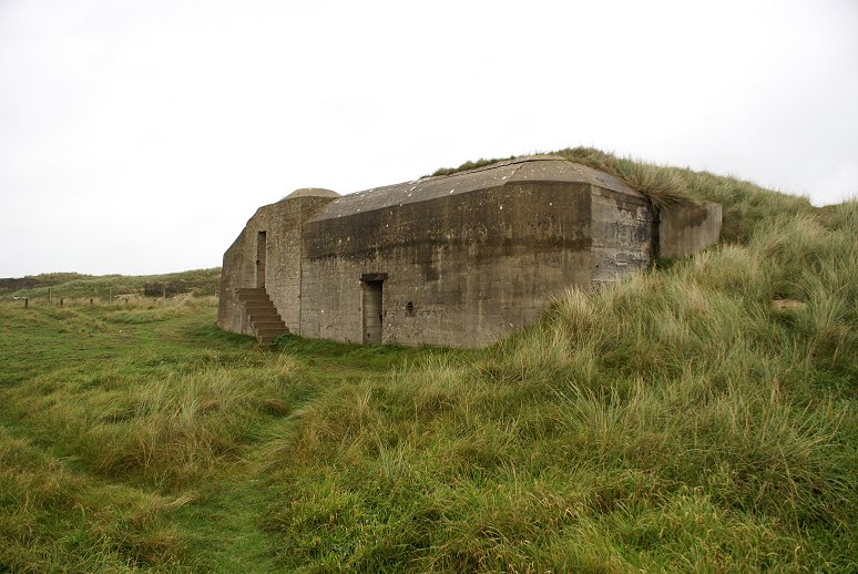
Left: Monument to the 1st Engineer Special Brigade. The
unit was given the task of clearing beach obstacles. They set up
HQ in this captured bunker and directed beach operations.
Right: American Battle Monuments Commission memorial.
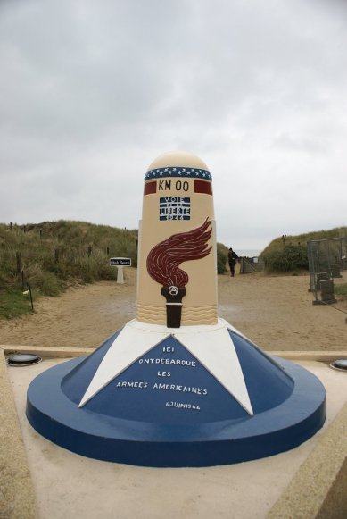
Kilometer 0 of the Way of Liberty. This special painted kilometer
marker is the first of many following the route of liberation.
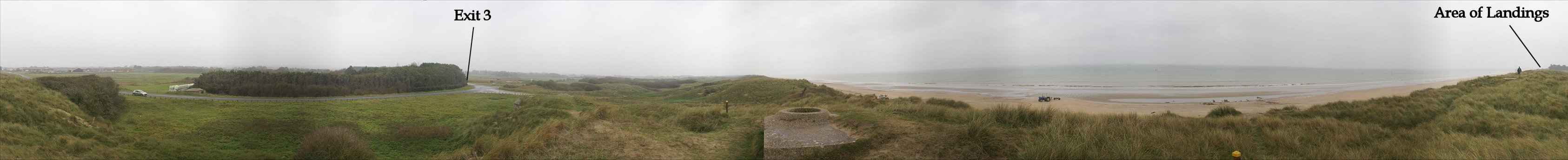
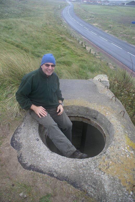
German defenses still exist. Here near Exit 3, there are
defenses on either side of the car at left, and you can see a concrete position
to the lower right of the intersection of Exit 3. A
prominent machine gun position overlooks the beach. On the
right side of the panorama just to the left of the man is another
concrete position.
Copyright 2010-11 by John Hamill