Culp's Hill
July 2-3, 1863
The "hook" of Meade's fish hook position, the right flank, was Culps Hill. The hill was vital to the Union position because Meade's vulnerable line of communication ran along the Baltimore Pike - just a quarter mile from Pardee Field on the lower portion of the hill. Although a Confederate scouting party had reached the undefended hill late on the first day, the Wadsworth's division of I Corps soon arrived, taking up the north-facing slope, followed at about 6am on the morning of July 2nd, by the XII Corps, which defended the east-facing slope. Although it was a rare practice at this time of the war, the Yankees on the hill entrenched. Because of this, the defense would hold.
For the second day, Lee considered making his main effort on the Union right - at Cemetery Hill and Culp's Hill. Confederate Second Corps commander Richard Ewell was concerned with his own flank and thought the hills too difficult to take. Lee changed his plans so that Longstreet would begin the attack on the Union left. A.P. Hill's Third Corps in the center would then join in, followed by Ewell. The sound of Longstreet launching the attack at 4 PM signaled to Ewell that it was time to start preparing for battle.
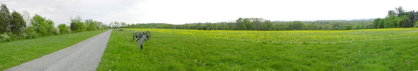
Benner's Hill
Ewell sent his artillery to deploy along this ridge, Benner's Hill in order to duel Union guns on east Cemetery Hill before the assault. The Union guns were just too much, however, and the guns were forced to withdraw. These gun carriages are facing Cemetery Hill. Culp's Hill is just over the prominent carriage.
Touring Advice: When I visited in May 2004, this rarely visited portion of the battlefield wasn't marked when traveling toward town. So you'll pass it when driving in that direction and end up turning around to come back. Well marked private property is immediately adjacent to the area, but as you can see in the picture below, when leaves are off the trees, there is a decent view across this private property looking toward Culp's Hill and the area to the east of it.
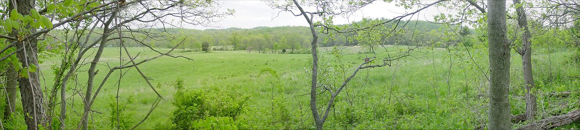
South From Benner's Hill
This is the view looking toward Culp's Hill from the southern end of the Benner's Hill ridge. On the right is the upper portion of Culp's Hill, the summit with the tower. But Culp's Hill has another lower portion to the south-southeast. I believe that this is the lower hill to the left of the summit. As we will see below, this lower portion of the hill, and the area of Spangler's Springs just to the southeast of the hill, was the scene of the potentially decisive portion of the Culp's Hill fight.
In the lowland between here and Culp's Hill is Rock Creek. Edward Johnson's division moved through these fields, now inaccessible private property, to the left of Rock Creek, and deployed facing toward the right of the picture, more precisely toward the eastern slopes of Culp's Hill. It was almost dark as the attack began.