Guilford CH First Line
After Tarleton's detachment was nearly destroyed at Cowpens, SC on January 17, 1781, Daniel Morgan knew Cornwallis with his 3,000 men would go after him with his whole force. Morgan retreated, and Gen. Greene with the main army moved to join him. Cornwallis destroyed all tents and unnecessary wagons and provisions, and vigorously pursued Morgan into North Carolina. Two hundred fifty British troops deserted immediately to avoid the hardship of living off the land, and by the time of Guilford Courthouse Cornwallis was down to less than 2,000 men.
Not long after Greene's and Morgan's troops joined, Morgan left the army for health reasons. On February 13th, Greene crossed the Dan River in Virginia to safety. The Carolinas and Georgia were in British hands, but Cornwallis was 250 miles from his base of operations at Winnsboro in wintertime, and the Tory rising he expected never happened. Cornwallis withdrew into North Carolina. Greene followed and the North Carolina and Virginia militias joined him while Steuben sent him some of the regulars he was training from Virginia.
Greene camped at Guilford Courthouse and offered battle. A detachment under Lt. Col. Henry Lee was sent several miles forward and clashed with the approaching British. Cornwallis had decided to attack despite being outnumbered two to one because he felt that only a victory would encourage a Tory rising. He later said he believed Greene had 10,000 men. Lee sent back word of Cornwallis' approach, and Greene deployed his troops for battle. His deployment was somewhat similar to Morgan's at Cowpens. The North Carolina militia was on the first line behind a rail fence and facing an open field with cavalry and other reliable troops on their flanks. About 300 yards behind the North Carolina militia was the Virginia militia, which would be flanked by the same troops protecting the first line after they withdrew. About 500 yards behind the Virginia militia was the main line composed of Maryland, Virginia, and Delaware Continentals.
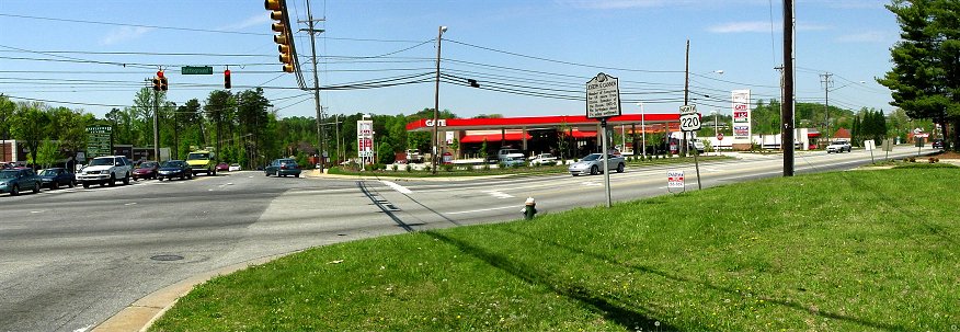
Present Day New Garden Road and Route 220
This is the intersection of the present day New Garden Road and the modern Route 220 which was constructed to bypass the battlefield. You can see that the New Garden Road beyond the stoplight descends a hill. To the right of road is a gentle hollow with a stream. Some historians suspect the wartime New Garden Road was in this hollow. Henry Lee says the road passed through a defile. Lee withdrew along the road and deployed on the left flank of the North Carolina militia. Cornwallis followed later.
According to legend, when 220 was being constructed, workers uncovered the remains of a British soldier near the present day gas station. In the interests of rapidly completing the project, they promptly covered him back up. Because of the buttons on his uniform, he is believed to have been Lt. O'Hara, son of the general. At another location the Greensboro government approved a dog walking facility at a location which has a 90% probability of being a mass grave. Clearly, the city of Greensboro has not properly looked after this important historical site.
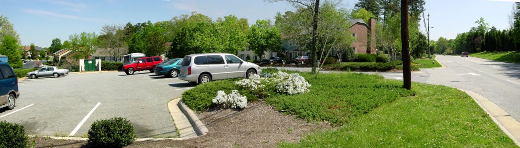
Looking up New Garden Road
The road on the right of the picture is the present day New Garden Road as it heads toward the American first line, which was near where the road disappears. On the far right across the road is the area of the Hoskins House, near where the British center deployed. On the left of the picture is a development named Greene's Crossing, an abomination to all freedom loving people. (If you want to know what Greene was crossing, you'd have to ask the battlefield desecrators who planned this destruction.) You can see the hollow which extends parallel to the present day New Garden Road. As mentioned in the previous photo, this hollow may have been the wartime location of the road.
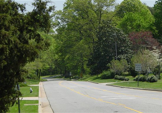
Zoom up New Garden
Barely visible on the right of the road shaded by the trees is the National Park sign. The road turning off to the right just before the sign is the approximate location of the American first line. As you can see, the British approach was uphill, which is not obvious looking at most battle maps. Most of the area of the British advance has been lost to development.
Hoskins House
Early on the morning of March 15, 1781, Cornwallis' army, which has been estimated at 1,900 officers and men, began the ten mile march to the American position. Although the American army numbered 4,400, Cornwallis thought it numbered 10,000 men. Despite being vastly outnumbered, he planned to attack. Cornwallis engaged in an artillery duel as his army deployed in front of what is now the Hoskins House. (Researchers now believe the house did not exist at the time but that buildings of some sort were nearby.) Webster's brigade moved into line on the left while Leslie's Brigade deployed right. O'Hara's Guards and Tarleton's cavalry were in reserve. The woods to the British right were less dense.
The British army advanced across an open field to attack the North Carolina militia positioned behind a rail fence. The American line was longer than expected, so the British were forced to commit the reserve as the battle was beginning. The American first line wasn't expected to stand and fight, only to fire three times and withdraw. The militia fired at 150 yards, and the British returned fire and continued to advance. At just 40 yards, the British troops fired and hesitated, knowing the militiamen were preparing another aimed fire with their muskets resting on the fence. Webster rode to front and urged his troops forward. Most of the militiamen ran.

Hoskins House Panorama
This is a nearly 360 degree view from the area of the Hoskins House. On the far left behind the trees is the present day New Garden Road, which as you can see climbs gently toward the American first line. The dirt path is the interpreted position of the wartime road. The British line deployed to advance along the road. The modern building houses the Tannenbaum Park museum, which you should definitely visit. As you can see, the ground descends toward the right just as it does toward the left, so this area would have been ideal to observe and direct the advance. Further to the right you can see the Hoskins House, then once again the treeline marks the present day New Garden Road.