Port-Louis and Lorient


Portugal was the first European power to reach the Far East in the late 1400s, establishing colonies and trade 'factors' as far away as the Spice Islands, China, and Japan.  The Dutch captured many Portuguese possession after Portugal was absorbed into the Spanish Empire for a time.  Other European countries were late to the game and as a result were left with seemingly slimmer pickings, including India.  England and France both established East India Companies seeking to profit from trade with the Orient.  The French efforts were less successful, perhaps in part because of heavy state involvement.  France was also preoccupied with Continental concerns, and maritime ambitions were divided by Mediterranean and Atlantic interests.  In 1600, Henry IV, the Catholic turned Protestant turned Catholic king, founded a state owned company to trade in the East.  Efforts floundered.  The French East India Company was founded in 1664 by Colbert during the reign of Louis XIV by amalgamating of three previous companies.  It was a joint stock company owned by both the state and by private investors.  Although the company failed to colonise Madagascar, they did successfully occupy the islands of Reunion and Ile de France in the Indian Ocean, which proved valuable stepping stones for voyages to India.  Meddling in the relations among the various Indian states, the French in India clashed with the English, who would eventually come to push the French out of India - then dominate the whole subcontinent.  The troubled French company didn't survive the French Revolution.

In 1666, Louis XIV granted land in and around Port-Louis in Brittany to the East India Company.  Port-Louis had been used since the early 1600s to warehouse goods related to Far Eastern trade, and in 1628 additional warehouses were built across the bay in a place that would be named L'Orient, or Lorient.  The French East India Company originally used Le Havre on the Channel coast as its base, but in 1675 they transfered to the Port-Louis area, which was safer during wartime.  


The company built a shipyard at Lorient and a large complex of buildings which sadly did not survive World War II.  The area is now a drab industrial area that gives no clue of its rich history.  This model represents the East India Company facility as it was planned to be - an amazing place, no doubt, and a true historical loss.


The company complex was a juicy target to France's enemies, and the British made a failed attempt on the place during the War of Austrian Succession, so measures had to be taken to protect it.

The harbor entrance had been fortified in the 1590s by the Spanish, who were fighting for the Catholic cause during the Wars of Religion.  At the conclusion of the wars, the fort reverted to French ownership.  The Spanish design was a square with four bastions.  Richelieu had the fort rebuilt and renamed Port-Louis after Louis XIII.  Between 1649 and 1653 fortifications were built around the adjacent town of Blavet, and Port-Louis became the citadel.  Visiting in 1683, Vauban was not impressed with the defenses, but rather than a total rebuild, he merely ordered modifications made.  Eventually, the citadel would be used as a prison, and it now houses several excellent museums.  It is a beautiful site to visit.


The ditch can be wet or dry depending on the tides.  Let's cross the bridge into the demi-lune.


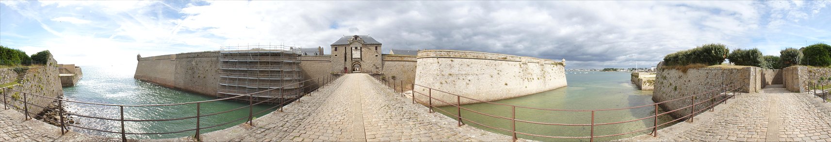
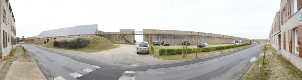
We've passed through the demi-lune, which you can see on either side of this 360 degree panorama.  Ahead you can see that the bastions are large, making the curtain between them relatively short.  


The bastions feature curved orillons rather than sharp angles.  These protect recessed flanks that cover the gate.  
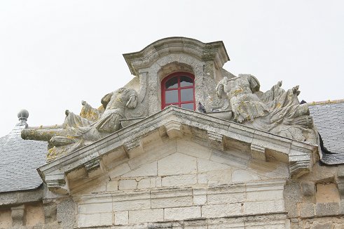
Drawbridges existed for both vehicles and pedestrians.  Some ornamentation survives.


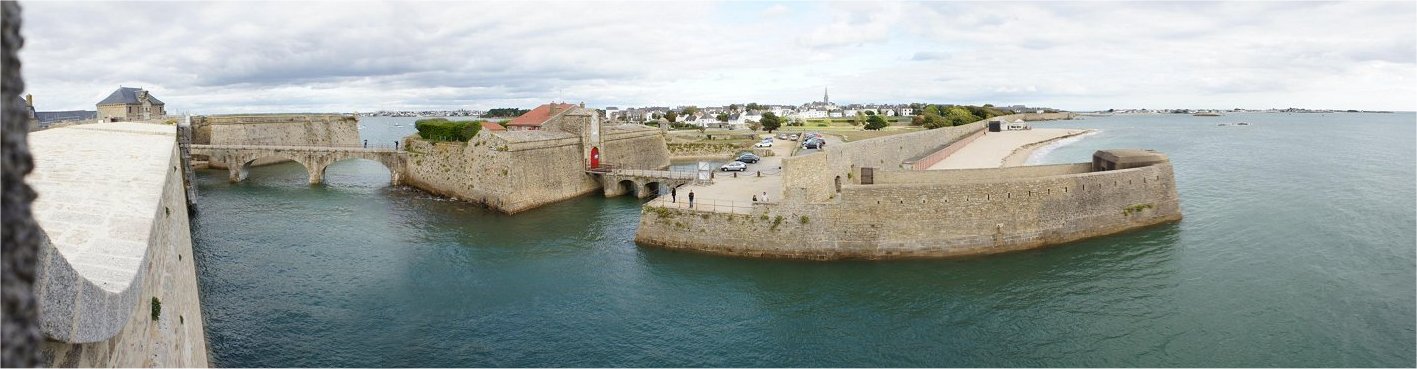
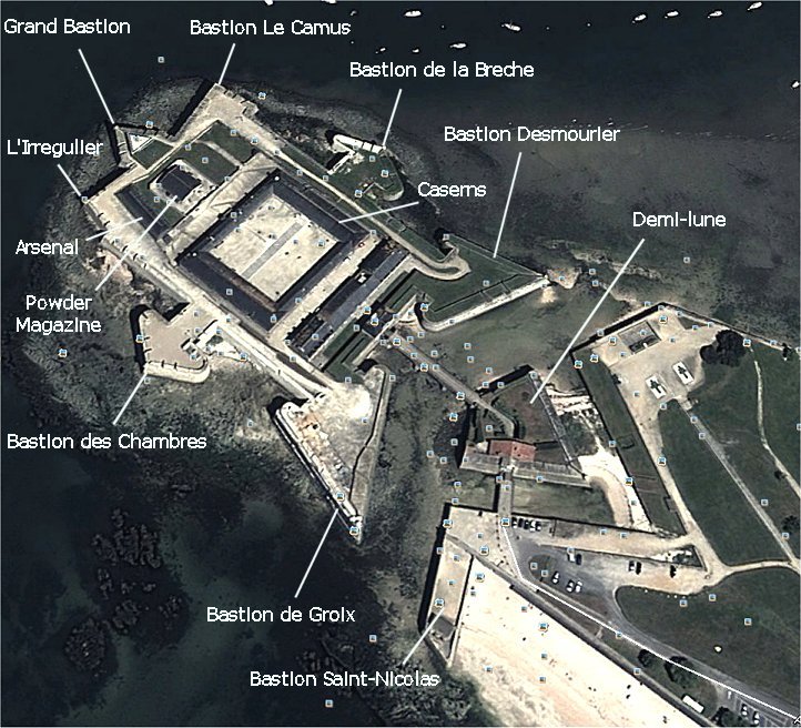
From the Bastion de Groix you can see the Demi-lune that we passed through.  To its right you can see a defensive wall extending along the coast protecting the town of Blavet.  Projecting into the water is the Bastion Saint-Nicolas, modified at its tip by the Nazis as part of their Atlantic Wall.


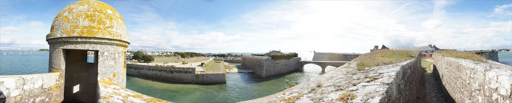
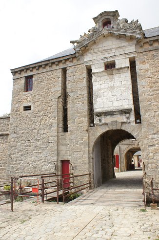
This is a 360 degree view from just outside the Bastion Dumourier's sentry post.


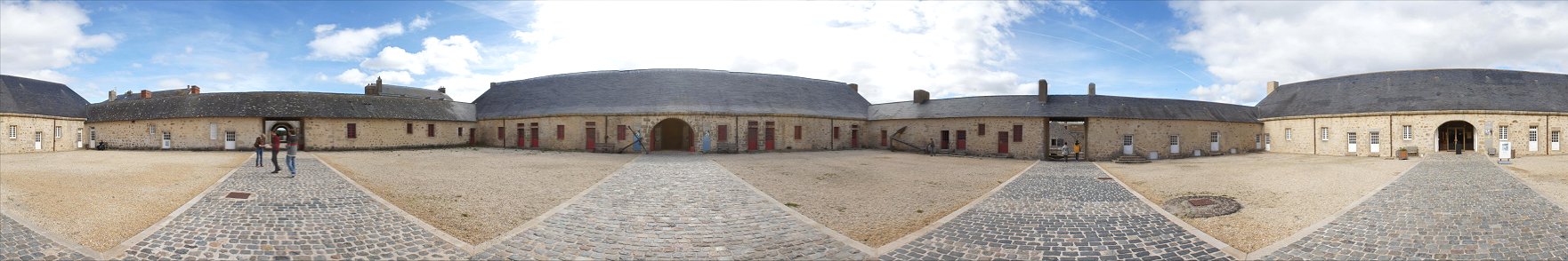
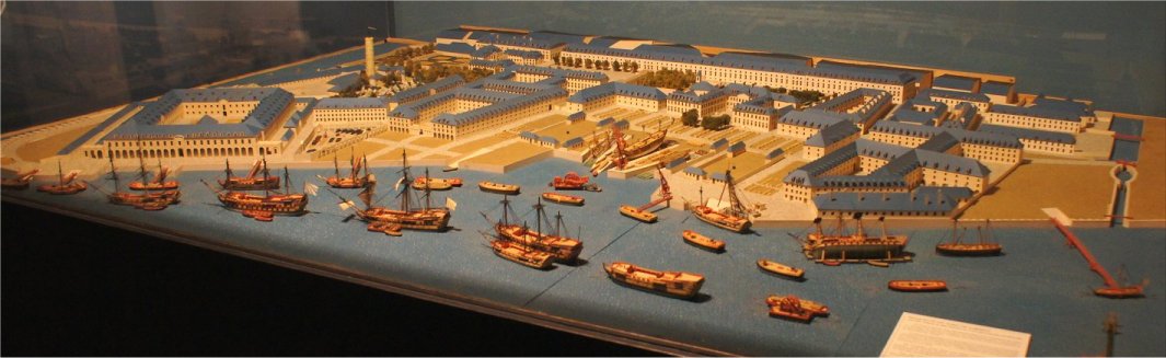
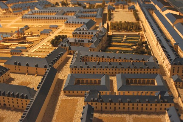
The center of the citadel is a square surrounded by barracks - now excellent museums, including a great one on the East India Company.  The gate is beyond the tourists on the left.  We'll go beyond the tourists on the right to see the other end of the fort.


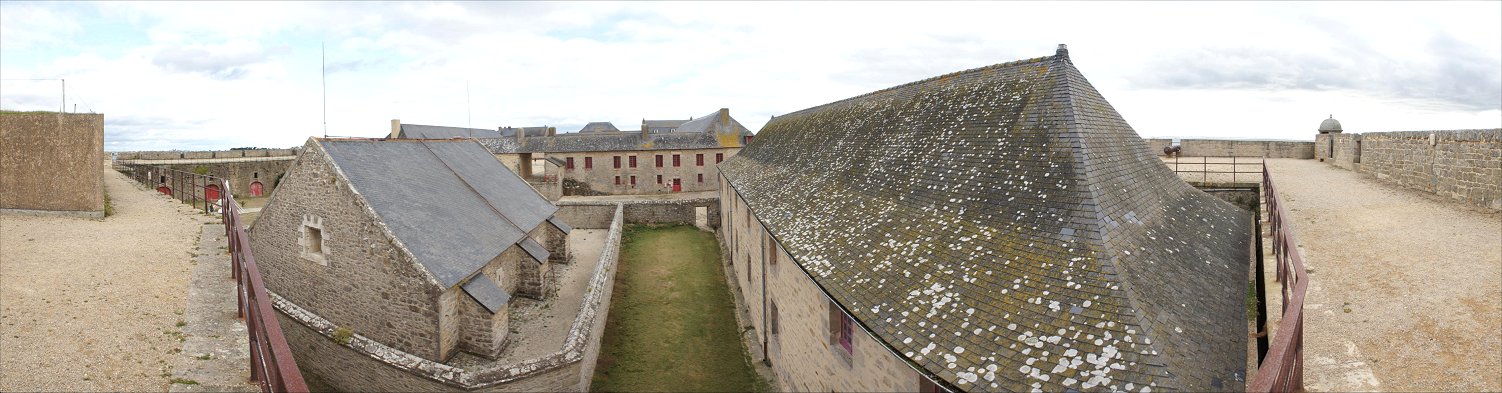
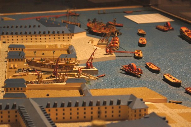
We walked through the opening just to the right of the powder magazine.  It dates to Vauban's time and is reinforced by buttresses and is surrounded by a wall.  To the right of it is the arsenal.  The walls on the far left and far right overlook the entrance to the harbor.


The fort clearly dominates the entrance to the harbor.  In the right background you can see U-Boat pens made by the Nazis, buildings that are impressive in their own right - but as ugly as the cause that built them.


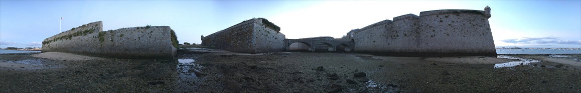
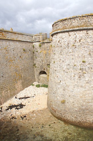
Low tide, down below.


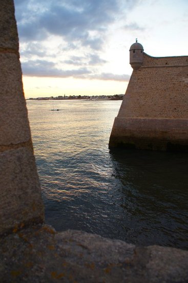
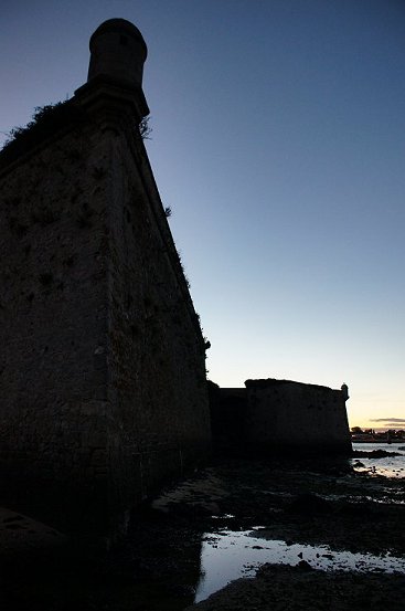
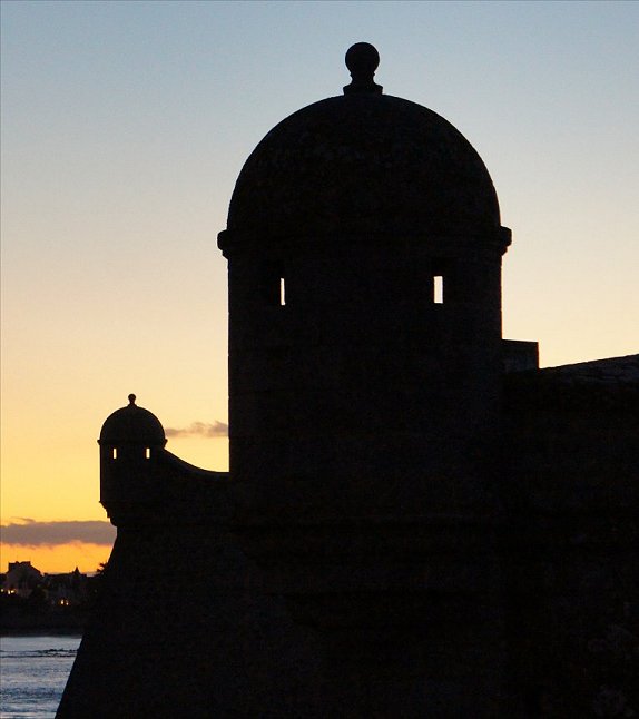
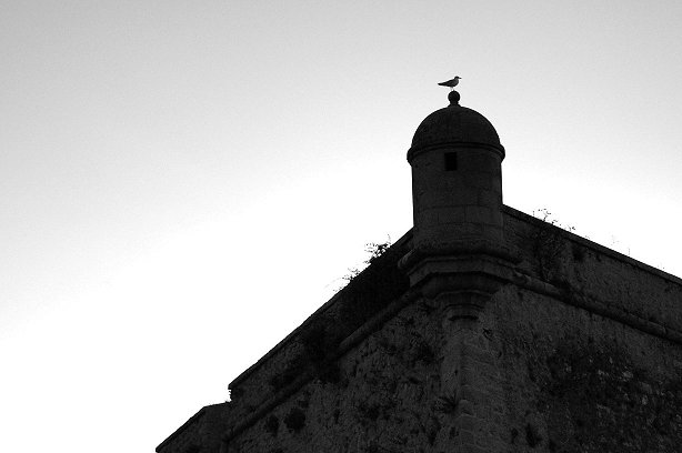
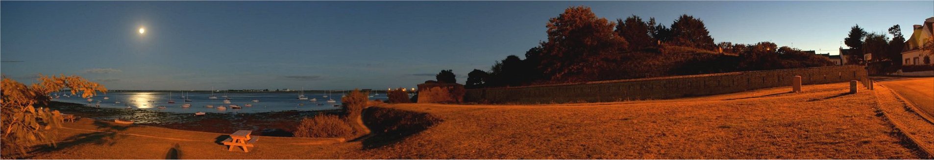
The citadel is quite scenic, especially at twilight.


This is the town side of defenses facing the Atlantic.  At left is a Nazi addition.


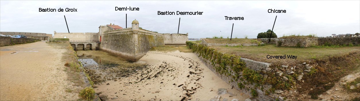
This is the land-facing portion of the town's defenses.


Copyright 2015 by John Hamill


Back to John's Military History Tour of Europe