Louis XIV's France absorbed Lorraine in the Treaty of Nijmegen
of 1679,
and this included the town of Longwy. Facing Hapsburg held
Luxembourgto the east, a fortified
Longwy was needed to counteract that great
fortress and protect invasion routes into France from the Ardennes.
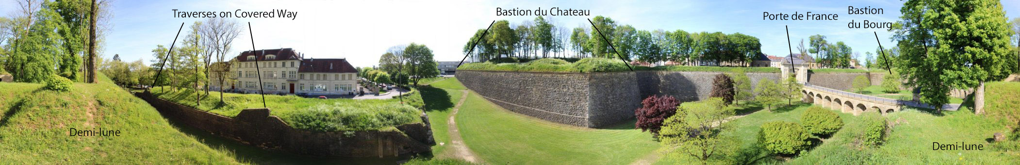
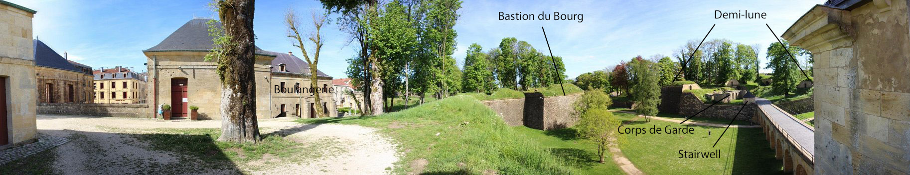
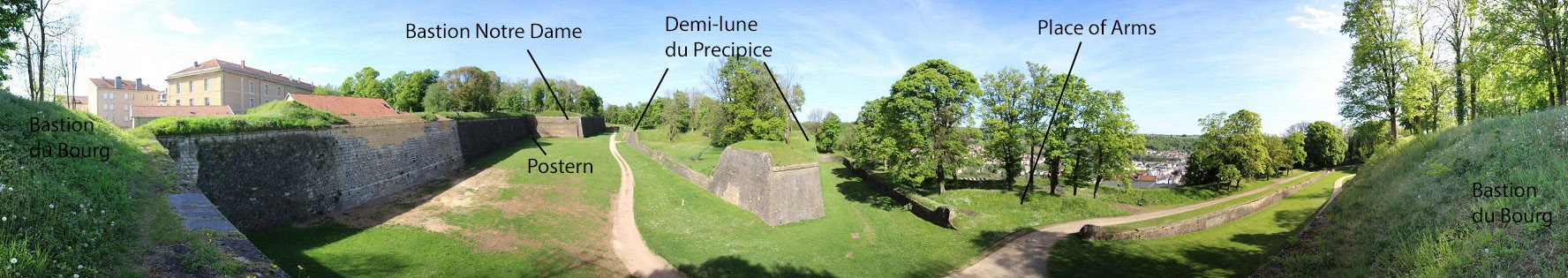
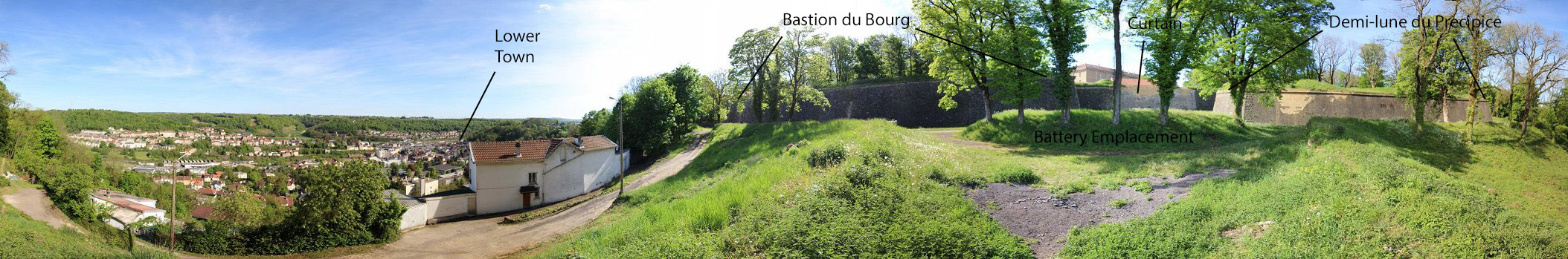
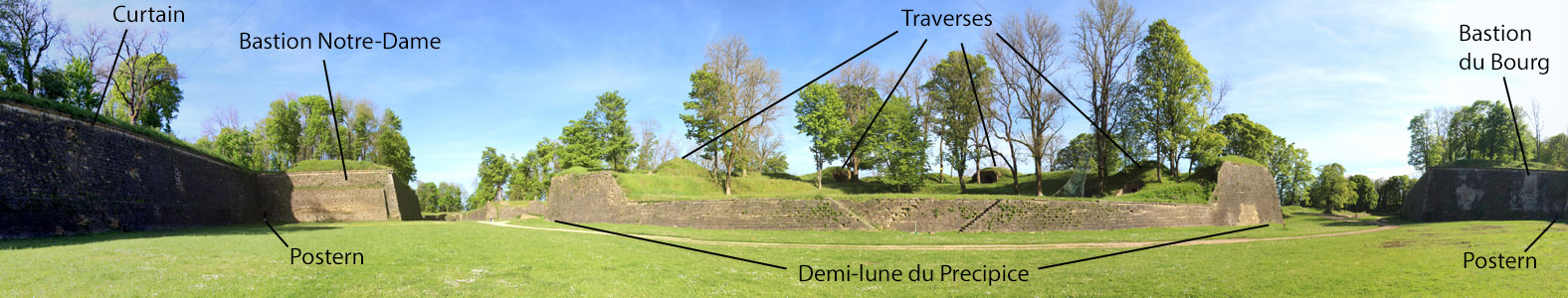
Tasked with design of the new fort, Vauban had the town leveled
to be
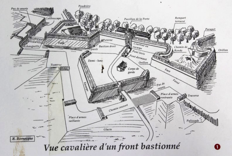
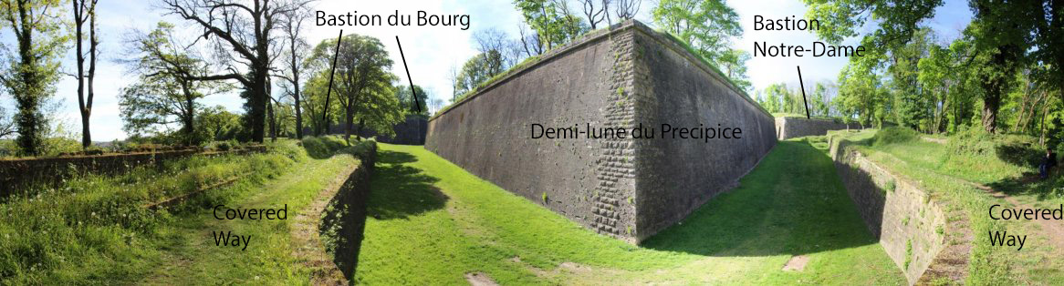
rebuilt inside the new fort. The fort had six bastions and five
demi-lunes plus a hornwork and other outworks. Vauban's plan to
refortify the old castle as part of a large fortified camp was never
implemented - these camps were intended to accommodate entire armies,
making for a more active and protracted defense, but the money was just
not there.
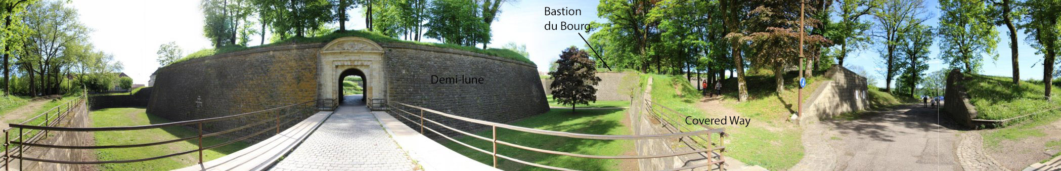
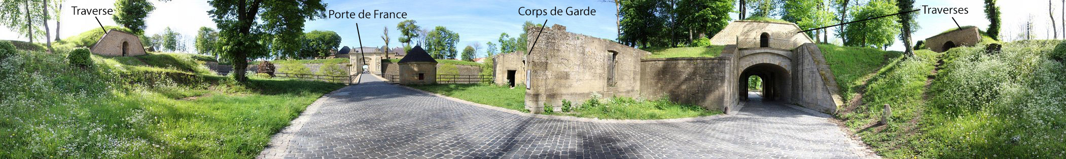
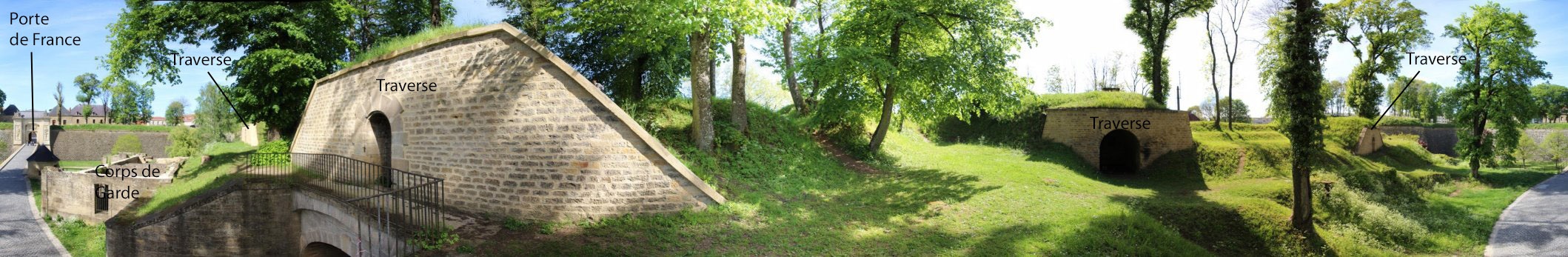
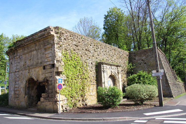
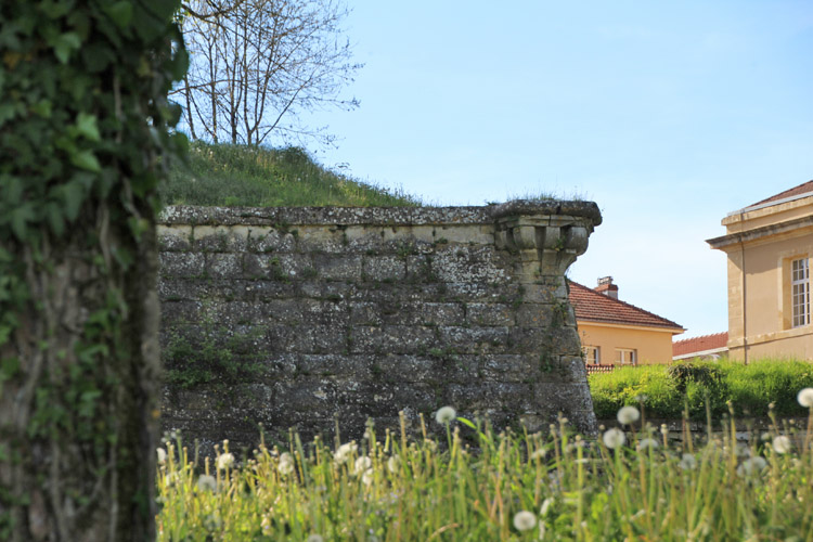
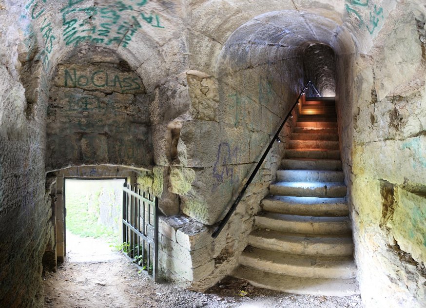
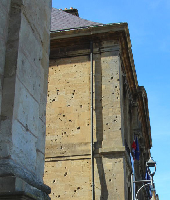
The fort saw action in 1792, 1814-15, 1870-71, and 1914. Most of
the fortifications have been dismantled, but enough remains to make for
a good visit.
|
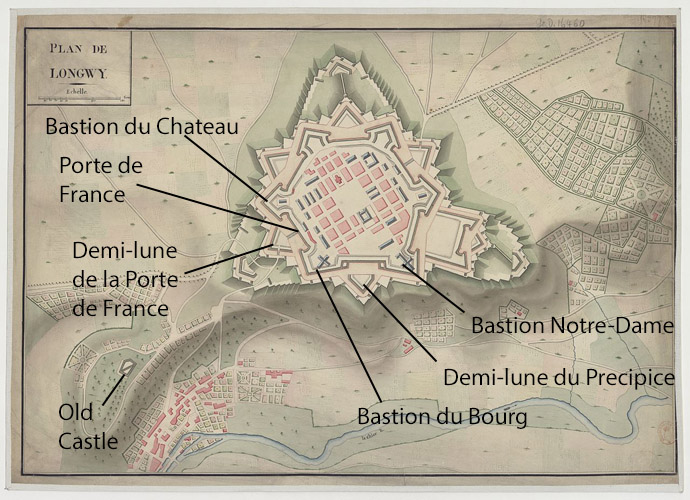
Adapted from Wiki:
https://fr.wikipedia.org/wiki/Citadelle_de_Longwy#/media/File:Plan_de_Longwy.jpg |