St Mihiel - Butte des Eparges and Woevre Plain


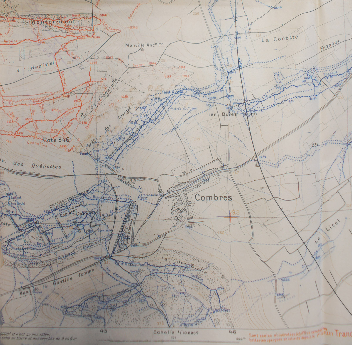
In September 1914, after the initial advance into France had been halted, the Germans once again went on the offensive, capturing land south of Verdun, an area that would be known as the St. Mihiel Salient.  The Germans strongly fortified the Butte des Eparges to the east of the town of Eparges.  The high ground there 
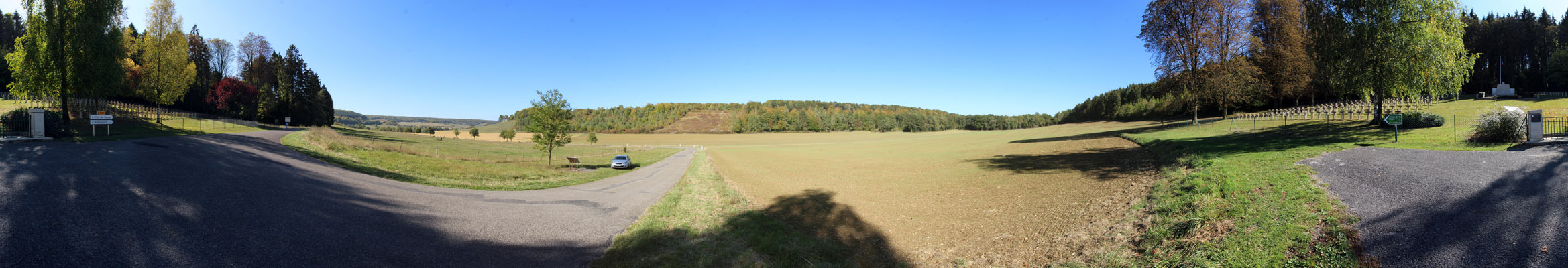
overlooks the Woevre plain to the east.  By February 1915, the French high command became concerned with Verdun;  the St. Miheil Salient cut off one of the two major rail lines into Verdun, and a German advance in the Argonne Forest took another rail line to Verdun out of action.  In addition to attacks on Butte Vauquois, the French high command ordered the recapture of the St. Miheil Salient, including the Butte des 
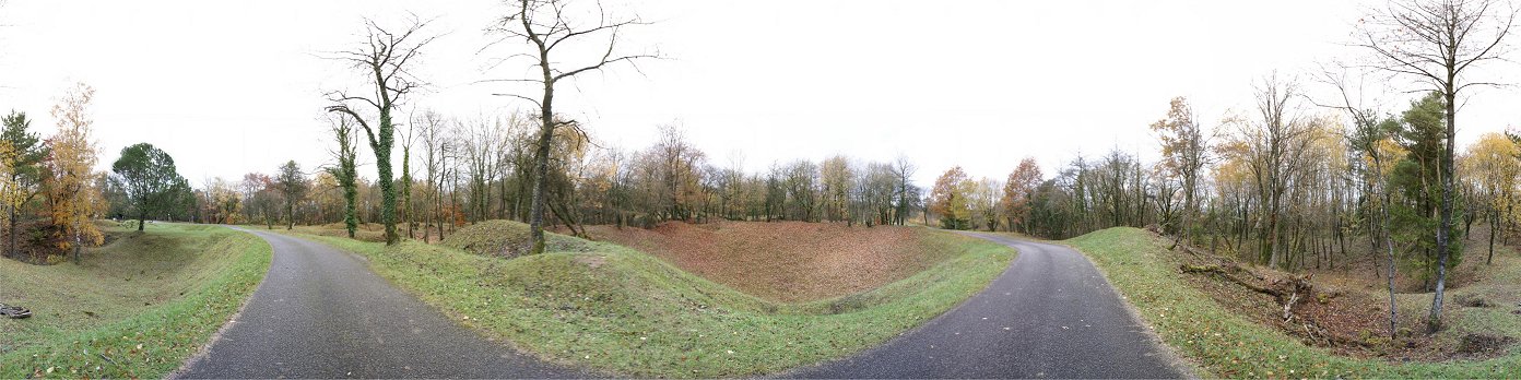
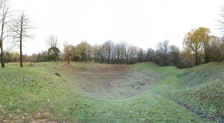
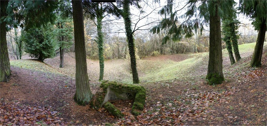
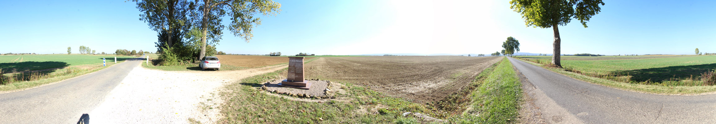
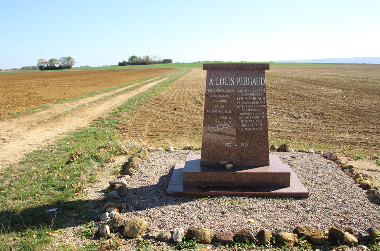
Eparges on its northern side.  On February 17, 1915, the French conducted a major attack, preceded by the explosion of four mines.  
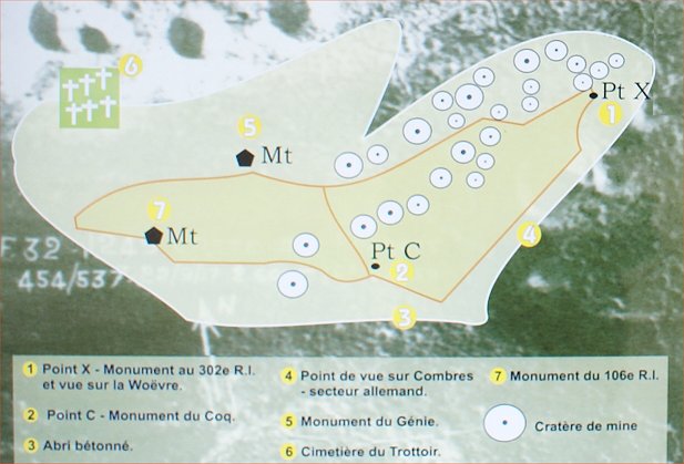
Fighting continued into April.  Point C on the southwestern end was captured on April 9th.  Most of the ridge was recaptured that month with the exception of Point X on the northeastern end.  Point X would hold out until the American St. Miheil offensive in 1918.  In all, nearly 300 mines were blown on the ridge during the war, with the largest being about 30 tons.
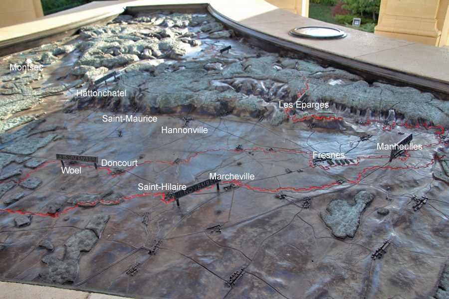
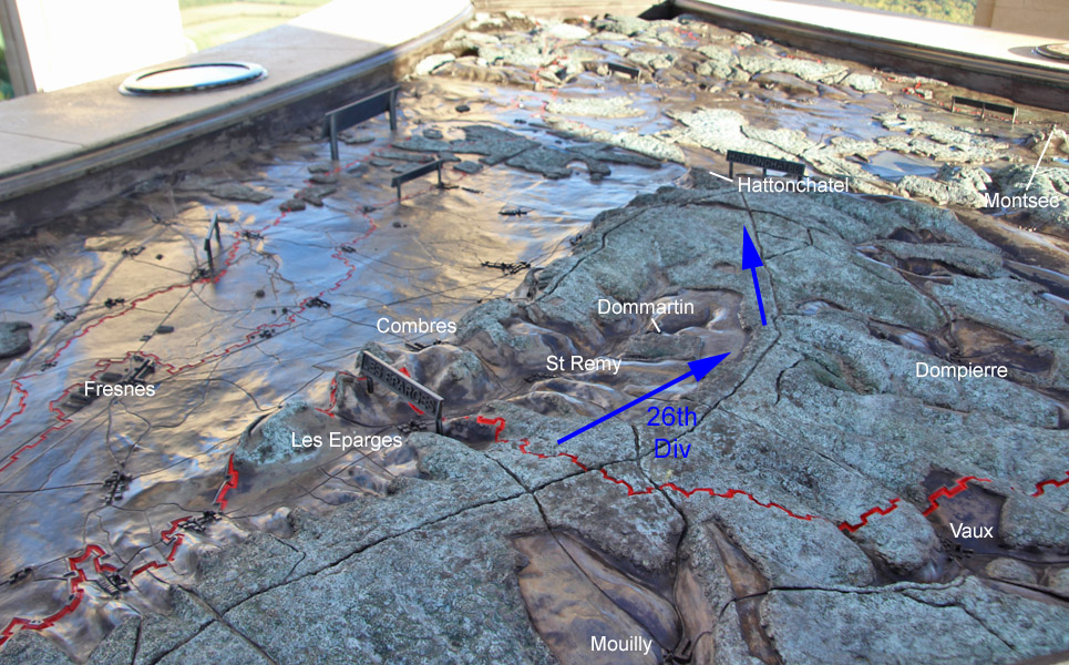
The shape of the relief map matches the trianglular shape of the St Mihiel Salient.  The red trench lines around Woel to Manheulles are the base of the salient, where the September American and French offensive ended.  The salient's northern face ran from around Manheulles through Les Eparges to St Mihiel.  


Trench map is courtesy of the George C Marshall Museum.  Blue represents German trenches, red represents French.  The butte can be seen with many mine craters and Points C and X on each end.


This is the view of the French side of the ridge, visible at either side, with the cemetery nestled at the foot of the ridge. French troops attacked up the Ravin de a Mort.


An interpretive sign on the ridge quotes Maurice Genevoix, a member of the 106th Infantry Regiment, in his book "The Men of 14":

Why are we fighting now, and in this way?  To defend what?  Win what? ...

Already thousands of dead for this fragment of a hill whose top remains beyond our reach.

To kill Krauts?  Wear them out?  But men can only be killed this way by sacrificing others, in same or even greater numbers.  So what?

To dislodge the Boches from some important strategic ridge?  From an advanced bastion over Woevre?  But then, what are the Hures?  And the Montgirmont?  Behind the hill of the Eparges, the mountain of Combres will stand in front of us.  With more hills behind Combres...  Ten thousand dead for each hill, is this what we want?  So, what?


Map


Monument to the 106th Regiment of Infantry


Monument to French Engineers


Mine Craters


Point X

Here, you can see that the ridge dominates the Woevre Plain.


The September 1918 offensive included the 4th Division attacking into the plain, but the main attack on the north face was by the 26th Division, which included a bold thrust down the Tranchee de Calonne to Hattonchatel.  Prominent in this advance was Col Hiram Bearss, who led his 102nd Infantry Regiment in a night advance.  Hiram's family later produced a cousin, Edwin, who is well known to Civil War enthusiasts.


German Artillery Headquarters

German battery fire was organized here in three underground rooms, connected by telephone - a telephone exchange was included in the bunker.

American troops captured the bunker, and the 103rd Field Artillery used the shelter.


Tranchee de Calonne


Built in the 1780s to better connect the king with one of his properties, the area was scene to fierce fighting in 1914 and 1915.  Ernst Junger was wounded in the area.  The trail beginning here at the road continues to the German artillery headquarters (just seen) and the site below.  

In the battles of September 1914, author Alain-Fournier and the 21 man patrol that he was part of were all killed by the Germans.  The event is shrouded in controversy, with early accounts claiming that the men were tortured and killed by firing squad, but archeological evidence shows that they were hit from all sides.  Some German researchers claim that the patrol fired on stretcher bearers.  The men's graves were discovered in the early 1990s, the bodies reburied in a local military cemetery.


St-Remy Cemetery

Alain-Fournier's gave is the one in the lower left corner of the photo.  At the time of my visit, an attentioned starved putty-tat was patrolling the area.


Mouilly

Just behind French frontlines.


4th Division


On the eastern edge of Maneulles is a monument to the 4th Division at the place of its furtherest advance.

Maneulles is on the left of the panorams, with a road forking to Fresnes.


Riaville

After the war, American photographers documented the area - photos are the Griffin group in the National Archives.


Marcheville


Doncourt


Louis Pergaud

Near Marcheville  is a monument to a French literary figure, Louis Pergaud, who died in April 1915 after being wounded and captured in an attack to support operations at Les Eparges.  Saved by the Germans, a French artillery barrage killed him.  At the start of the war, Pergaud tried to avoid military service as a pacifist, to no avail.


Copyright 2010-20 by John Hamill


Back to St Mihiel