Berwick upon Tweed
Berwick is a picturesque town in northern England just a mile or two from the Scottish border. It is situated on high ground where the River Tweed enters the North Sea, providing natural protection to two sides of the town. In the many wars between England and Scotland, the area changed hands on several occasions, but by the mid 1500s in was English, and Queen Elizabeth I ordered modern fortifications built around the town to keep it that way.
The early 1500s saw a revolution in fortification design in continental Europe, with the new gunpowder artillery making tall thin castle walls vulnerable and obsolete. Henry VIII had a number of forts built on the south coast with the new low and thick stone-faced earthen walls, but the trace, or layout on the ground, was inferior, often with rounded features that left dead ground where attackers could take refuge just under the walls. The walls of Berwick reflected the new trace italienne, which featured diamond shaped bastions along the straight curtain walls which put attackers in a crossfire and eliminate all dead ground.
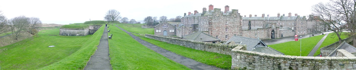
From Curtain Wall to Windmill Bastion
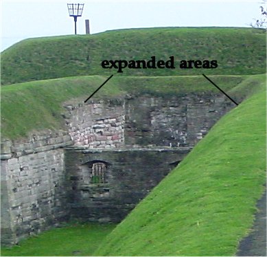
Down the paved path along the rampart is Windmill Bastion, built between 1563 and 1570. The earthen mound atop the bastion is the cavalier, which was completed decades later. The recessed area of the bastion is a flanker. You can see its gun ports on the lower level. Because Berwick's flankers were cramped, they were later enlarged by digging out slices of the bastions and walls (see below picture), and plans for a second level of guns were scrapped.
I believe the earthworks on the far left are the remains of the medieval city walls, which appear to have been used as the counterscarp, forming what at the time was a wet ditch. A D-shaped earthwork in front of the bastion pre-dates the walls, and was completed in 1523.
Beyond the bastion you can see the walls bending to the right toward the King's Bastion along the North Sea. The Barracks on the right half of the picture were built after the Jacobite rebellion of 1715. The concept of barracks was new at the time and replace the system of soldiers being billeted in houses with civilian families. Now the barracks contain a regimental museum and "By the Beat of the Drum", a museum of military life.
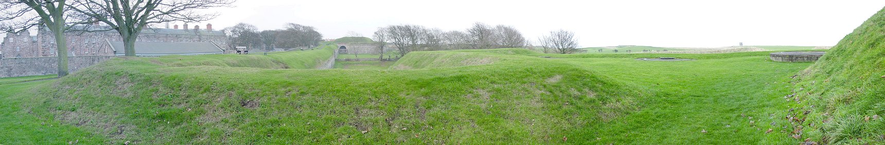
From Windmill Bastion to Brass Bastion
This is the view from the flank of Windmill Bastion looking toward the Brass Bastion where the walls bent sharply left and continued to the Cumberland Bastion, then Meg's Mount overlooking the Tweed. Within the bastion you can see more modern gun mounts, which date sometime from to the mid 1800s to the Second World War. On the far right the built up earth is the cavalier, which would be defended if the walls were breached and stormed.
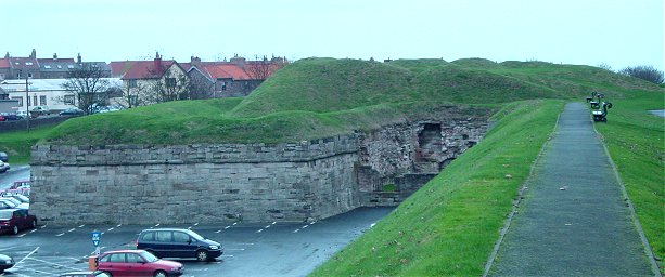
Cumberland Bastion
As you can see, the town has expanded beyond the city walls, but the cars give a good indication of the height of the walls. This is the Cumberland Bastion along the west-facing walls. This picture gives a good idea of the size and extent of the cavalier. During my visit a couple of British Army recruiters were set up near here, but since we no longer live in the eighteenth century, they did not get me drunk and slip me the king's shilling.