Castillo de San Marcos
and Fort Matanzas
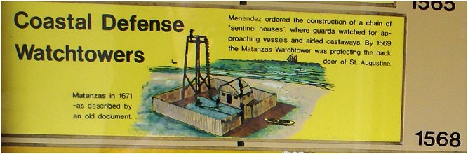
The Spanish treasure and trade network included exotic goods from the Far East funneled through the Philippines to Mexico. These goods and Peruvian silver were transported across Mexico and sent to Havana along with Mexican silver for an annual voyage to Spain, a voyage vital to Spanish government and always eagerly awaited. The treasure route from Havana to Spain used the Gulf Stream along the coasts of Florida and North America. In 1564 the French settled Florida at Fort Caroline near modern day Jacksonville, a clear threat to the Spanish treasure ships. In response, the Spaniards settled at St. Augustine and slaughtered the French settlers. For over a century, wooden forts protected the town of St. Augustine. The settlement survived a burning in 1586 by Francis Drake as well as a pirate attack in 1668. This and the extension of British settlement to Charleston convinced the Spanish to build a permanent stone fort at St Augustine - Castillo de San Marcos.
Castillo de San Marcos was completed in 1695. In 1702 during the War of Spanish Succession, British colonials occupied the town of St. Augustine but failed to take the fort. In 1740, the town resisted another British/colonial siege. In response to a potential enemy riverine advance from the south, Fort Matanzas was built in 1742. During the Seven Years War, British troops took Havana, the key to the Spanish empire. The peace treaty gave Florida to Britain in exchange for the return of Havana. At the conclusion of the American Revolution, Florida was returned to Spain, and in 1821 the United States gained control of Florida.
From the Southwest Corner
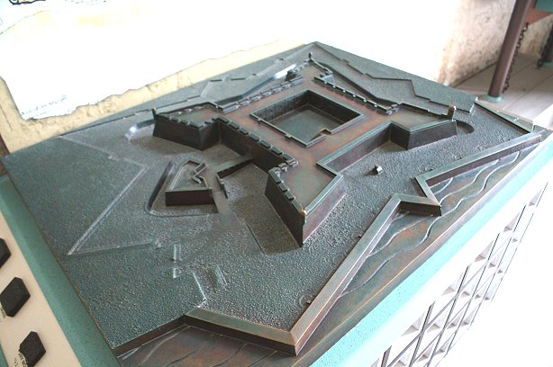
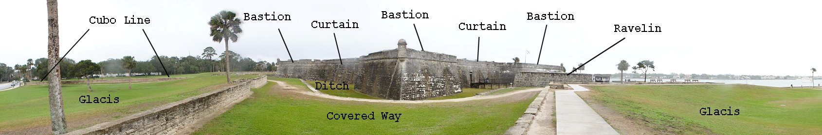
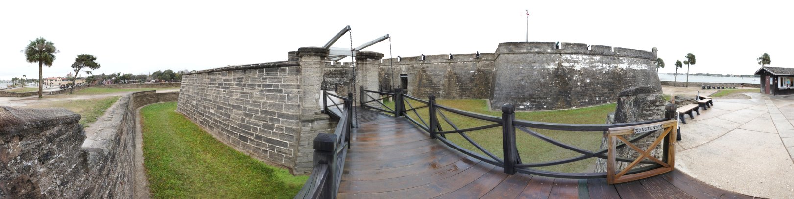
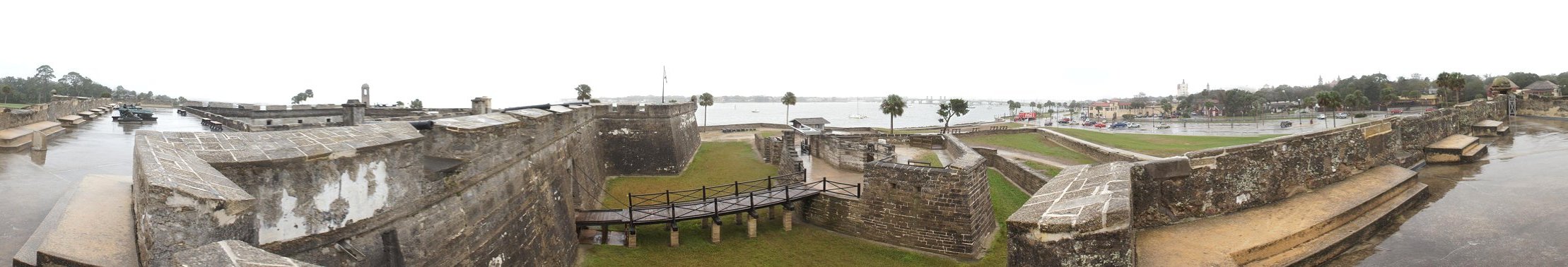
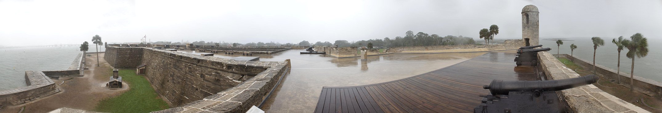
| Typical of smaller European styles and in keeping with a design dating to the early 16th century, the square fort has diamond shaped bastions at each corner to enfilade any attack on the walls, called curtains. The outwork on the right side of the picture is the ravelin or demi-lune. It protects the gate into the fort, which is on the town side. A fort guarding an important European city would have more sides, or curtains, and more outworks, but the basic concepts would be the same. (For extensive material on European forts, see John's Military History Tour of Europe.) Cannon mounted the walls which were protected by a ditch, which could be wet or dry. The covered way is the grassy area outside the ditch. Infantry could occupy this area behind the cover of the low stone wall. Beyond this, the gently sloping glacis gave the defenders a clear field of fire. On the left, the Cubo Line, the city walls of St Augustine, extend west to the river. This type of fort was an evolution of forts originally designed in the late 1400s to protect against the new mobile artillery which could easily destroy tall, narrow medieval walls. | |
Northwest Corner
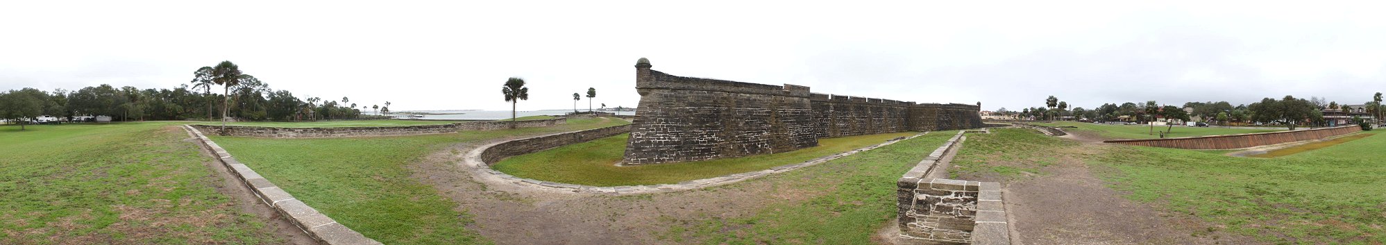
An enemy approaching from the north would face the northern side of the fort, liking digging approach trenches. In the distance, a channel opens to the Atlantic.
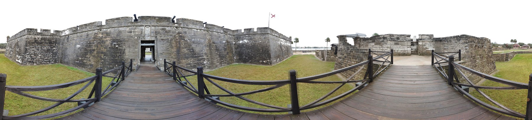
The Ravelin
Construction of the ravelin was never completed.
Next, we proceed across the bridge toward the drawbridge and the gate.
| The 360 degree view above has some distortion, making straight lines curved, but it gives an excellent overview of the fort. Ahead of us, across the drawbridge, the gate includes a sliding portcullis. | 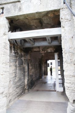 |
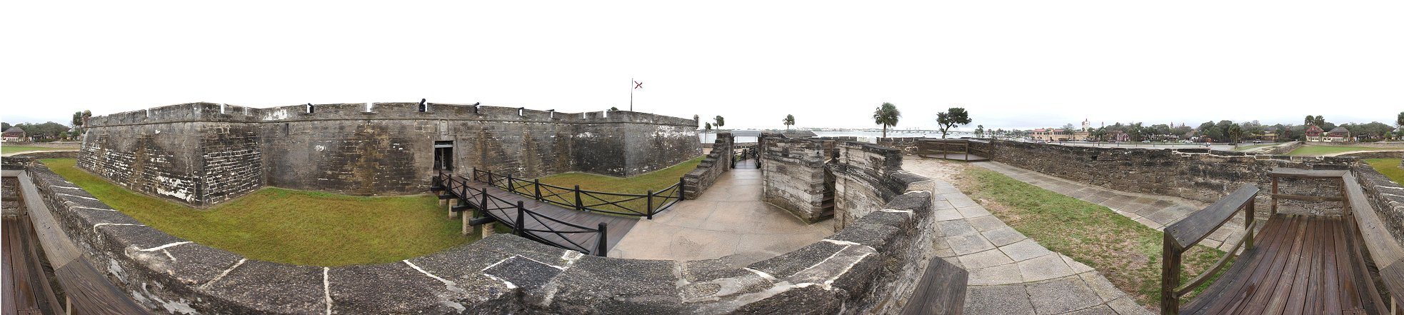
Ravelin From Above
And from above we can see that the ravelin is lower. If an attacker succeeded in capturing it, fire from the curtain wall would make it difficult to hold.
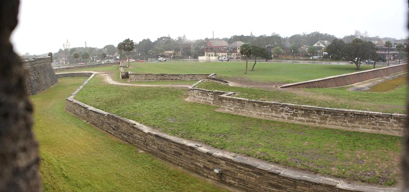
Cubo Line
After the British captured the town in 1702, the Cubo
Line was constructed to better protect Saint Augustine. This line was
made of palm logs and dirt and was fronted by a ditch.
The Castillo served as a citadel, the final refuge for defenders of the
town, as well as a point from which government authorities could
dominate the town and its residents, if necessary.
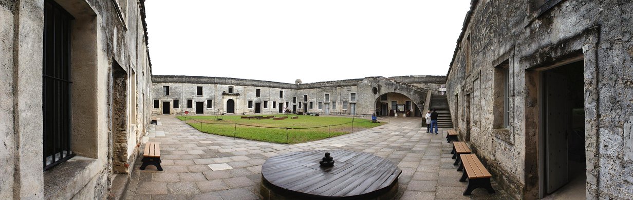
Interior
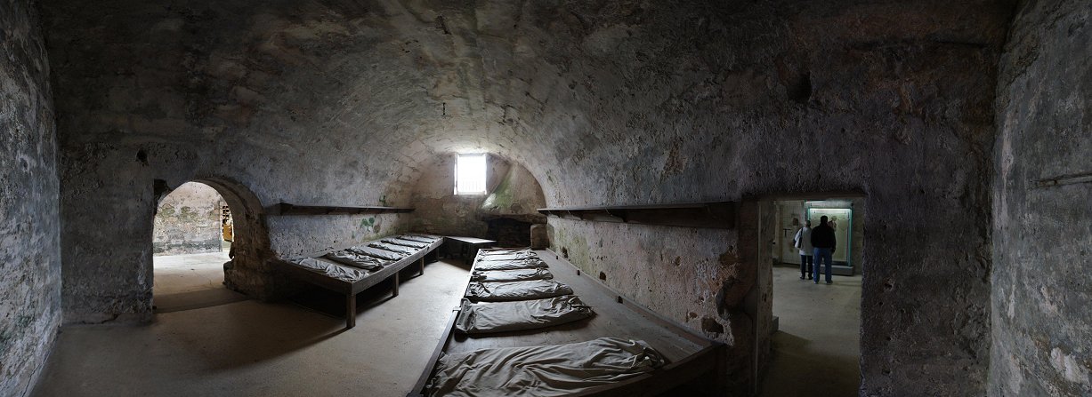
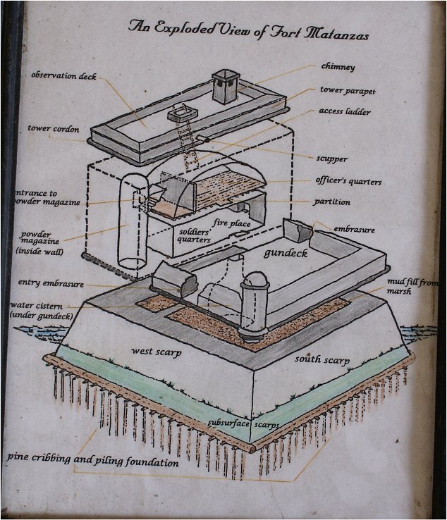
Surrounding the inside are a series of casemates built as a later addition in the 1730s. With mortars a valuable siege weapon, casemates provided overhead protection. The design also allowed for bigger guns above.
Casemates Near the Entrance
The fort's entrance is through the passage at left.
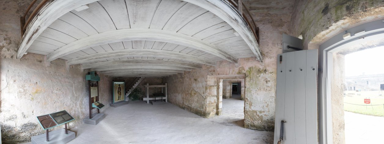
| Although difficult to show because of close quarters, during the British period, men would live on two levels within casemates. | 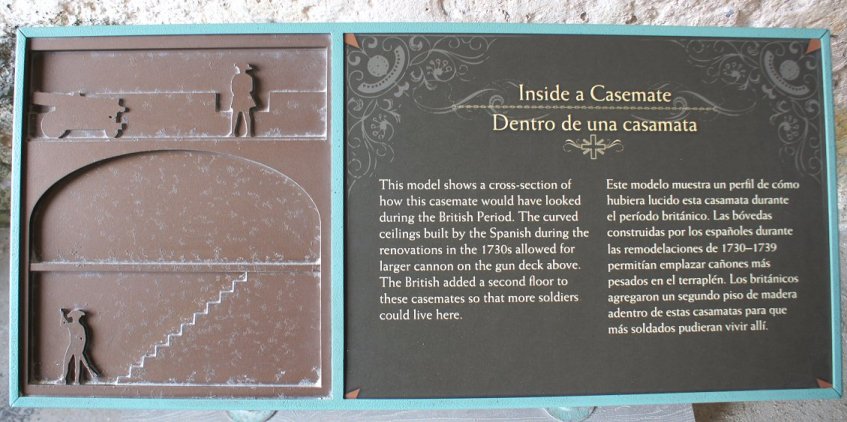 |
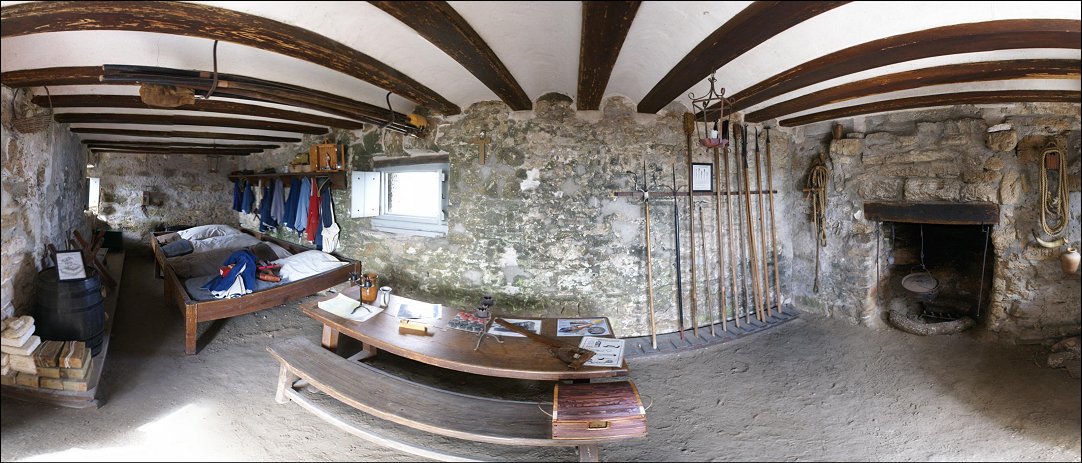
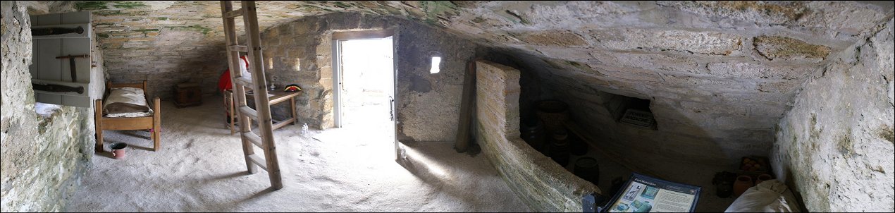
Officer's Quarters
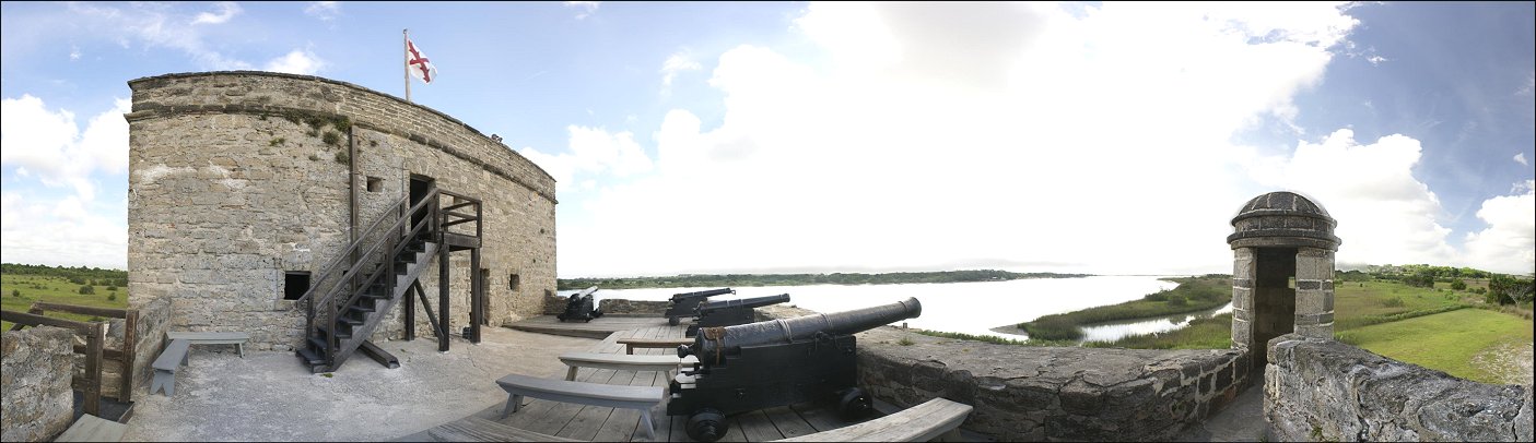
At right is access to the powder magazine. The ladder leads to the observation deck.
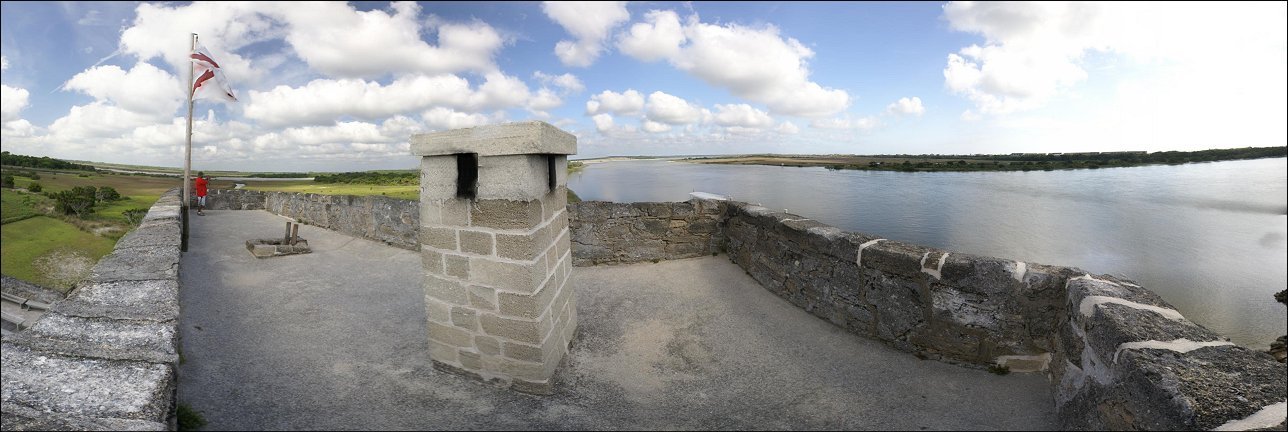
Observation Deck
Back to John's Military History Page