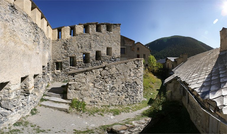
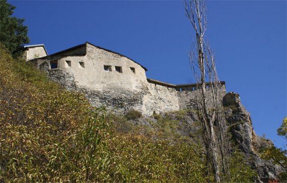
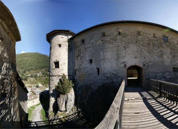
Chateau Queyras


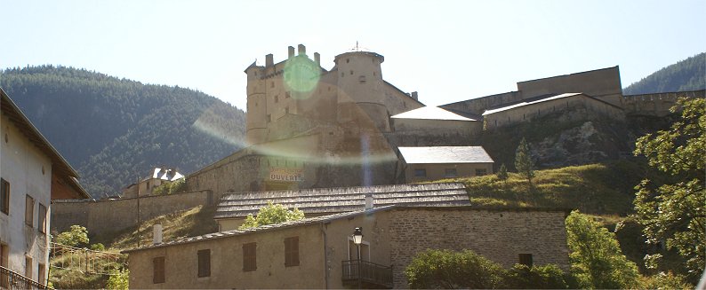
A castle has stood where Chateau Queyras is since the Middle Ages, but exactly how old it is, no one knows.  By the 1300s it belonged to the French royal family.  In 1587 during the wars of religion the castle surrendered to Protestant troops.  In 1692 the castle held off an attack of English and Savoy 
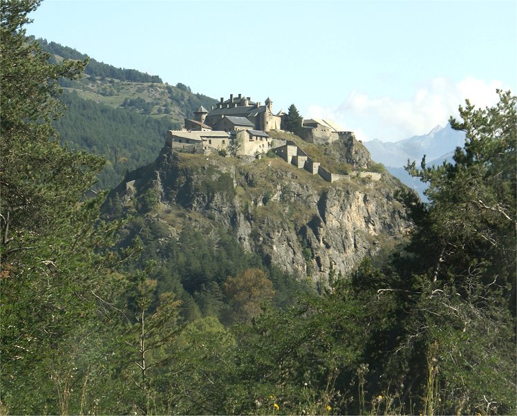
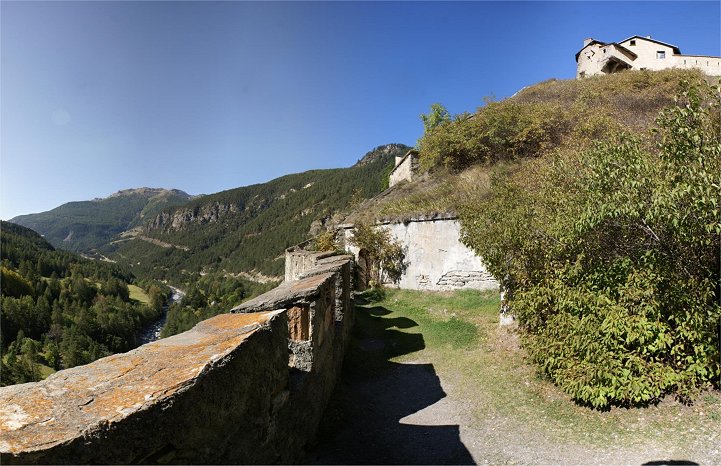
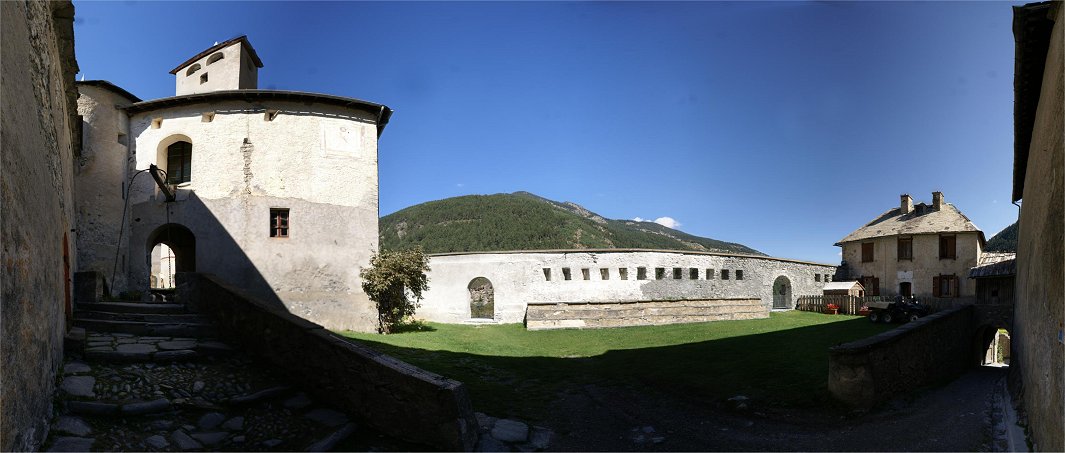
troops under Schomberg.  The spot is an obvious one for fortification 
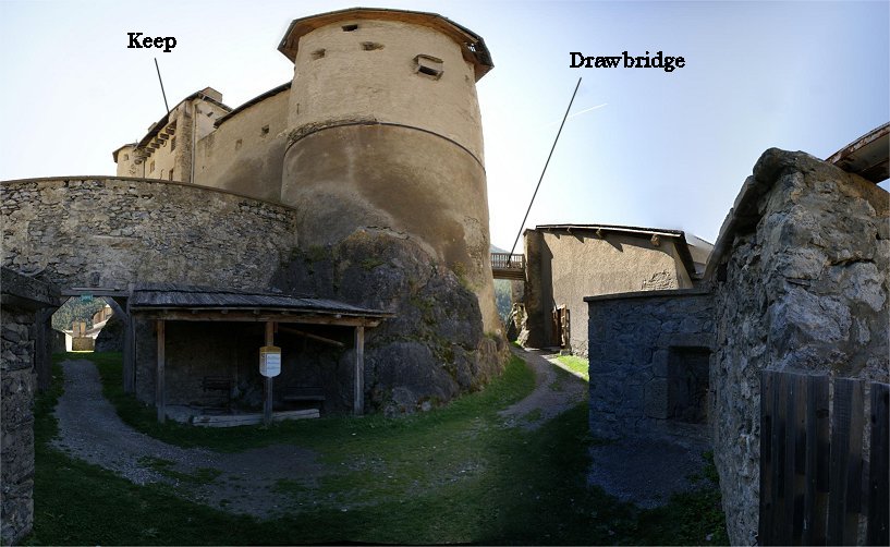
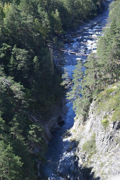
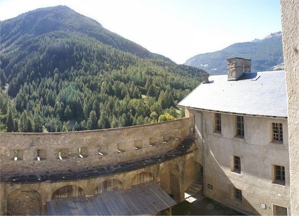
as it dominates the valley around it.  Atop a rocky outcrop in a deep glacial valley, the Guil River passes through a gorge on one side of 
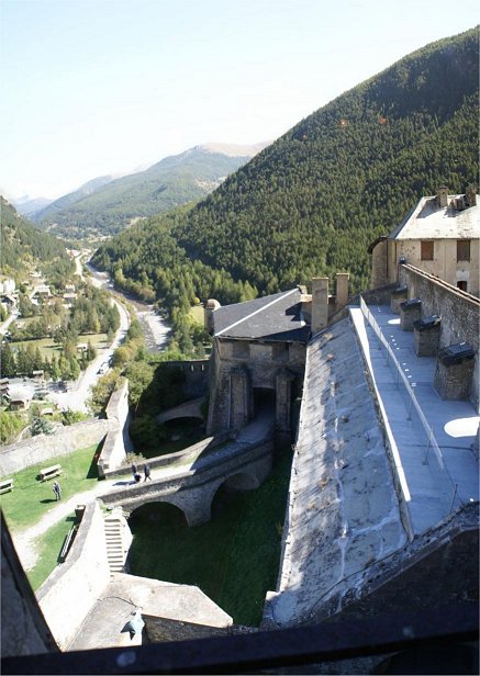
the castle, and the other side has just enough room for a road.  The road to the east leads to Italy, formerly Savoy, and to the west the road runs along the river, including through gorges, to Mont Dauphin, a fortress town designed and built by Vauban.  Vauban visited Chateau Queyras in 1692 after the siege and planned improved defenses.  The result is an interesting combination of an old medieval castle and 17th century design - all adapted to the terrain.


North Face

South Face


The letters correspond to the panoramas below.  The castle is easy to get lost in.


A) Tourist Entrance

We will use the tourist entrance, across the drawbridge at left, over a ditch, and into a demi-lune.  The keep is the tall tower at center.


B) Demi-lune

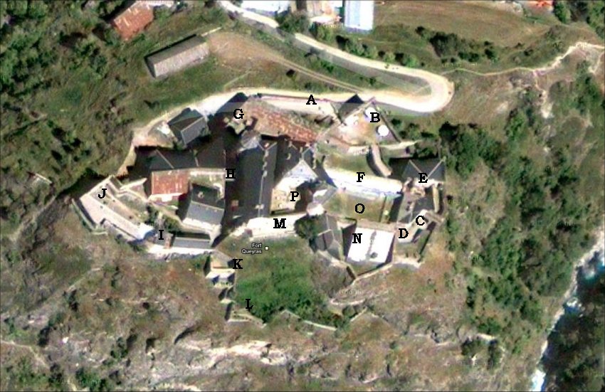
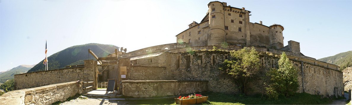
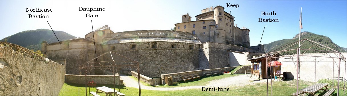
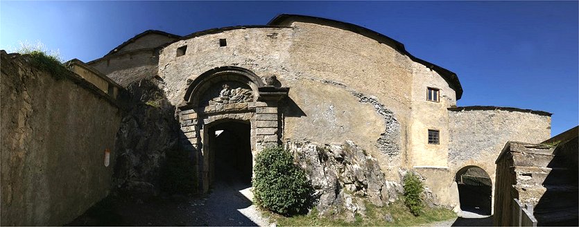
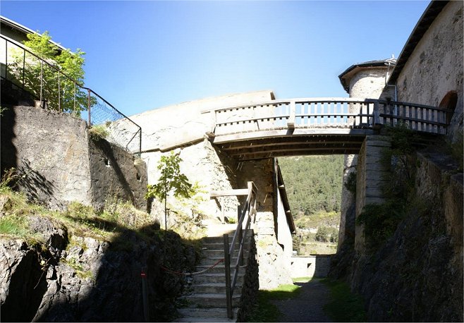
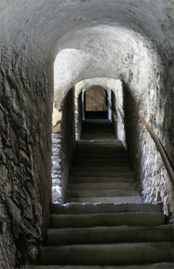
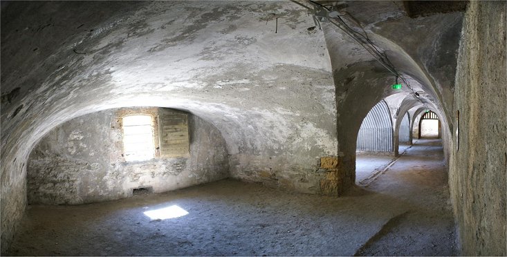
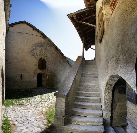
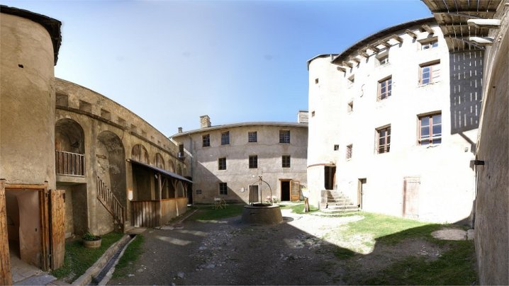
Having paid our entrance fee at the shed at right in the panorama above, we continue through the demi-lune and across another bridge to pass through the Dauphine Gate.  Vauban completely replaced the northeast section of the castle.
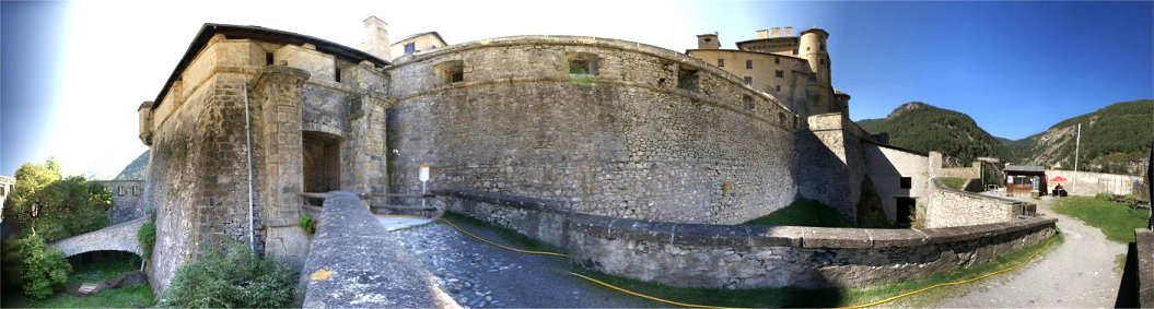
Dauphine Gate


C) Through Dauphine Gate

Passing between two walls further secures the entrance.  We entered the gate at right and find another arch to pass on the left of the panorama.  Beyond that arch is the Royale Gate, which we see next.  Then we will return to the area of his photo and take the steps up the tower to reach the Northeast Bastion.  


D) Royale Gate

The border between the medieval and the Vauban modification, the gate was widened to accommodate cannon.  A coat of arms graces the pediment.  The stairs at right lead to fighting positions.


E) Northeast Bastion

Backtracking and climbing some steps we enter the Northeast Bastion.  Designed to contain four guns, the bastion was given a roof sometime after its construction in Vauban's time.


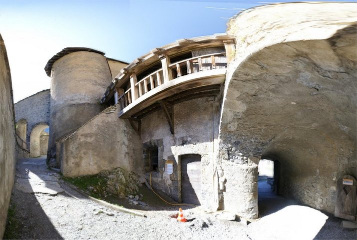
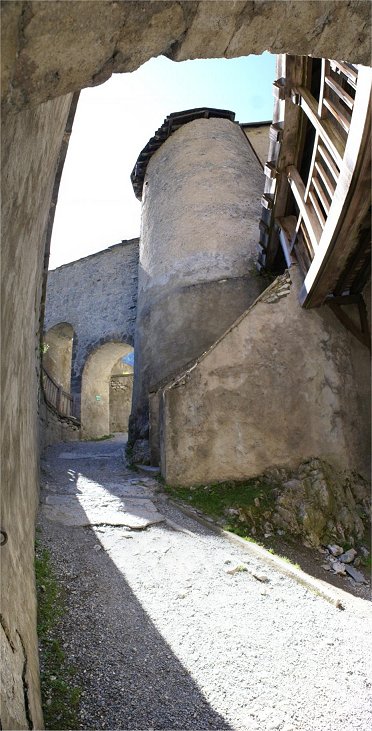
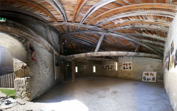
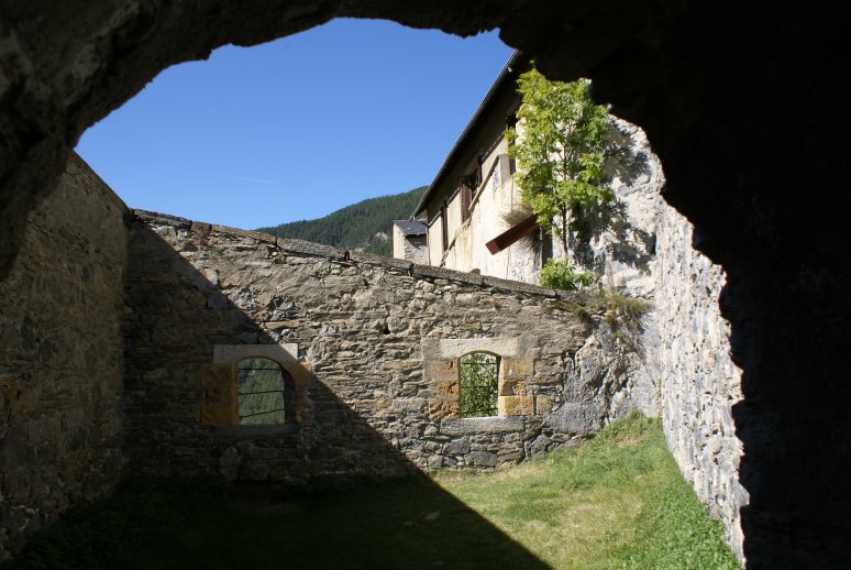
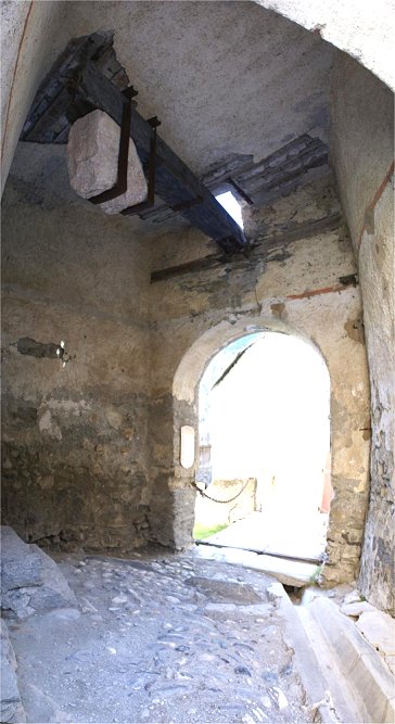
We walked through the passage at right from the Northeast Bastion.  Ahead on the left is North Barracks Blockhouse. F) North Barracks Blockhouse

Built in 1841-42, the North Barracks Blockhouse is designed for five guns - aimed at Rouet Plateau.


G) North Bastion

Between the Vauban walls and the medieval structure, you have a good view of the keep, which is built with overhang so that objects can be dropped on attackers.  The tower is design to drop other items, as there is a latrine inside.  Under the shed there is lifting equipment dating to the 1930s designed to move supplies around the facility.  The drawbridge site was part of Vauban's expansion of the fort - spanning a ditch from the medieval section to the new area.


H) Drawbridge

We will pass under the site of the drawbridge but will return to it later.


I) Bakery


J) West  Side of Fort

A wooden platform existed, allowing for two tiers of loopholes to be used.


K) Stairs and Buttresses

A stairway leads south to defenses at the cliff edge.  Buttresses, or fighting positions, are terraced along the stairs.  The top buttress (center photo) was modified in the 1840s to accommodate two cannon.  


 L) Governor's Garden

Here at the governor's gardens, the defenses at cliff's edge overlook the Guil gorge, popular with experience whitewater boaters.  It would be nearly impossible for an enemy to pass south of the fort.  As a result, the defenses, including those seen above, are much weaker than the east and north facing defenses.


M) Southwest Barracks

Built in the 1840s, the four vaults were designed to accommodate cannon.  On the top right note the ventilation shaft.


N) Powder House at Left


O) Artillery Yard

The old castle courtyard was modified by Vauban.  The keep's courtyard is across the ditch and through the drawbridge at left.  Vauban filled the ditch and leveled the courtyard, creating fighting positions


The drawbridge worked by counterweight.


P) Keep Courtyard

The keep at right was built sometime before 1265.  It held all the castle's important supplies until Vauban distributed them throughout the castle.  In the 18th century, the keep was home to the commandant and several officers.  At left note the loopholes for the infantry.  Directly behind the well at center is a barracks building.  Behind us is the chapel.


Climbing the stairs of the keep, we see several rooms and views of the castle and surrounding terrain.


Inside the barracks can be found, among other things, Cold War graffiti from the 1960s.


H) Drawbridge

Several systems were used over time to raise and lower the drawbridge.  The eventual system involved this mechanism with two 100 kg counterweights.


Col d'Izoard
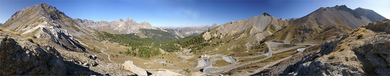
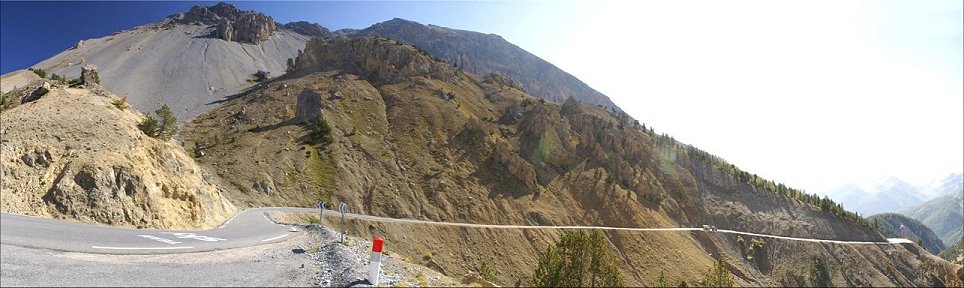
The Alps were enormous barriers to armies, and in the early modern era, the campaigning season was short, especially at high altitude.  The modern road over the Col d'Izoard connects the Guil Valley with Briancon in the north, but in earlier times movement was channelized into the valleys.  Successful defense of places like Chateau Queyras and Mont Dauphin would make an invasion of France in this area very difficult, and the same was true for Briancon across a mountain ridge to the north..


Copyright 2012 by John Hamill


Back to John's Military History Tour of Europe