Dover Castle Part 2
Northern Tip and East Face
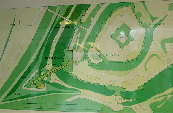
Map
This is a map on display near the entrance to the medieval tunnels.
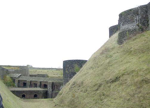
From the Road to the Constable's Gate
Part of the Norfolk Towers is visible on the upper right. The round tower in the center, St. John's Tower, was built in response to the vulnerabilities shown by the 1216 siege. On the left half of the picture you can see the southern end of the redan and the caponier which connects it to the rest of the castle. It could provide deadly fire into the moat.
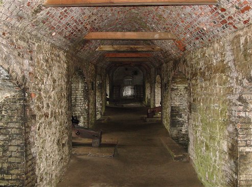
Caponier
Here is the view along one of the two levels of the caponier. Armament included a new technology of the time - carronades, large caliber thin barreled artillery that could deliver large slow velocity rounds at the enemy.