Fort Nelson
Constructed in the 1860s to deal with the threat of a French invasion, Fort Nelson, part of a system of forts, was built on high ground north of Portsmouth in order to protect the area's naval facilities. The forts were obsolete soon after they were built. Perhaps because of this, improved relations with France, and that the forts faced inland, these forts are known as Palmerston's Follies, after the then-Prime Minister. Since they were built in a time of fast technological change, the forts are relatively unique in comparison with their predecessors, which changed little from the 1500s to the early 1800s.
Like earlier forts, Ft. Nelson's walls were exposed to minimal enemy fire. Facing a deep ditch, the walls rose to no higher than ground level. High earthen ramparts were mounted with large smoothbore 68 pounders, and although the forts were self-contained, they were spaced and positioned to be mutually supporting. While earlier forts typically used diamond shaped bastions, the Palmerston forts were polygonal, using their curtain mounted artillery for long range defense, and caponiers and demi-caponiers to enfilade the ditch for close in defense.
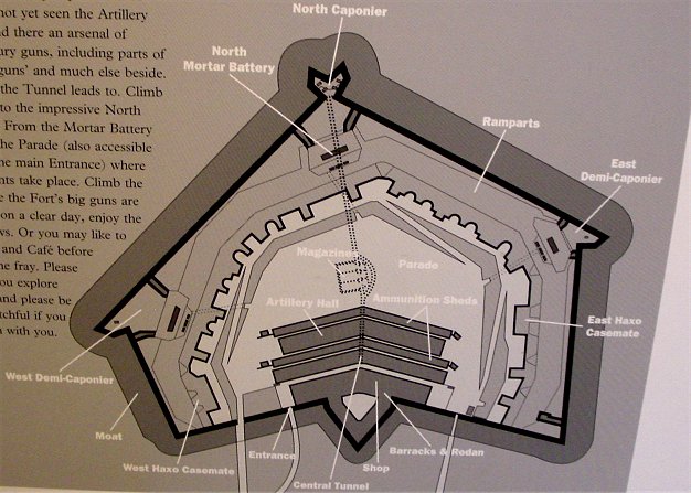
Map of Ft. Nelson
We will be looking mainly at the area of the northern corner of the fort, the caponier, mortar battery, and infantry firing area. Much of the fort is now taken up by the excellent exhibits of the Royal Armouries artillery collection.
Non-Panoramas
Panoramas
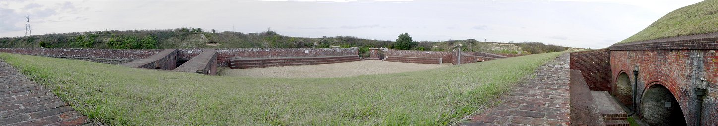
The north mortar battery is to the right of the picture, protected from direct enemy fire, with the mortars firing from under the brick columns. The area in the center of the picture with firing steps, bound by double brick walls on each side (rifle galleries), would be occupied by infantry, who could fire into the ditch and cover the flanks of the caponier, which extends into the ditch from the area of the opening between the firing steps. The caponier covered the ditch with enfilade fire. Lets take a look on top of it.
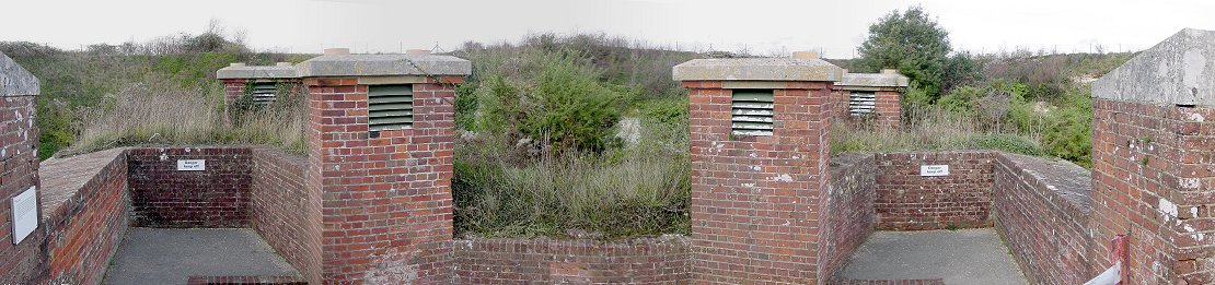
As mentioned before, on the northern tip of the fort is a caponier used to enfilade the ditch. This is a panorama of the top of the caponier, which, as you can see from the ground in the distance, is below the level of the ground outside of the fort. The caponier is oddly shaped, somewhat like the diamond shaped bastions of old, but with the tip removed, making it kind of a six sided Pac Man. The brickwork appears to be chimneys used to rid the inside of the smoke during firing of the cannon.
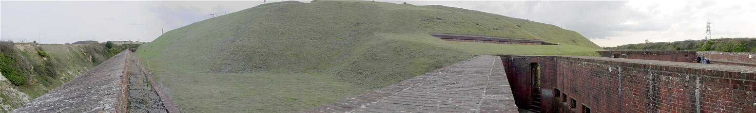
This is the view from the eastern rifle gallery at the northern end of the fort. The rifle galleries led from the mortar battery to the infantry firing areas seen previously. To get a better feel of the size of the area, you can see a family on the right of the picture in the infantry area. Similar infantry areas, mortar batteries, and caponiers or demi-caponier were on the eastern and western corners of the fort, and all were connected by tunnels to the barracks area in the rear of the fort.
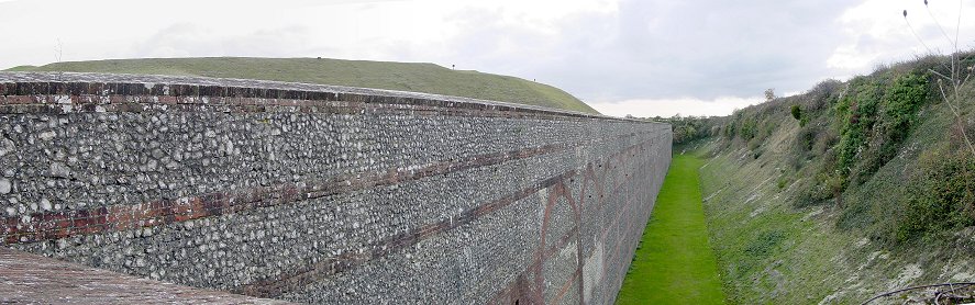
This is the view from the north caponier along the curtain wall, made of flint reinforced with brick. The counterscarp opposite the walls have eroded over time but were vertical when the fort was built.
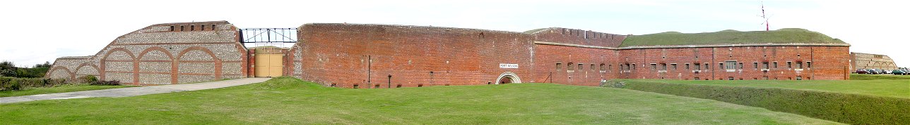
This is the rear of the fort, which faces the Portsmouth area from atop the heights overlooking the city. You can see the southwestern corner of the fort to the left, and the southeastern corner to the right. The redan you can see jut out from the walls to the right provided flanking fire to the rear of the fort and also provided barracks space. The fort's main entrance is partially below ground level, and is visible as the white arch topped by a Fort Nelson nameplate. The gate on the left was added in 1938 for ammunition trucks, serving the fort's new role as an anti-aircraft ammunition magazine.
Links:
http://www.palmerstonforts.org.uk Palmerston Forts Society - Includes a very good virtual tour.
http://www.portsdown-tunnels.org.uk/index.html Portsdown Tunnels - Includes panoramas and aerial views.
Return to John's Military History Tour of Britain