Mont Dauphin


vars
Col du Vars

    In July 1692, with French forces occupied at Briancon, the forces of Savoy-Piedmont in the Ubaye valley crossed the Col du Vars and conducted a devastating raid of French territory reaching Embrun and Gap and even threatening Grenoble before returning to Savoy-Piedmont.  Louis XIV was surprised at the raid.  The threat of future invasions from Savoy-Piedmont over the Col du Vars prompted the French to add to their system of Alpine border fortification in the late 17th century.  An invasion from across the Col du Vars needed a counter, and Vauban was the man for the task, arriving late in 1692.  When the fortification was complete, an invasion from across the Col du Vars would face a new, original fortress, Mont Dauphin.  After the peace of 1713, France gained the Ubaye valley, making an invasion across the Col du Vars unlikely, but construction continued at Mont Dauphin.  From then on, the enemy would be limited to other invasion routes.  To reach the new fortress of Mont Dauphin an invader either had to first capture Chateau Queyras, then negotiate difficult mountainous terrain, including gorges - or approach from the north after pacifying Briancon, which by the mid 18th century boasted a vast array of forts.  If the attacker successfully captured Mont Dauphin, he would face the fortifications at Embrun.  Perhaps because of this impressive array of defenses, and the waning threat from Savoy-Piedmont, Mont Dauphin never faced an attack, excepting an air strike by Italy during the Second World War.

    For the great new fortress, Vauban, on the advice of his friend and local commander Marshal Catinat, investigated the high ground where four valleys converged near the confluence of the Durance and Guil Rivers.  He selected this as the site of a new fortress and named it "Mont Dauphin" after the king's son and the name of the province of France.  With steep slopes on three sides, it was ideal defensive terrain.  Construction began in 1693, but when Vauban visited the site as it neared completion in 1700, he was unhappy with the construction.  Life was difficult in the mountains, and famine was one of the problems hindering construction, making everything more expensive.  The town within the fortress was never appealing enough to attract a vibrant community - partly due to high winds - and the fortress remains largely empty to this day.  The fortress was modified through the Napoleonic period and into the late 19th century, with its most interesting addition being an innovative lunette in the 1790s.  


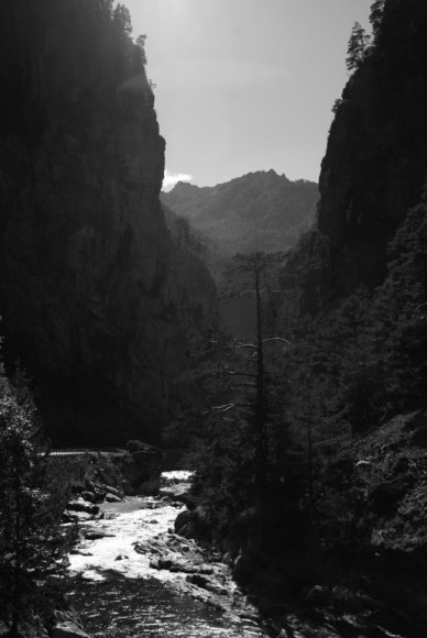
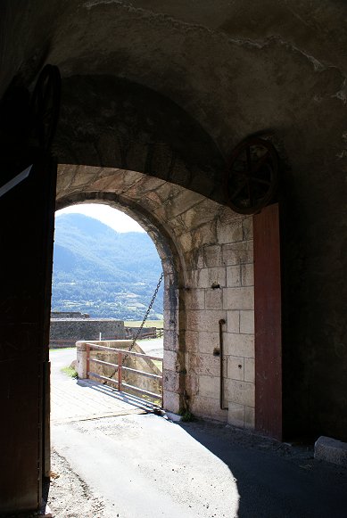
Gorge Between Chateau Queyras and Mont Dauphin


from south

Mont Dauphin From South

From the road from Col du Vars you can see that the plateau that Mont Dauphin was built on dominates the valley below and confluence of the Durance from Briancon and the Guil from Chateau Queyras.  This plateau is primarily made of a rock called conglomerate, a fusion of smaller rocks eroded by glaciers many millenia ago.  Vauban, an intelligent and curious man with facial characteristics suggesting autism, was fascinated by the rock but could not explain its origins.  The rock was unsuitable for building, including for use in  mortar, and deeper foundations than expected were found necessary.

The plateau was virtually unapproachable from three sides.  The most practical approach was from a narrow strip of land extending to a mountainside.  The site had the advantage of being south-facing so there was plenty of sunlight.


from south

A closer view gives more detail of the site.  The Porte d'Embrun side was the easiest to defend and the last to be fortified.  Construction priority was to the narrow strip of land stretching to the mountain.  The other sides were so step as to barely need defenses at all.  But across the River Guil gorge was land that an enemy could use to bombard the fortress - Vauban proposed that an outwork be built there, but in a kingdom chronically in debt, the project was never begun.


Southern Face

Terrain protects the southern, eastern, and western sides of Mont Dauphin.  The southern face towers around 400 feet above the River Durance below.  Although a narrow road now enters Mont-Dauphin's southern side, during the 18th century this route would be much cruder, used by mules and pedestrians but not by carts.  A relatively simple defense was built on this approach, begun only in 1760, it was among the last of the defenses to be completed.   The demi-lune in front of the southern Porte d'Embrun is unusually small.  See below.  


Porte  d'Embrun

In the first haf of the 19th century, a small ditch was added in front of the gate.


Demi-lune From Rochambeau Caserne


Caserne Rochambeau

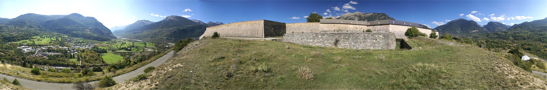
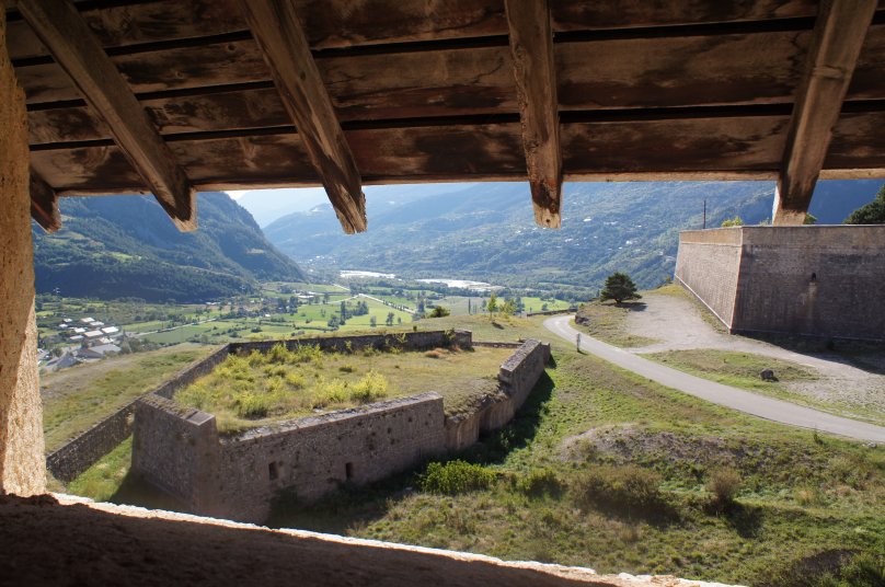
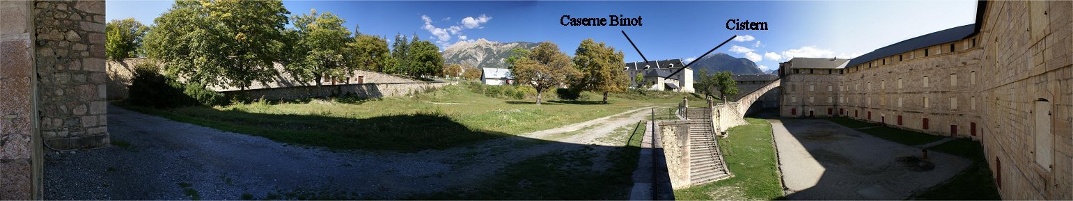
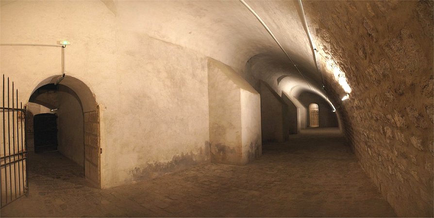
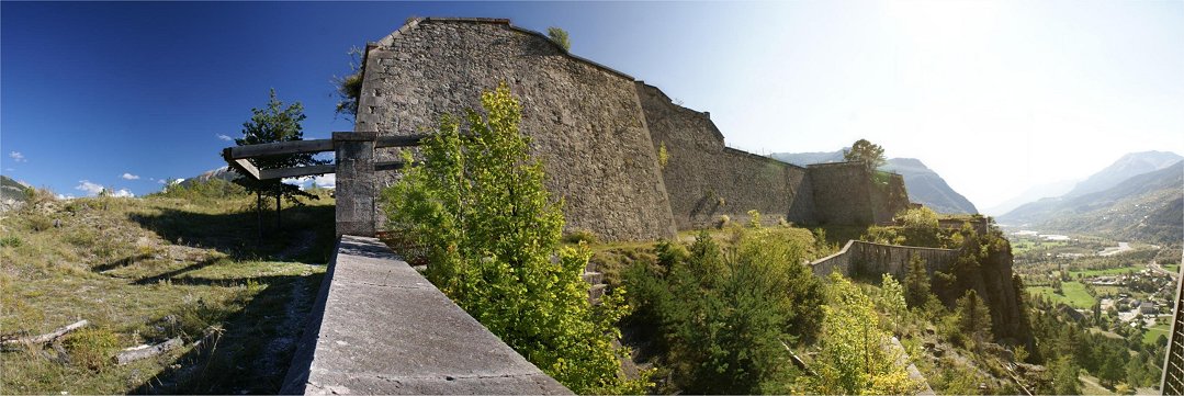
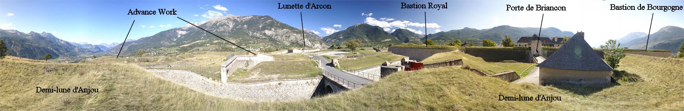
The panorama above is the view from just inside the southern gate, Porte 
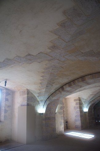
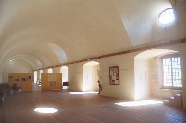
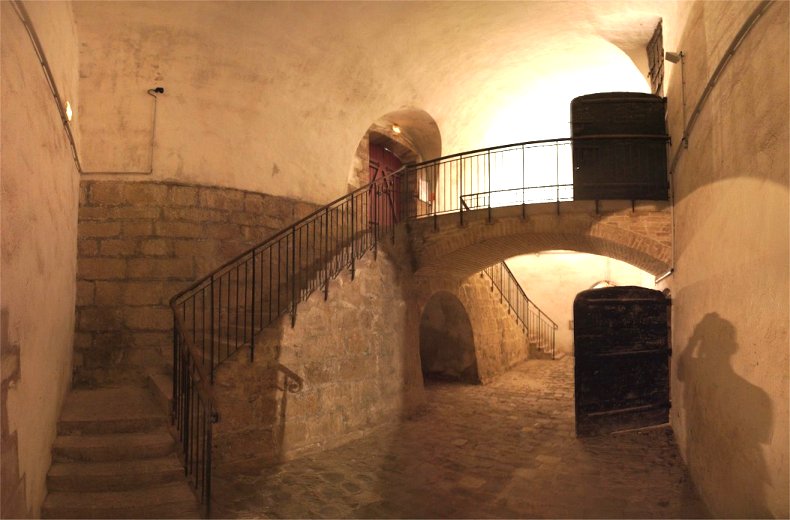
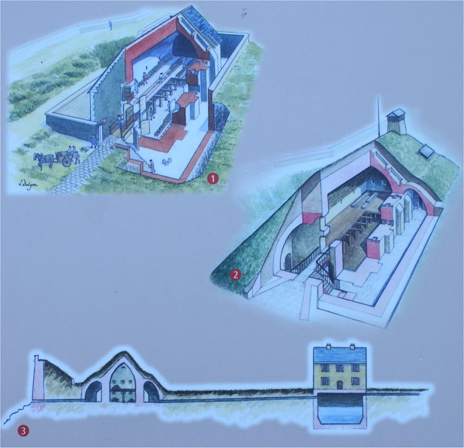
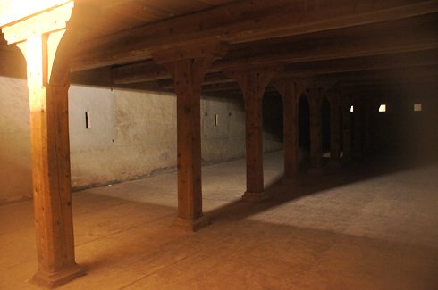
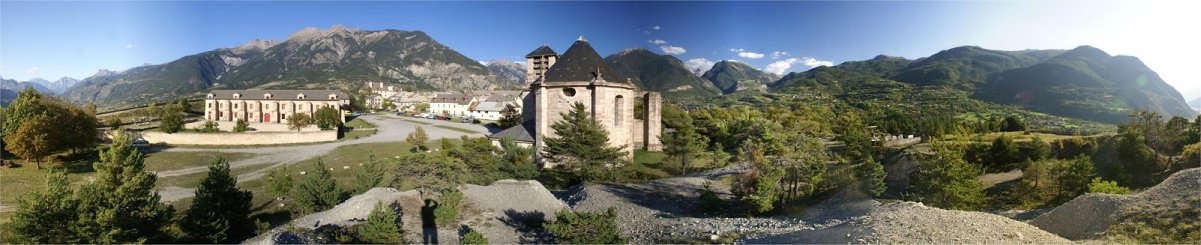
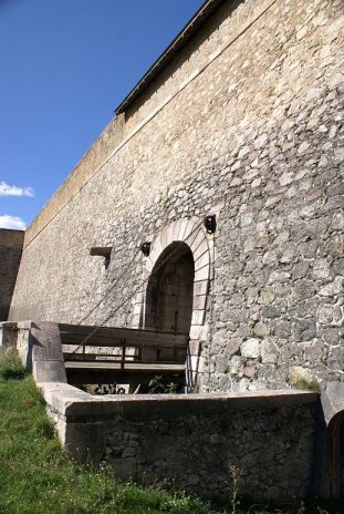
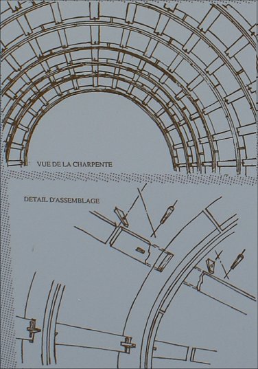
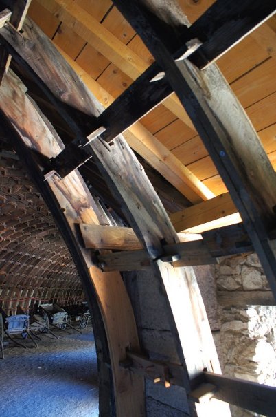
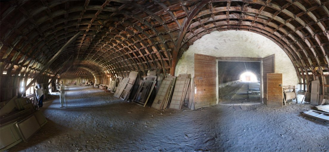
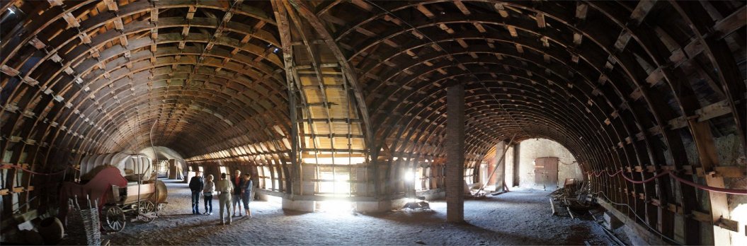
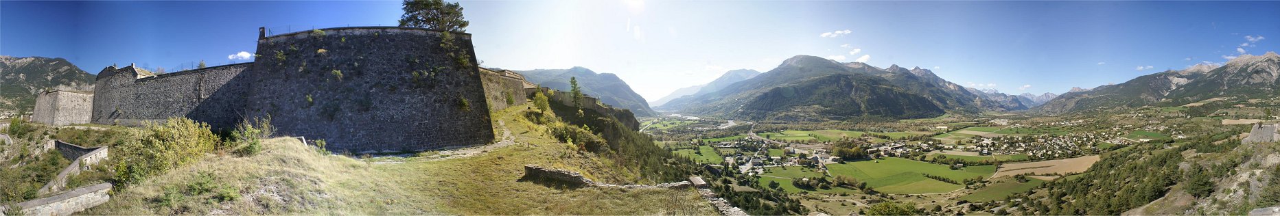
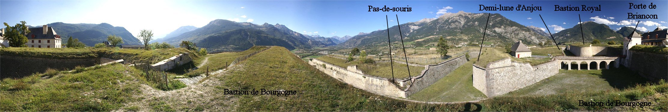
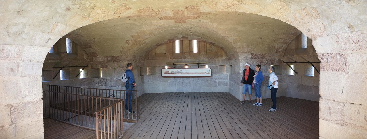
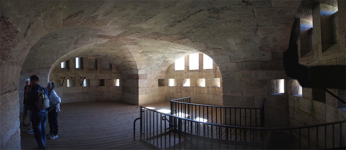
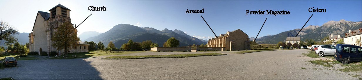
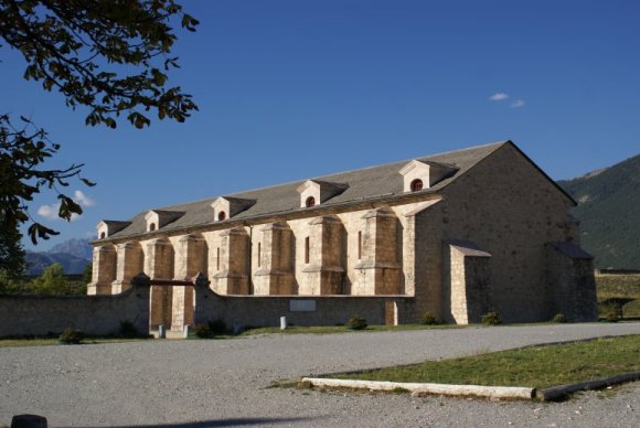
d'Embrun.

Caserne Binot is a barracks perfectly adapted to the steep terrain on which it is built.  In front of Caserne Binot is a cistern that could hold 1,840 cubic meters of water.  In peacetime, water was collected in the mountains and piped into the fort, but this supply of water would have been cut during a siege.  Rainwater and melted snow could also be stored in the fortress's cisterns.  As a result it was necessary to store water in cisterns.  The second, much larger cistern, the one here, was completed in 1730 and could hold two months worth of water. The oldest cistern is located near the powder magazine, and it could provide water to flood the magazine in case the fortress was taken.   

At left is the "Plantation".  It was created to provide shade and wood to the population and to the army.  It included ash and lime trees, more resistant varieties.  An additional benefit was that the trees helped mitigate the strong winds which are known to affect the area.

At right is the Caserne Rochambeau.  Built from 1766 to 1783, the Caserne Rochambeau is a barracks built along the inside of the southern ramparts.   It is a unique design inspired by a great architect of the 16th century, Philibert Delorme, who envisioned a system of assembling smaller parts.  The building's wooden frame can be disassembled, and one man is able to handle each individual piece.  Using small pieces was cheaper since long timber had become scarce and expensive. The wood used was larch, a tree native to the area which has needles that turn color and fall off in the autumn.  The design allowed for a large space that could be used for storage of materials or the training of troops in winter.  This wooden roof was built between 1819 and 1823.  Also note the exterior staircase to an upper floor atop a flying buttress, a feature added in 1785 to help counter the weight of the building. 

The interior of Caserne Rochambeau was accessible only by guided tour. 


Rochambeau Caserne

The inside is unique and spectacular - but like the other interiors accessible only on a group tour.


Western Face

Little was needed to improve upon the natural defenses of this step slope.  Only the fort's northern face required a strong, layered defense.


North Face

The north face featured three bastions, the eastern one with a counterguard to its front.  Two demi-lunes were in front of the curtain wall between the bastions.  Building on a section of the plateau wider than the ground in front of it, fire from the defenses would tend to converge on advancing trenches.  To add greater depth, the eastern demi-lune was fronted by an advance bastion in the 19th century and the western demi-lune and bastion were also fronted by a more complex advance work.  A lunette was constructed in front of the middle bastion in the area that a besieging army would be obliged to begin approach trenches.  The area in front of the lunette dipped lower, making it dead ground not covered by the main defenses.  Plans for further lunettes were never carried out.  The lunette would take the name of the man who strengthened it in the late 1700s, d'Arcon,

Now we will see the defenses from west to east.


Advance Work

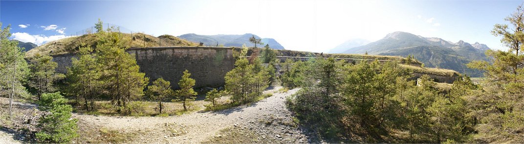
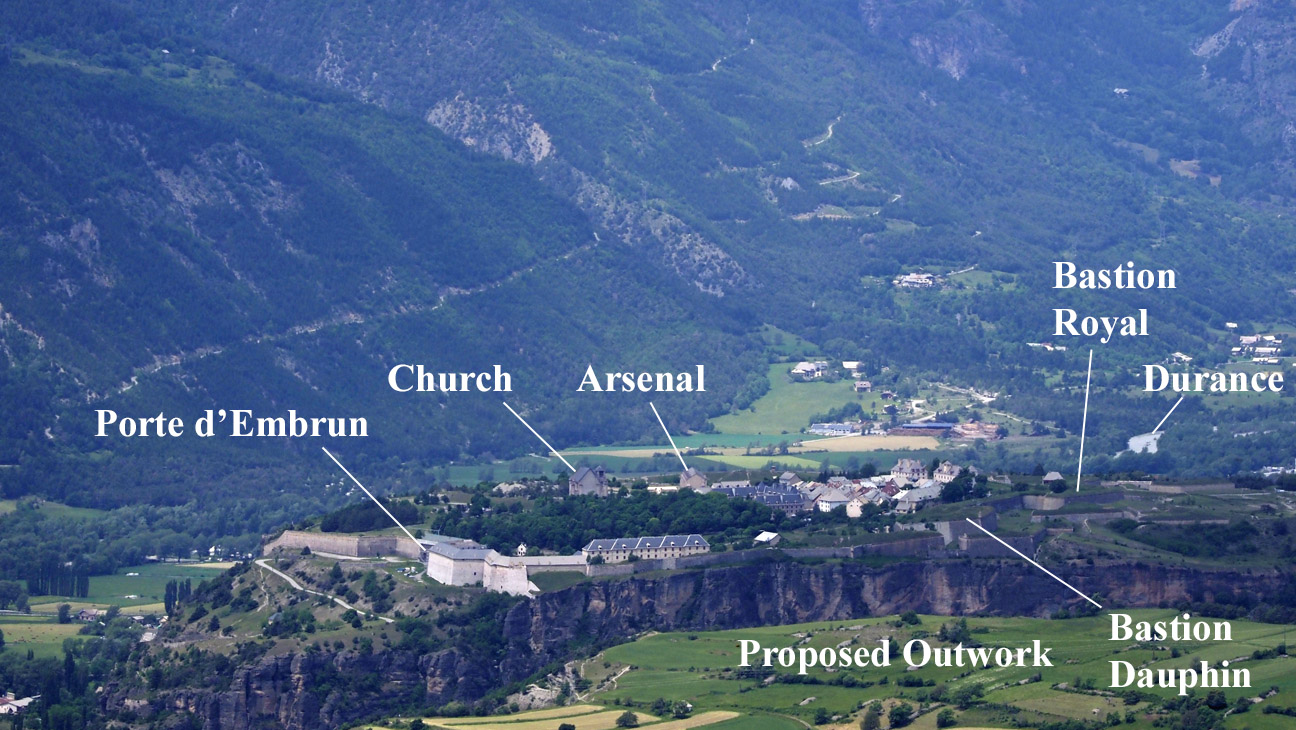
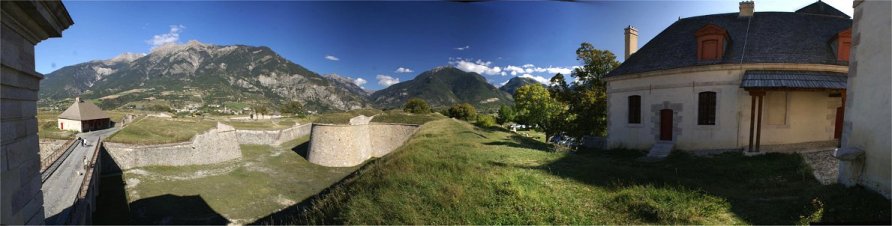
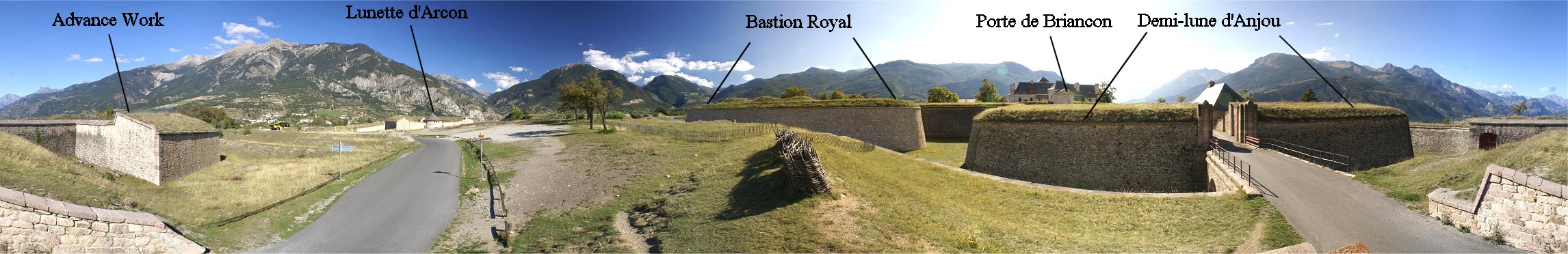
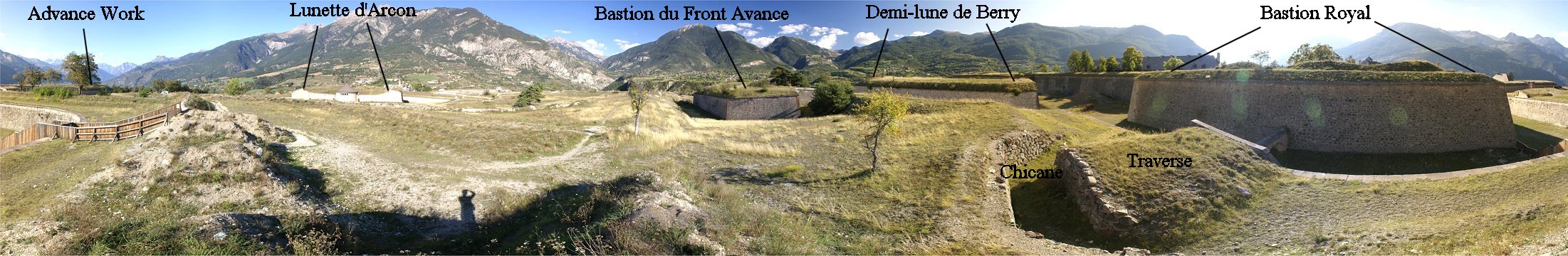
The above panorama is of the front of the advance work, an unusually shaped fortification that defies easy categorization.  Vauban was a believer that a geometrical 'cookie cutter' solution was wrong in many cases, that the designer must adapt his design to the terrain, so this outwork seems designed in that spirit, but it dates to the late 1800s.  The advance work is unusually shaped and includes terracing.  It does not easily fit into a category.  Sadly this portion of the fortress was closed off during my visit, preventing a more thorough investigation.

Note: The two panoramas of the western face were made from beneath the western edge of the advance work.


From Western Bastion

The fortress's bastions are shaped in the old style with recessed flanks.  This may not be clear with the Bastion de Bourgogne, but Bastion Royal may make this more clear.  The pas-de-souris, or mousetrap, leads into the complex advance work, a 19th century addition.  This 'mousetrap' feature makes ladders necessary to enter the advance work.  Another more expedient method would be to stick bayonets between the masonry. The bridge to the Porte de Briancon was originally wood topping stone pillars, but this was eventually replaced by all stone construction.   


Porte de Briancon

At left is the view from atop the Briancon gate.

The right photo is from just inside the gate, which comes through the building at right, the Pavillon de L'Horloge.  This building housed a clock, included the guard room, and was where the fort commander lived.  The building at left in the photo at right, the Pavillon des Officiers, completed in 1700, was home to unmarried lieutenants and captains.


gate  cutaway

Porte de Briancon

The gate was a four story complex.  An attack directly on the gate would involve crossing the bridge, originally wooden, and likely destroyed before battle.  The drawbridge was next - this tilting type of bridge mechanism freed up the stonework above for ornamentation to glorify the monarchy.  The drawbridge, if open, was followed by a studded door - wood reinforced by metal.  If closed and somehow penetrated, attackers would face a pit.  Immediately after the pit was an orgues mechanism, or organ, operated from the level above - the orgues was an evolution of the medieval portcullis.  While the descent of a portucullis could be blocked by a single object, the orgues was made of several unconnected vertical pieces which descended independently from each other so that it would be difficult to block the descent of all the vertical pieces.  Further along the corridor was a guardroom, a prison, and forge.  A door and stairs also descended to the level of the ditch where a postern gate allowed the besieged to mount a sortie through the ditch.  Above the corridor near the exit into town were quarters for the fortress governor.


Demi-lune d'Anjou

A guardhouse greets visitor entering town from the north.  Atop the Demi-lune d'Anjou can be seen the advance work, but little sense can be made of it.  Several hundred yards in advance is the Lunette d'Arcon.


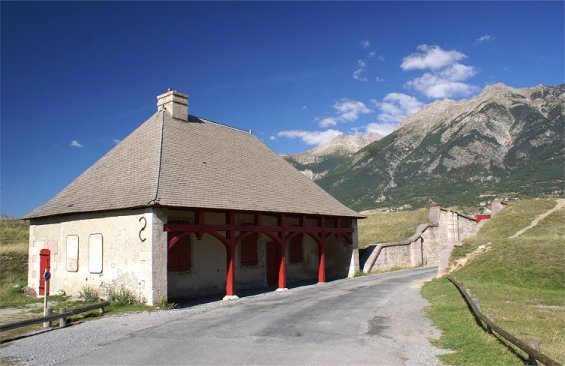
This is the view from just in front of the Demi-lune d'Anjou.  Wickerwork gabions are visible here.  These were used like sandbags by a besieger as they advanced their trenches toward a fortress.  In this case they and nearby trenches were dug in 2007 to study siege techniques and also destroy the remains of a 1939 artillery work.


View from Bastion Royal

From the tip of Bastion Royal, the center of the three bastions, you can see most of the northern defenses, from the other two bastions at either flank, both demi-lunes, the advance work in front of the western bastion, and the bastion du front which is forward of the eastern demi-lune.  The earthwork inside the Bastion Royal is a cavalier, designed so that the bastion can be defensible even if the wall is breached.  The arch at left that spans the ditch is an aqueduct built to bring water into the fort to be stored in cisterns.  The aqueduct was originally built from the trunks of larch trees.

Across the ditch, infantry would protect the covered way.  Traverses protected the infantry from enfilade fire and provide a firing position in case a section of the covered way was captured.

On the right of the panorama is the tunnel to the Lunette d"Arcon.  Originally the lunette was accessed by a ditch, but this was later covered over to make a tunnel.


In later times the term "caponier" became a covered passage through the ditch - or a covered fighting position in the ditch - both with overhead protection.  Mont Dauphin has an earlier version of a caponier - earthworks providing protection from flanking fire for men moving to and from the Demi-lune de Berry.


Now we have gone back outside the fortress and looked in.  A traverse is prominent here, once again designed to protect infantry on the covered way from enfilade fire.  It is also designed to be used as a fighting platform, and men can move around it with ease through a chicane.  Next we will walk around the Bastion du Front Avance.


The Bastion du Front, an addition from the first half of the 19th century, comes to the edge of the bluff overlooking the River Guil.  Across the Guil gorge on the Guillestre Plateau Vauban hoped to build an outwork, but the project was never started. 

Next, we will walk along the path to the left of the bastion to the Demi-lune de Berry behind it.


Vauban's outworks in this area include not only the Demi-lune de Berry between the Bastion Royal and the Bastion Dauphin but also a counterguard in front of the Bastion Dauphin.


Bastion Dauphin

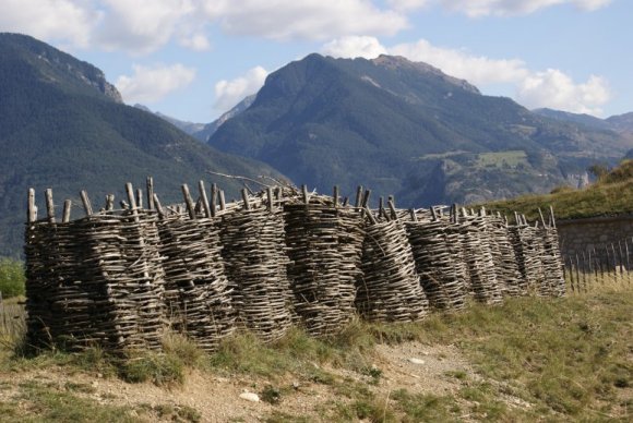
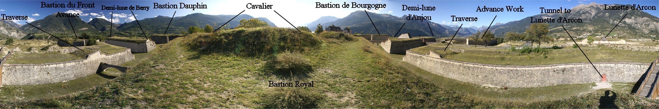
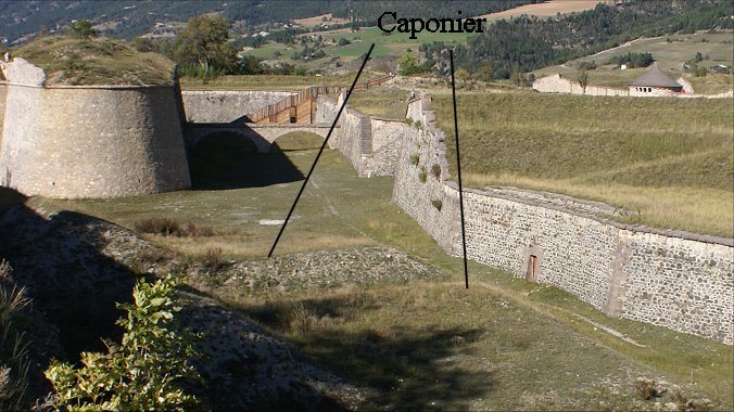
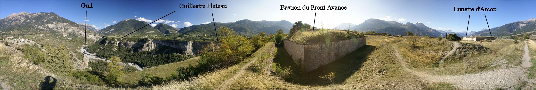
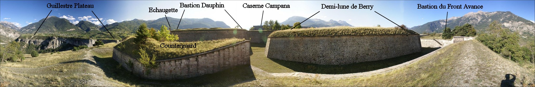
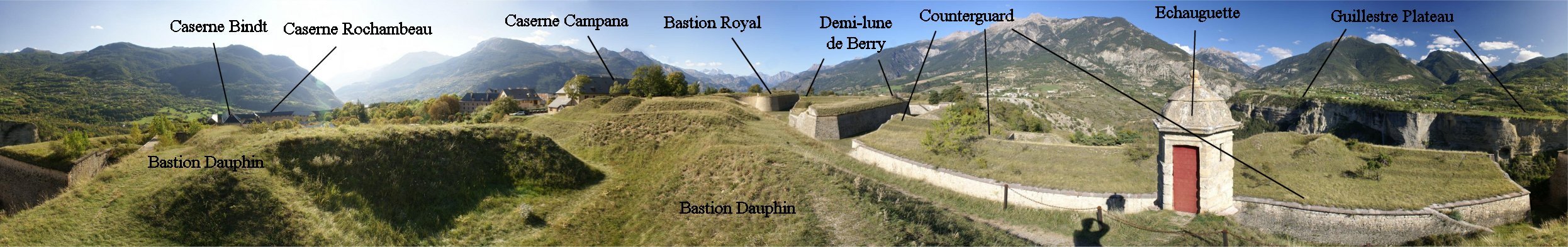
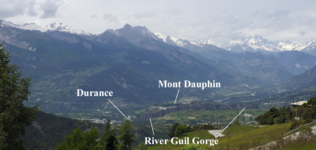
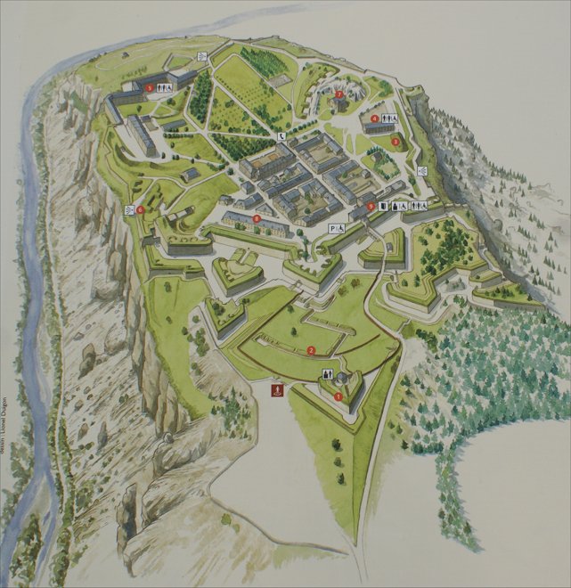
Much of the fortress is visible from the eastern bastion, which is protected by a counterguard.  A sentry post, or echauguette, overlooks it and across the Guil gorge to the Guillestre Plateau.  
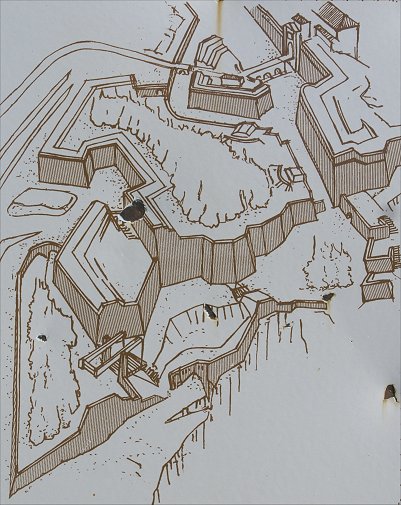
Echauguettes gave hints to besiegers were angles existed in the defenses, so they were built without mortar so that they could be disassembled and 
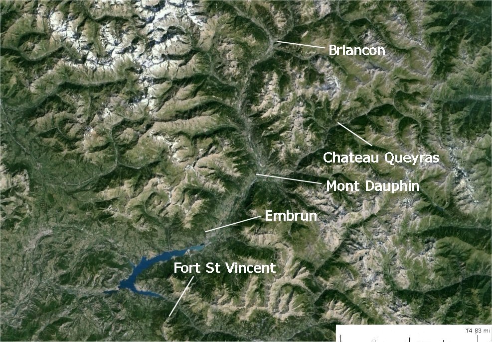
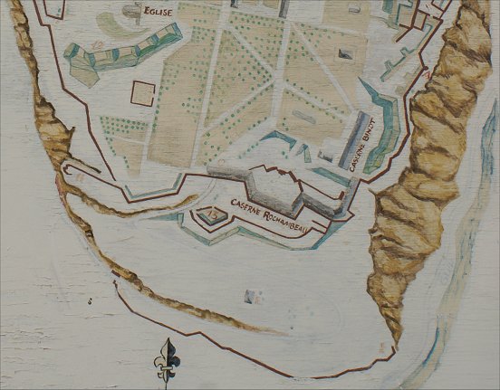
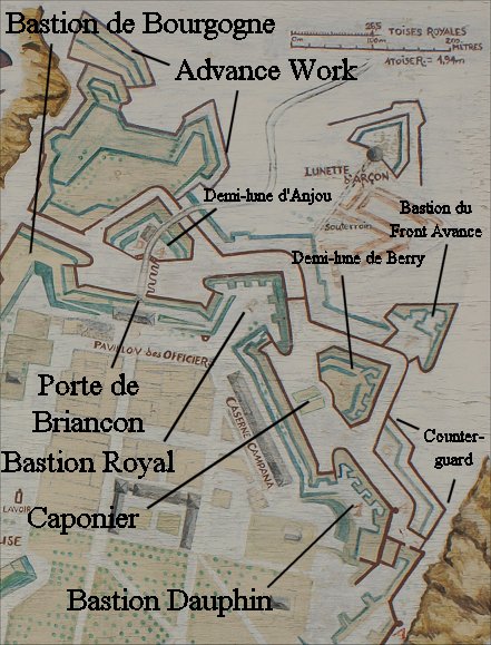
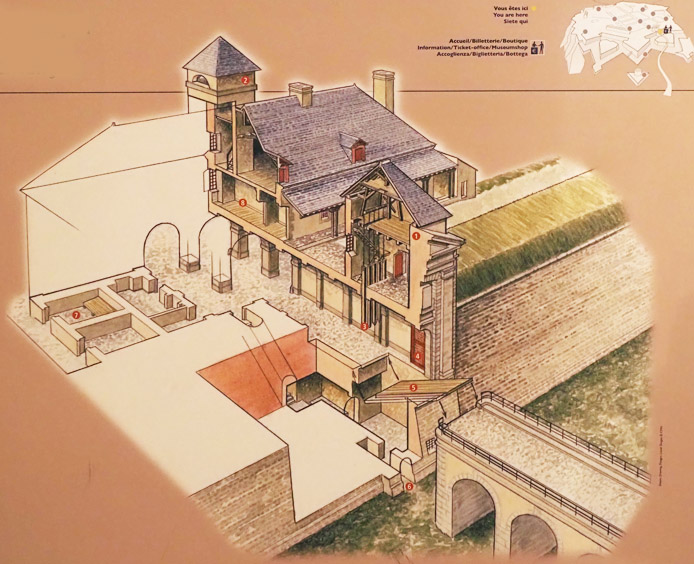
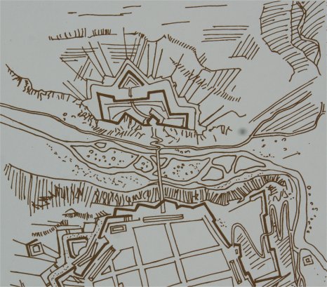
removed during a siege. 

Vauban designed defenses for the plateau across the Guil gorge, but they were never built.  (See map at right.)  It would have been an expensive and difficult project that would have involved spiral staircases cut through the rock, used to access the valley floor but also serving as wells.  Even had this been done, communication by bridge across the river would have been vulnverable to enemy fire.

Not clearly distinguishable here, the Bastion du Front Avance is forward of the Demi-lune de Berry.  Inside the fortress several barracks can be seen, with the Caserne de Rochambeau along the fortress's southern rampart.  The Caserne Campana was built in 1695 to partially house some of the troops building the fort.

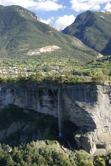
The waterfall is not natural.  It is the discharge from a waterway diverted for irrigation.  irrigation canals are common in the mountains of France.


Eastern Face

Not entirely obvious from the top, the fortress's eastern face is a cliff.


Lunette d'Arcon

An outwork originally built here between 1728 and 1731 was a demi-lune designed to eliminate dead ground not visible from the main fort.  This was in an area where an enemy would likely begin a siege.  In 1791 the lunette was transformed and improved by General d'Arcon, becoming the Lunette d'Arcon.  Two other planned lunettes were not built.  Named after its inventor, a veteran of the Seven Years War, the lunette was innovative in its time and influenced fort design elsewhere.  Eventually linked to the fortress by an underground passage, the lunette has firing ports to its rear in a multi-story circular structure designed as living quarters.  A traverse running down the center of the lunette served as a magazine, separating the parapet into two sides and protecting men on each side from fire from their rear.  Beyond the traverse, the underground passage from the main fortress continues forward to a casemate inside the lunette's counterscarp - allowing defenders to fire along both sides the ditch.  Additional tunnels - countermines - extended in three directions from the lunette to protect against enemy tunneling.


Tunnel to Lunette d'Arcon


Lunette d'Arcon - Redoubt Lower Level

The tunnel leads to this chamber, which is the lower level of the redoubt at the rear of the lunette.  Ahead, and gated off, the passage continues.  Although you can't see it, a ladder swings down for access to the traverse.  The tunnel extends beyond this to the galleries covering the ditch, and countermine passages extend even beyond this.  Another countermine began behind the group of people in the panorama above and extended diagonally for some distance.  When enemy trenches reached these countermines, gunpowder charges could be blown, destroying the enemy earthworks.

As none of these passages are accessible, we continue up the stairway at left.  (The interior of the lunette was accessible only by tour groups.)


Lunette d'Arcon - Redoubt Upper Level


Lunette d'Arcon - Redoubt Upper Level

Firing slits face all directions - both inside the lunette and to its rear.  Note the iron projections from the walls.  These could support boards so that infantry could use the upper firing slits.  


The fortress included a large church, in part to try to keep the local population Catholic, but it was never completed.  Begun in 1697, there was a lack of money and never a large enough population.  Incomplete, it is oddly shaped as a result - too high for its length, too short for its height.

The powder magazine is nearly obscured behind the arsenal.  The powder magazine could be flooded with water from the cistern.

The arsenal served as both a warehouse and as a maintenance and repair facility for armaments.  The arsenal of Mont-Dauphin was built here in the most difficult place for enemy fire to reach.  The first wing, parallel to the Durance, was finished soon after 1700.  In the mid 1700s a second perpendicular wing was built. Only the second building remains as the oldest building was bombed by the Italian air force in 1940.  This destroyed section was behind the stone wall at the far end of the enclosure. 


Arsenal - Lower and Upper Floors

On the ground floor were stored artillery carriages, wheels, chassis, and  replacement artillery platforms ​​for the ramparts.  Note the construction of the vaulted ceiling of the lower floor.  Fusils, muskets, swords and ammunition were kept on the upper floor, which now includes an exhibit on fortification and two models.    


Powder Magazine

We entered through the red door above.  The bridge leads to the magazine's upper floor, and the stairs on either side descend to the lower level where we are.  This area was once open to the sky but was covered over in 1874 by three meters of earth, and a lighting rod was included.

Built between 1693 and 1695, the Poudriere was designed by Vauban, and it is one of the oldest buildings in the fort.  It could store more than one hundred tons of powder on two levels.  The magazine was designed so it could be instantaneously flooded in case the fortress was captured, rendering the powder unusable - at least until it was re-ground, a time consuming process.  Water passed through a passage from the cistern, visible in one of the above panoramas.  Thick masonry walls with buttresses were designed so that any explosion would be blown up and not out.  Because of advances in artillery, the powder magazine was buried under a hill of earth in 1881.


Powder Magazine - Lower Level

Here you can see the original buttresses.  The walls surrounding the magazine have been arched over to meet the roof of magazine so that the whole facility could be covered with earth.  On the lower level you can also see the passage from the cistern.


Magazine Upper and Lower Levels

In the upper level, you can see spots for three lamps on the far wall to illuminate the room.  As in all magazines, precautions kept sparks away from the powder.  In the lower level, wooden supports allow for more space to store powder than would be available with a purely stone structure. 


From atop a rock pile you can see the buildings that we just talked about.  To the right the mounds of earth are firing positions for guns, built beginning in 1873.  Bunkers built with stones originally intended for the church sheltered the gunners and ammunition.  


Rue Catinat

Along the town's primary street are various buildings, many originally of military use.  Designed to resist bombardment and sometimes sharing a roof, buildings forming a square block typically had center courtyards for gardens.  Attics, only accessible by ladder, served as barns.

Like at Briancon, a trough down the center of the street helped drain refuse, improving sanitation.  On the right of the picture, behind the teenage in orange, is a fountain feed by water diverted by aqueducts from outside the fortress.  With the defeat at Assietta in the War of Austrian Succession, it became clear that Mont-Dauphin needed more accomodation for a mobile army and more hospital facilites for the sick and wounded.


Hospital


Completed in 1787, the hospital was designed to serve garrisons and armies in the area.  It had 100 beds and included indoor latrines.

Visible to the right of the hospital is the plantation of trees.


Copyright 2011-25 by John Hamill


Back to John's Military History Tour of Europe